File:Map of the town of Basalt - DPLA - 69be30b89d139962c104dc852f8bc878.jpg
Jump to navigation
Jump to search
Size of this preview: 628 × 600 pixels. Other resolutions: 251 × 240 pixels | 503 × 480 pixels | 804 × 768 pixels | 1,072 × 1,024 pixels | 2,145 × 2,048 pixels | 3,700 × 3,533 pixels.
Original file (3,700 × 3,533 pixels, file size: 992 KB, MIME type: image/jpeg)
Captions
Captions
Add a one-line explanation of what this file represents
Summary
[edit]This file was uploaded by the Digital Public Library of America, and the following item metadata was created by the contributing institution's staff.
Note: this data is being maintained by an automated bot, synced with the source data.
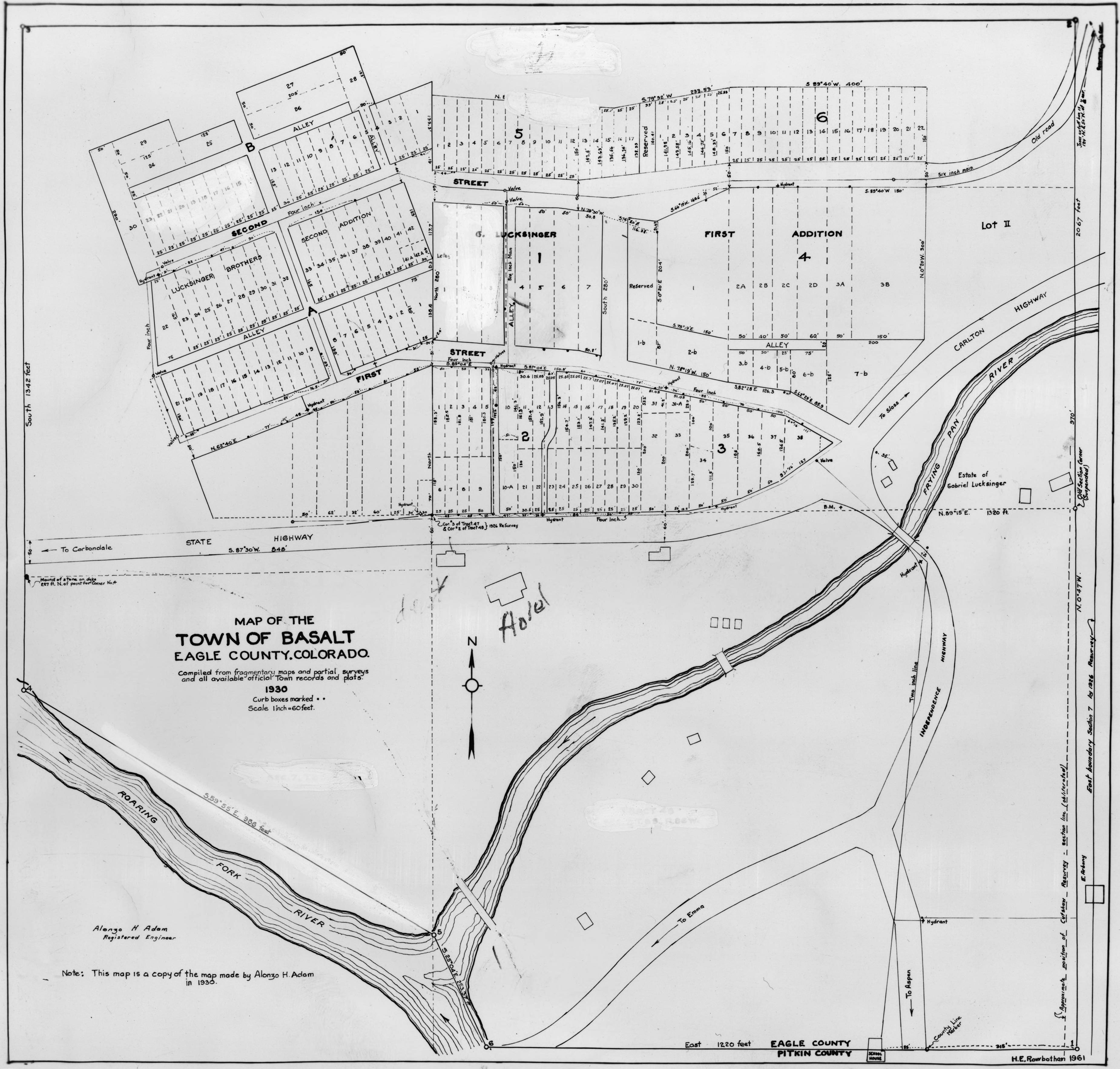
| Description | Reproduction of map; shows Basalt, Eagle County, Colorado, with street names, lot numbers, water mains, "G. Lucksinger," the Roaring Fork and Frying Pan Rivers., Scale [1:60] | ||||||||||||||||||||
| Title | Map of the town of Basalt | ||||||||||||||||||||
| Institution |
|
||||||||||||||||||||
| Subject | |||||||||||||||||||||
| Source |
Plains to Peaks Collective |
||||||||||||||||||||
| Author |
Morgan, Ralph |
||||||||||||||||||||
| Permission (Reusing this file) |
Copyright determination made by Denver Public Library (Q69470198) using RightsStatements.org
|
||||||||||||||||||||
| Partnership |
|
||||||||||||||||||||


File history
Click on a date/time to view the file as it appeared at that time.
| Date/Time | Thumbnail | Dimensions | User | Comment | |
|---|---|---|---|---|---|
| current | 12:42, 18 December 2020 | | 3,700 × 3,533 (992 KB) | DPLA bot (talk | contribs) | Uploading DPLA ID 69be30b89d139962c104dc852f8bc878 |
You cannot overwrite this file.
File usage on Commons
The following page uses this file: