File:Mappa brigantaggio Italia (1860-1870).svg
Jump to navigation
Jump to search

Size of this PNG preview of this SVG file: 599 × 600 pixels. Other resolutions: 240 × 240 pixels | 479 × 480 pixels | 767 × 768 pixels | 1,023 × 1,024 pixels | 2,046 × 2,048 pixels | 907 × 908 pixels.
Original file (SVG file, nominally 907 × 908 pixels, file size: 2.63 MB)
Captions
Captions
Add a one-line explanation of what this file represents
Summary
[edit]| Description |
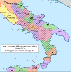
Italiano: Mappa delle aree interessate dal brigantaggio postunitario (1860-1870), applicazione della legge Pica (1863-1865) |
| Date | (UTC) |
| Source |
This file was derived from: |
| Author |


.svg&action=edit§ion=1)
Licensing
[edit].svg&action=edit§ion=2)
This file is licensed under the Creative Commons Attribution-Share Alike 3.0 Unported license.
- You are free:
- to share – to copy, distribute and transmit the work
- to remix – to adapt the work
- Under the following conditions:
- attribution – You must give appropriate credit, provide a link to the license, and indicate if changes were made. You may do so in any reasonable manner, but not in any way that suggests the licensor endorses you or your use.
- share alike – If you remix, transform, or build upon the material, you must distribute your contributions under the same or compatible license as the original.
Original upload log
[edit].svg&action=edit§ion=3)
This image is a derivative work of the following images:
- File:Provincie_duosiciliane_con_confronto.png licensed with Cc-by-sa-3.0, GFDL
- 2011-04-15T14:28:03Z Archeo 2675x3320 (829335 Bytes) {{Information |Description ={{it|1=Mappa delle Provincie e dei Distretti del [[Regno delle Due Sicilie]] (ante 1860), in relazione con l'attuale (2011) suddivisione amministrativa di Regioni e Province.}} {{it|1=Mappa dell
- File:Mappa_applicazione_legge_Pica.png licensed with Cc-by-sa-3.0, GFDL
- 2011-02-23T15:58:12Z Friedrichstrasse 1043x1200 (211656 Bytes) {{Information |Description ={{it|1=Mappa delle aree di applicazione della legge Pica (1863-1865)}} |Source ={{own}} |Author =[[User:Friedrichstrasse|Friedrichstrasse]] |Date =2011-02 |Permission
File history
Click on a date/time to view the file as it appeared at that time.
| Date/Time | Thumbnail | Dimensions | User | Comment | |
|---|---|---|---|---|---|
| current | 09:54, 3 May 2014 | | 907 × 908 (2.63 MB) | Fulvio314 (talk | contribs) | "Regno d'Italia" |
| 09:48, 3 May 2014 |  | 907 × 908 (2.61 MB) | Fulvio314 (talk | contribs) | minor fix as per Graphic lab request | |
| 07:05, 3 May 2014 |  | 907 × 908 (2.59 MB) | Fulvio314 (talk | contribs) | + Calabria ulteriore I & Calabria ulteriore II | |
| 06:47, 2 May 2014 |  | 907 × 908 (2.58 MB) | Fulvio314 (talk | contribs) | + ref. | |
| 09:04, 1 May 2014 |  | 907 × 891 (2.72 MB) | Fulvio314 (talk | contribs) | == {{int:filedesc}} == {{Information |Description={{it|1=Mappa delle aree interessate dal brigantaggio postunitario (1860-1870), applicazione della legge Pica (1863-1865)}} |Source={{Derived from|Italy map-blank.svg|Provincie_duosiciliane_con_confronto... |
You cannot overwrite this file.
File usage on Commons
The following page uses this file:
File usage on other wikis
The following other wikis use this file:
.svg&oldid=593829417)