File:Mappa di Eratostene.jpg
Jump to navigation
Jump to search

Size of this preview: 800 × 487 pixels. Other resolutions: 320 × 195 pixels | 640 × 390 pixels | 1,024 × 623 pixels | 1,280 × 779 pixels | 2,560 × 1,559 pixels | 5,085 × 3,096 pixels.
Original file (5,085 × 3,096 pixels, file size: 2.37 MB, MIME type: image/jpeg)
Captions
Captions
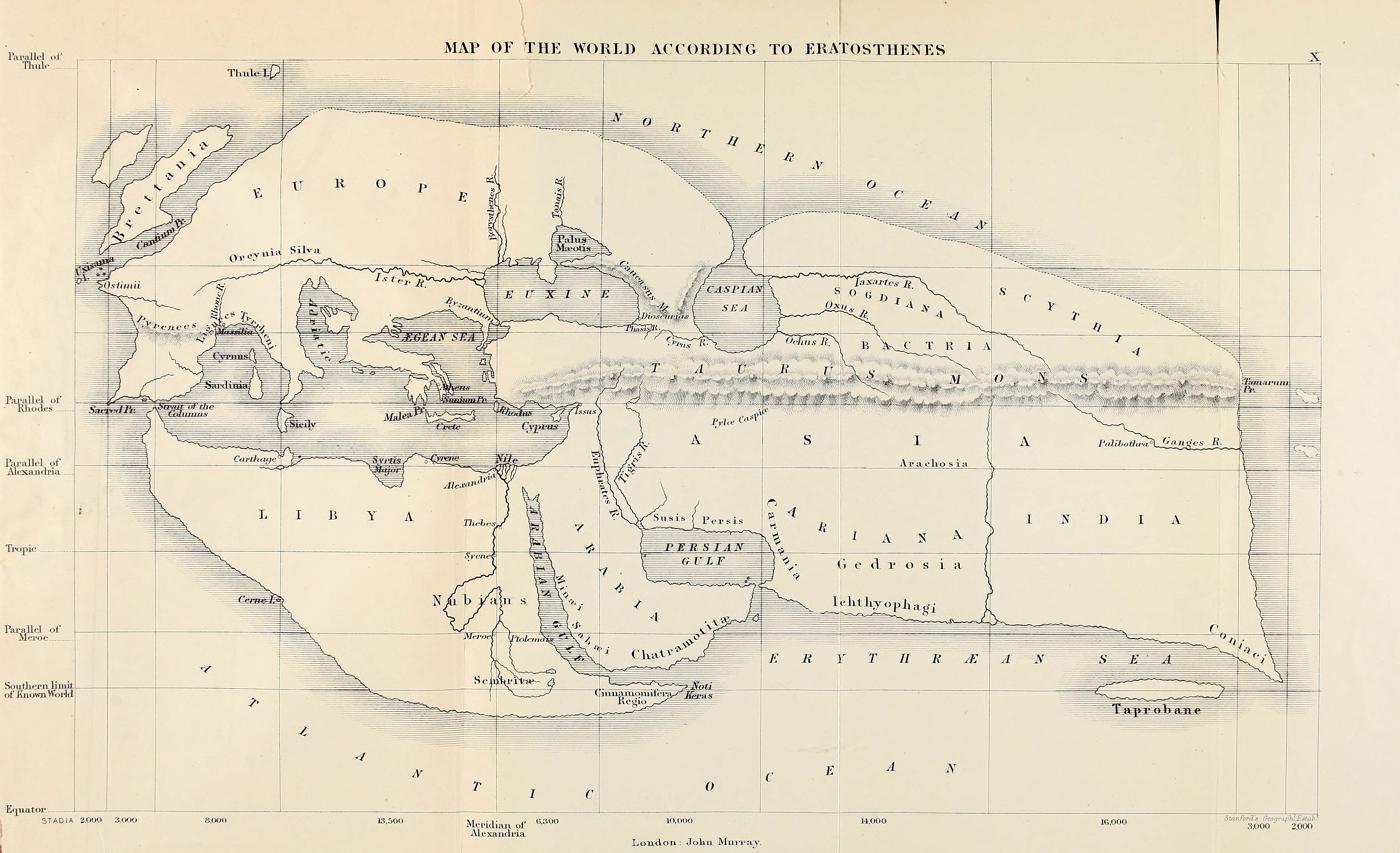
the article talks about a study with geography.
Summary
[edit]| Description |
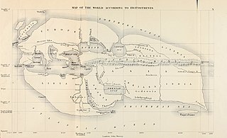
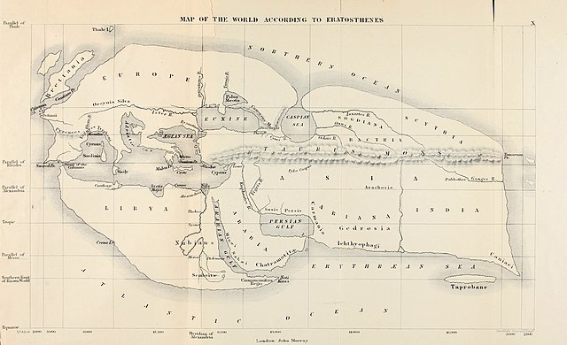
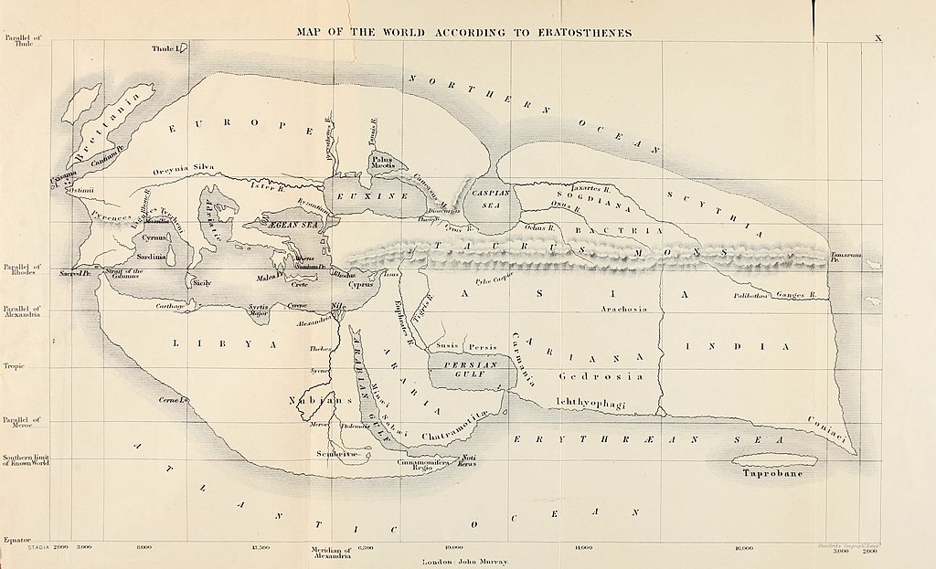
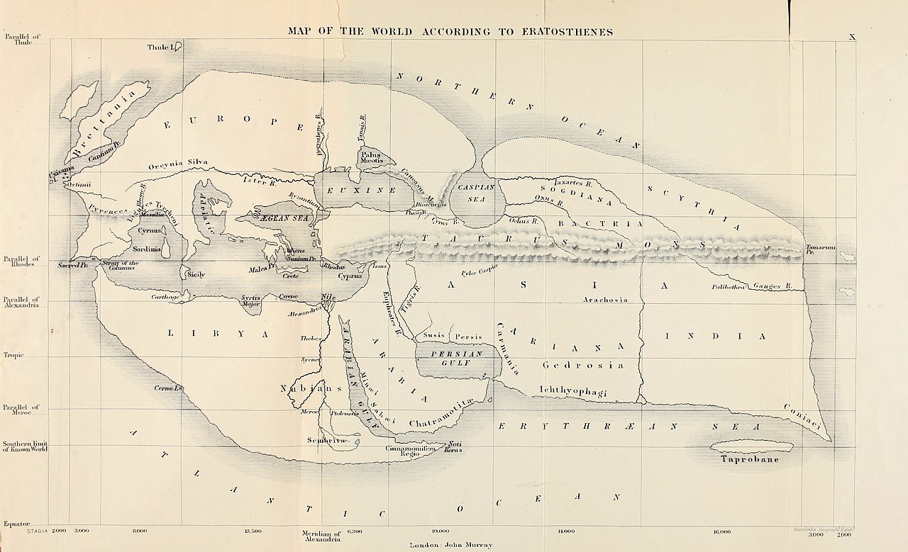
English: 19th century reconstruction of Eratosthenes' map of the known world, c. 194 BC. Italiano: Mappa di Eratostene. |
||||||||||||||||||||||||||||||||||||||||||
| Date | |||||||||||||||||||||||||||||||||||||||||||
| Source | Bunbury, E.H. (1811-1895), A History of Ancient Geography among the Greeks and Romans from the Earliest Ages till the Fall of the Roman Empire, page 667. London: John Murray, 1883. | ||||||||||||||||||||||||||||||||||||||||||
| Creator |
|
||||||||||||||||||||||||||||||||||||||||||
| Geotemporal data | |||||||||||||||||||||||||||||||||||||||||||
| Bounding box |
|
||||||||||||||||||||||||||||||||||||||||||
| Georeferencing | |||||||||||||||||||||||||||||||||||||||||||
| Other versions |
|
||||||||||||||||||||||||||||||||||||||||||


Derivative works of this file: Mappa di Eratostene-ar.png
Licensing
[edit]
|
This work is in the public domain in its country of origin and other countries and areas where the copyright term is the author's life plus 100 years or fewer. This work is in the public domain in the United States because it was published (or registered with the U.S. Copyright Office) before January 1, 1929. | |
| This file has been identified as being free of known restrictions under copyright law, including all related and neighboring rights. | |
File history
Click on a date/time to view the file as it appeared at that time.
| Date/Time | Thumbnail | Dimensions | User | Comment | |
|---|---|---|---|---|---|
| current | 14:51, 5 July 2020 | | 5,085 × 3,096 (2.37 MB) | Sette-quattro (talk | contribs) | Higher resolution version, from https://archive.org/details/historyofancient00bunb/page/n720/mode/2up |
| 19:12, 24 June 2007 |  | 1,040 × 611 (149 KB) | TcfkaPanairjdde (talk | contribs) | Mappa di Eratostene, da en.wiki en:Iran.jpg La mappa è tratta da: * Bunbury, E.H., ''A History of Ancient Geography among the Greeks and Romans from the Earliest Ages till the Fall of the Roman Empire''. London: John Murray, 1883. {{PD-Art}} |
You cannot overwrite this file.
File usage on Commons
The following 6 pages use this file:
File usage on other wikis
The following other wikis use this file:
- Usage on af.wikipedia.org
- Usage on ar.wikipedia.org
- Usage on az.wikipedia.org
- Usage on be-tarask.wikipedia.org
- Usage on bs.wikipedia.org
- Usage on ca.wikipedia.org
- Usage on ceb.wikipedia.org
- Usage on cs.wikipedia.org
- Usage on de.wikipedia.org
- Usage on diq.wikipedia.org
- Usage on el.wikipedia.org
- Usage on en.wikipedia.org
- Alexander the Great
- Eratosthenes
- Seleucus I Nicator
- Persian Gulf naming dispute
- Taprobana
- Name of Iran
- Early world maps
- History of the Indo-Greek Kingdom
- User:Campstriker
- Sources of Indo-Greek history
- User:MinisterForBadTimes/Themistocles
- Homonoia
- File talk:Mappa di Eratostene.jpg
- Travel in classical antiquity
- User talk:Mdd/History of technical drawing
- User:Falcaorib/Ancient Empires (300 BC-01 AD)
- Usage on es.wikipedia.org
- Usage on eu.wikipedia.org
- Usage on fa.wikipedia.org
View more global usage of this file.