File:Masurischer Kanal Landkarte 1890 001.jpg
Jump to navigation
Jump to search
No higher resolution available.
Masurischer_Kanal_Landkarte_1890_001.jpg (497 × 384 pixels, file size: 76 KB, MIME type: image/jpeg)
Captions
Captions
Add a one-line explanation of what this file represents
| Description |
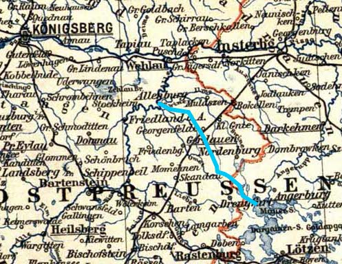
Deutsch: Verlauf des Masurischen Kanals auf einer Karte von Ostpreußen im Jahr 1890. |
| Date | (UTC) |
| Source | |
| Author |
|
I, the copyright holder of this work, hereby publish it under the following licenses:
| This file is licensed under the Creative Commons Attribution-Share Alike 3.0 Unported license. | ||
| ||
| This licensing tag was added to this file as part of the GFDL licensing update. |

|
Permission is granted to copy, distribute and/or modify this document under the terms of the GNU Free Documentation License, Version 1.2 or any later version published by the Free Software Foundation; with no Invariant Sections, no Front-Cover Texts, and no Back-Cover Texts. A copy of the license is included in the section entitled GNU Free Documentation License. |
You may select the license of your choice.
Original upload log
[edit]
This image is a derivative work of the following images:
- File:Preussen_Karte.jpg licensed with Cc-by-sa-3.0-migrated, GFDL
- 2008-06-14T06:25:55Z Sendker 2048x1647 (917151 Bytes) {{Information |Description=Karte von Preußen aus dem Jahr 1890 |Source=Meyers Konversations-Lexikon. Eine Encyklopädie des allgemeinen Wissens. 4., gänzlich umgearbeitete Auflage. 16 Bde. Bibliographisches Institut, Leipzi
Uploaded with derivativeFX
File history
Click on a date/time to view the file as it appeared at that time.
| Date/Time | Thumbnail | Dimensions | User | Comment | |
|---|---|---|---|---|---|
| current | 15:47, 11 September 2010 | | 497 × 384 (76 KB) | Janericloebe (talk | contribs) | endgueltige Version meinerseits |
| 15:43, 11 September 2010 |  | 516 × 372 (83 KB) | Janericloebe (talk | contribs) | verbessert | |
| 01:13, 11 September 2010 |  | 569 × 383 (91 KB) | Janericloebe (talk | contribs) | {{Information |Description={{de|1=Verlauf des Masurischen Kanals auf einer Karte von Ostpreußen im Jahr 1890.}} |Source=*File:Preussen_Karte.jpg |Date=2010-09-11 01:11 (UTC) |Author=*File:Preussen_Karte.jpg: Sendker *deriv |
You cannot overwrite this file.
File usage on Commons
There are no pages that use this file.