File:Mexico 1824 (equirectangular projection).png
Jump to navigation
Jump to search
Size of this preview: 800 × 598 pixels. Other resolutions: 320 × 239 pixels | 640 × 479 pixels | 1,024 × 766 pixels | 1,280 × 957 pixels | 1,400 × 1,047 pixels.
Original file (1,400 × 1,047 pixels, file size: 405 KB, MIME type: image/png)
Captions
Captions
Add a one-line explanation of what this file represents

|
This historical map image could be re-created using vector graphics as an SVG file. This has several advantages; see Commons:Media for cleanup for more information. If an SVG form of this image is available, please upload it and afterwards replace this template with
{{vector version available|new image name}}.
It is recommended to name the SVG file “Mexico 1824 (equirectangular projection).svg”—then the template Vector version available (or Vva) does not need the new image name parameter. |
Summary
[edit]| Description |
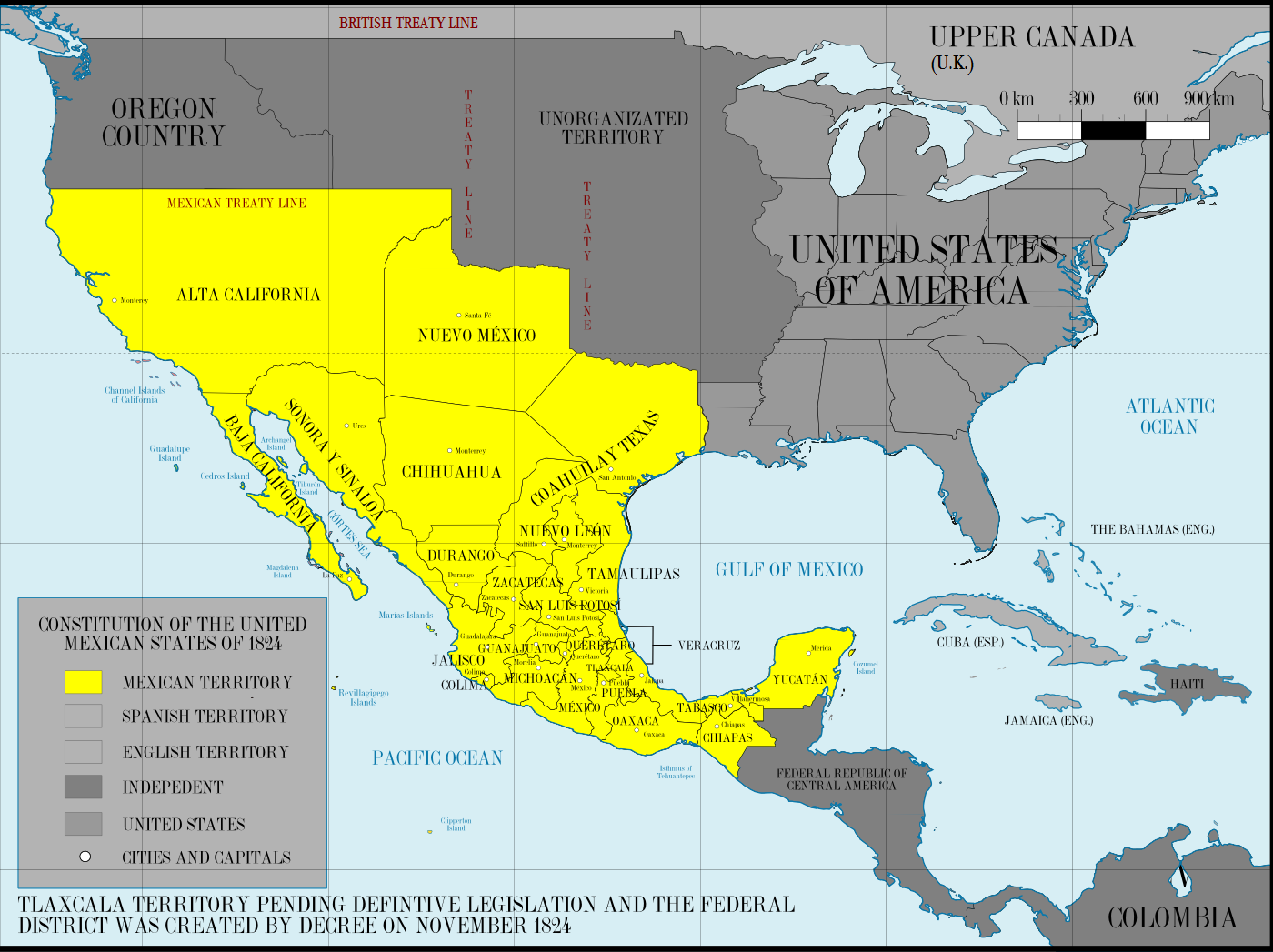
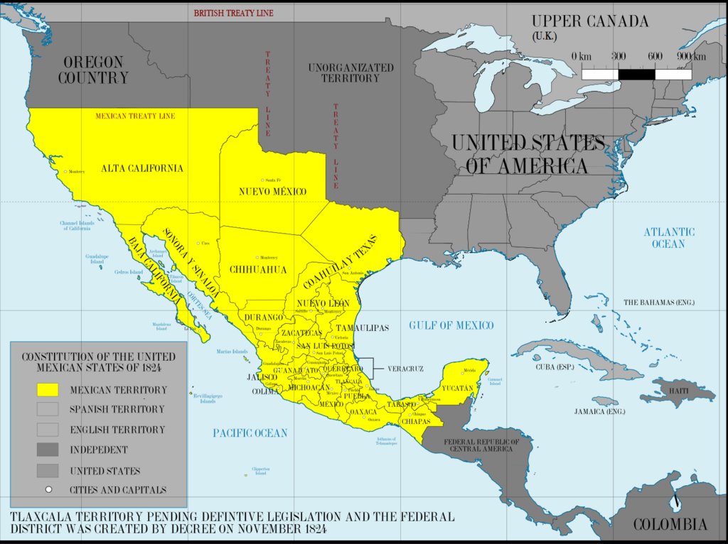
English: First Federal Republic of Mexico in 1824
Español: Primera República Federal de México en 1824. |
| Date | |
| Source |
This image was created with Adobe Photoshop.
|
| Author | Giggette |
| Other versions |
|

.png)
.png)
.png&action=edit§ion=1)
| Camera location | | View this and other nearby images on: OpenStreetMap |
|---|
.png¶ms=019.409500_N_-099.130700_E_globe:Earth_type:camera_type:satellite_region:MX_heading:0.00&language=en)
Licensing
[edit].png&action=edit§ion=2)
I, the copyright holder of this work, hereby publish it under the following licenses:
This file is licensed under the Creative Commons Attribution-Share Alike 3.0 Unported license.
- You are free:
- to share – to copy, distribute and transmit the work
- to remix – to adapt the work
- Under the following conditions:
- attribution – You must give appropriate credit, provide a link to the license, and indicate if changes were made. You may do so in any reasonable manner, but not in any way that suggests the licensor endorses you or your use.
- share alike – If you remix, transform, or build upon the material, you must distribute your contributions under the same or compatible license as the original.

|
Permission is granted to copy, distribute and/or modify this document under the terms of the GNU Free Documentation License, Version 1.2 or any later version published by the Free Software Foundation; with no Invariant Sections, no Front-Cover Texts, and no Back-Cover Texts. A copy of the license is included in the section entitled GNU Free Documentation License. |
You may select the license of your choice.
File history
Click on a date/time to view the file as it appeared at that time.
| Date/Time | Thumbnail | Dimensions | User | Comment | |
|---|---|---|---|---|---|
| current | 07:55, 29 June 2015 | | 1,400 × 1,047 (405 KB) | Illegitimate Barrister (talk | contribs) | Correction, it was the U.K. at the time, not England. |
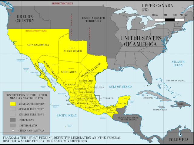
| 20:31, 25 May 2013 |  | 1,400 × 1,047 (420 KB) | Giggette (talk | contribs) | Design | |
| 02:44, 25 May 2013 |  | 1,201 × 893 (360 KB) | Giggette (talk | contribs) | Changes | |
| 08:20, 18 May 2013 |  | 1,201 × 893 (350 KB) | Giggette (talk | contribs) | Updating | |
| 20:09, 17 May 2013 |  | 1,201 × 893 (341 KB) | Giggette (talk | contribs) | {{Information |Description ={{en|1=Mexico 1824 (equirectangular projection)}} |Source ={{own}} |Author =Giggette |Date =2013-05-17 |Permission = |other_versions = }} |
You cannot overwrite this file.
File usage on Commons
The following 2 pages use this file:
.png&redirect=no)
File usage on other wikis
The following other wikis use this file:
- Usage on arz.wikipedia.org
- Usage on ast.wikipedia.org
- Usage on azb.wikipedia.org
- Usage on be.wikipedia.org
- Usage on de.wikipedia.org
- Usage on en.wikipedia.org
- Usage on es.wikipedia.org
- Usage on fa.wikipedia.org
- Usage on frr.wikipedia.org
- Usage on fy.wikipedia.org
- Usage on hu.wikipedia.org
- Usage on it.wikipedia.org
- Usage on ja.wikipedia.org
- Usage on ko.wikipedia.org
- Usage on pt.wikipedia.org
- Usage on sd.wikipedia.org
- Usage on sq.wikipedia.org
- Usage on sr.wikipedia.org
- Usage on tr.wikipedia.org
Metadata
.png&oldid=903664270)
Categories:
- Maps of the history of Mexico
- Maps of the history of the United States
- Maps of the history of California
- 1824 in Mexico
- Territorial evolution of Mexico
- California in the 1820s
- New Mexico in the 1820s
- Maps of colonial California
- Colonial New Mexico
- Maps of Spanish North America
- Maps of Mexico (equirectangular projection)
- Maps of the history of Texas
- Maps of the history of New Mexico