File:Meyers5 Frankfurt Gallus.png
Jump to navigation
Jump to search
No higher resolution available.
Meyers5_Frankfurt_Gallus.png (763 × 538 pixels, file size: 134 KB, MIME type: image/png)
Captions
Captions
Add a one-line explanation of what this file represents
| Description |
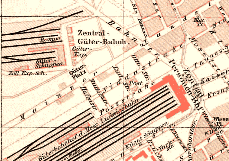
Deutsch: Stadtplan Frankfurt, 1893: Das noch weitgehend unbebaute Gallusviertel, zwischen Hauptbahnhof und Hauptgüterbahnhof. English: Frankfurt city map, 1893: Gallus quarter, between Central station in the south and main cargo yard in the north, today a densely built-up commercial district with skyscrapers. |
| Date | |
| Source |
Deutsch: Meyers Konversationslexikon, 5. Auflage English: Meyers Konversationslexikon, 5.th edition Scan obtained from http://www.hicleones.com/ |
| Author | Unknown, uploaded by Michael König (Magadan) |
| This image comes from the 5th edition of Meyers Konversationslexikon (1893-97). The copyrights have expired and this image is in the public domain. | 
|
This work was published before January 1, 1899 and it is anonymous or pseudonymous due to unknown authorship. It is in the public domain in the United States as well as countries and areas where the copyright terms of anonymous or pseudonymous works are 125 years or fewer since publication.
|
File history
Click on a date/time to view the file as it appeared at that time.
| Date/Time | Thumbnail | Dimensions | User | Comment | |
|---|---|---|---|---|---|
| current | 23:13, 30 September 2005 | | 763 × 538 (134 KB) | Magadan (talk | contribs) | {{User:Magadan/Meyers5 | BESCHR_DE = Stadtplan Frankfurt, 1893: Das noch weitgehend unbebaute Gallusviertel, zwischen Hauptbahnhof und Hauptgüterbahnhof. |BESCHR_EN = Frankfurt city map, 1893: Gallus quarter, b |
You cannot overwrite this file.
File usage on Commons
The following 3 pages use this file:
File usage on other wikis
The following other wikis use this file:
- Usage on azb.wikipedia.org
- Usage on de.wikipedia.org
- Usage on www.wikidata.org