File:Meyers b3 s0989a.jpg
Jump to navigation
Jump to search
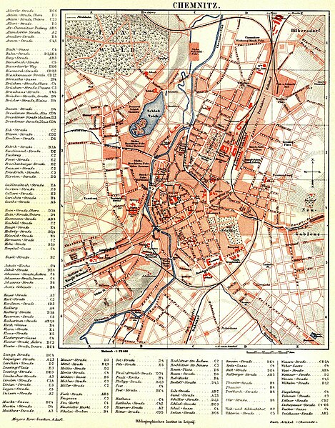
Size of this preview: 469 × 599 pixels. Other resolutions: 188 × 240 pixels | 376 × 480 pixels | 601 × 768 pixels | 802 × 1,024 pixels | 1,604 × 2,048 pixels.
Original file (1,604 × 2,048 pixels, file size: 771 KB, MIME type: image/jpeg)
Captions
Captions
Add a one-line explanation of what this file represents
Summary
[edit]
| Description |
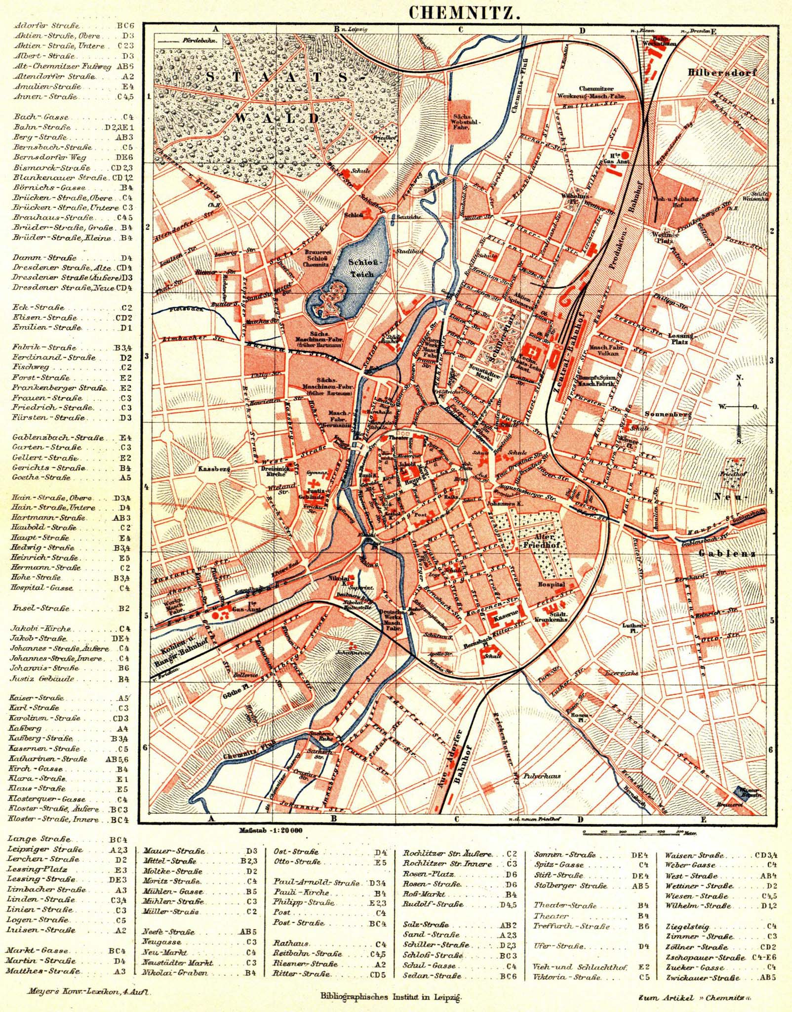
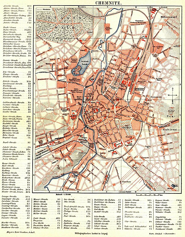
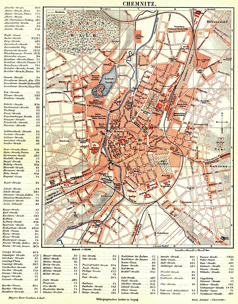
English: Meyers Lexikon — Vol. 3 — Page 998 a — Plate I: City Map of Chemnitz
Deutsch: Meyers Lexikon — Vol. 3 — Seite 999 a — Tafel I: Stadtplan von Chemnitz (1 : 20.000) mit Straßenverzeichnis |
|||||
| Date | between 1885 and 1890 | |||||
| Source | Meyers Konversationslexikon | |||||
| Author | Bibliographisches Institut | |||||
| Permission (Reusing this file) |
|
Licensing
[edit]
This page comes from Book 3 of the 4th edition of Meyers Konversationslexikon (1885–90). The copyrights for that book have expired and this page is in the public domain.
|
This work is in the public domain in the United States because it was published (or registered with the U.S. Copyright Office) before January 1, 1929.
Public domain works must be out of copyright in both the United States and in the source country of the work in order to be hosted on the Commons. If the work is not a U.S. work, the file must have an additional copyright tag indicating the copyright status in the source country.
Note: This tag should not be used for sound recordings. |
File history
Click on a date/time to view the file as it appeared at that time.
| Date/Time | Thumbnail | Dimensions | User | Comment | |
|---|---|---|---|---|---|
| current | 12:52, 17 June 2020 | | 1,604 × 2,048 (771 KB) | Mapmarks (talk | contribs) | nicht die gleiche Karte! Reverted to version as of 21:11, 21 October 2014 (UTC) |
| 09:53, 17 June 2020 |  | 2,492 × 3,235 (1.05 MB) | UweRohwedder (talk | contribs) | höher aufgelöste version derselben karte von hier: https://www.st-andreas-friedhof.de/_doc/Stadtplan-Chemnitz-1885.jpg | |
| 21:11, 21 October 2014 |  | 1,604 × 2,048 (771 KB) | Mapmarks (talk | contribs) | higher resolution | |
| 09:36, 30 August 2006 |  | 800 × 1,021 (301 KB) | Red Rooster (talk | contribs) | {{Information| |Description={{PD-Meyers-pages|12}} |Source= |Date= |Author= |Permission=Author died more than 70 years ago - public domain |other_versions= }} {{PD-old}} |
You cannot overwrite this file.
File usage on Commons
The following 4 pages use this file:
File usage on other wikis
The following other wikis use this file:
- Usage on de.wikipedia.org
- Usage on de.wikisource.org