File:Meyers b4 s0884a.jpg
Jump to navigation
Jump to search
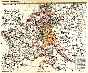
Size of this preview: 720 × 599 pixels. Other resolutions: 288 × 240 pixels | 577 × 480 pixels | 923 × 768 pixels | 1,230 × 1,024 pixels | 2,048 × 1,705 pixels.
Original file (2,048 × 1,705 pixels, file size: 809 KB, MIME type: image/jpeg)
Captions
Captions
Add a one-line explanation of what this file represents
Summary
[edit]| Description |
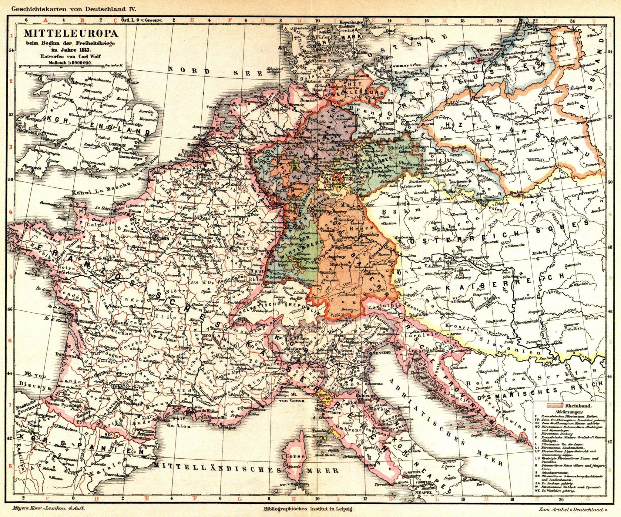
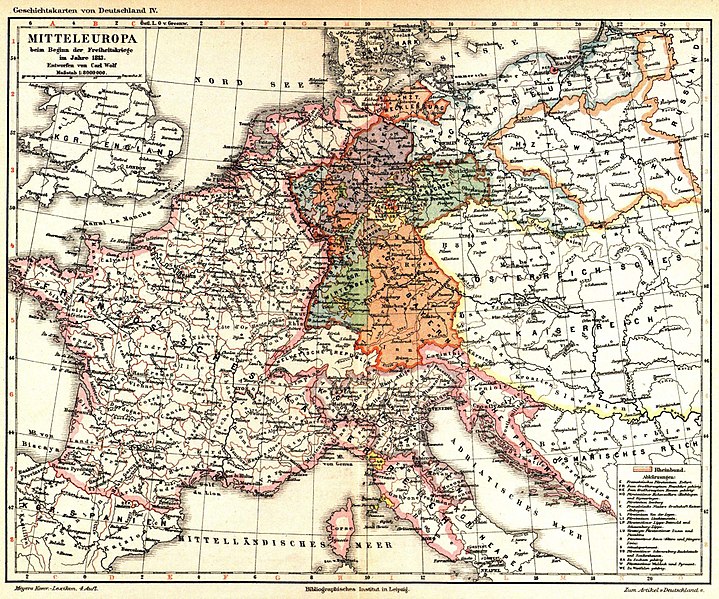
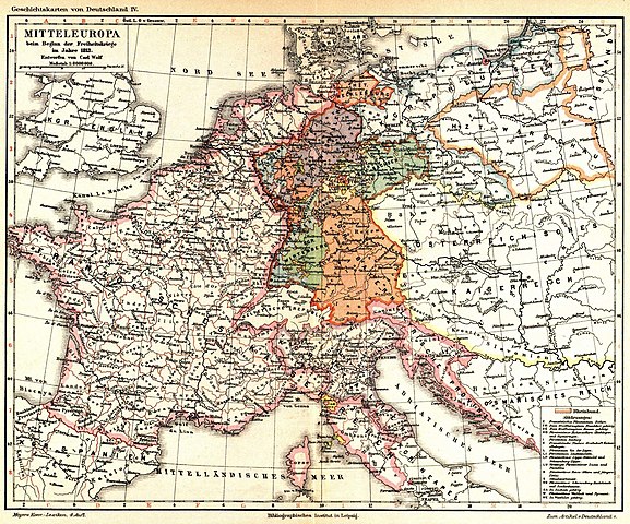
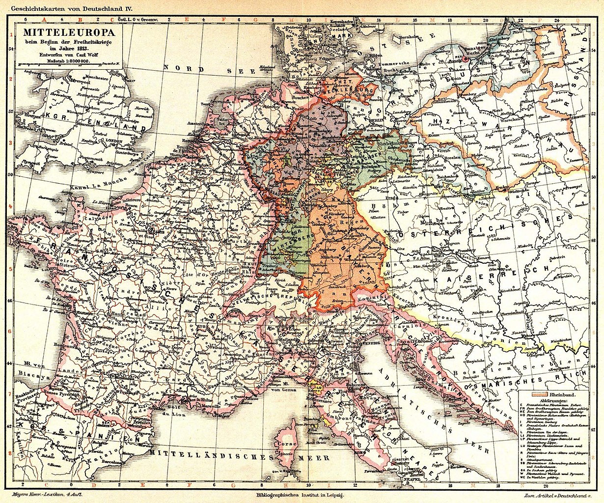
Deutsch: Mitteleuropa beim Beginn der Freiheitskriege im Jahre 1813 (1 : 8.000.000) (Geschichtskarten von Deutschland IV) English: Central Europe at the beginning of the wars of freedom in C.E.1813 (1: 8,000,000) (history maps of Germany IV) |
| Date | circa 1885 |
| Source | Meyers Konversations-Lexikon, 4th ed., vol. 4 |
| Author | Carl Wolf |
| Other versions |
|


Licensing
[edit]
This page comes from Book 4 of the 4th edition of Meyers Konversationslexikon (1885–90). The copyrights for that book have expired and this page is in the public domain.
|
This work is in the public domain in the United States because it was published (or registered with the U.S. Copyright Office) before January 1, 1929.
Public domain works must be out of copyright in both the United States and in the source country of the work in order to be hosted on the Commons. If the work is not a U.S. work, the file must have an additional copyright tag indicating the copyright status in the source country.
Note: This tag should not be used for sound recordings. |
File history
Click on a date/time to view the file as it appeared at that time.
| Date/Time | Thumbnail | Dimensions | User | Comment | |
|---|---|---|---|---|---|
| current | 22:32, 30 April 2018 | | 2,048 × 1,705 (809 KB) | Mapmarks (talk | contribs) | new upload as File:Meyers Hist Handatlas 1911 Nr 33.jpg - Reverted to version as of 11:50, 26 September 2014 (UTC) |
| 14:46, 27 April 2018 |  | 3,692 × 2,972 (2.19 MB) | FDRMRZUSA (talk | contribs) | Higher resolution. Better quality. Same source and license. | |
| 11:50, 26 September 2014 |  | 2,048 × 1,705 (809 KB) | Mapmarks (talk | contribs) | {{PD-Meyers-pages|4|cur=884}} Category:Old maps of Europe Category:1813 in Europe Category:Maps of the Confederation of the Rhine Category:1880s maps |
You cannot overwrite this file.
File usage on Commons
The following 5 pages use this file:
File usage on other wikis
The following other wikis use this file:
- Usage on de.wikisource.org