File:Moers 2011-03, Fernmeldeturm CN-1.jpg
Jump to navigation
Jump to search
Size of this preview: 195 × 599 pixels. Other resolutions: 78 × 240 pixels | 156 × 480 pixels | 250 × 768 pixels | 333 × 1,024 pixels | 666 × 2,048 pixels | 2,865 × 8,803 pixels.
Original file (2,865 × 8,803 pixels, file size: 11.74 MB, MIME type: image/jpeg)
Captions
Captions
Add a one-line explanation of what this file represents
| Description |
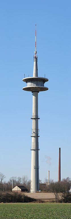
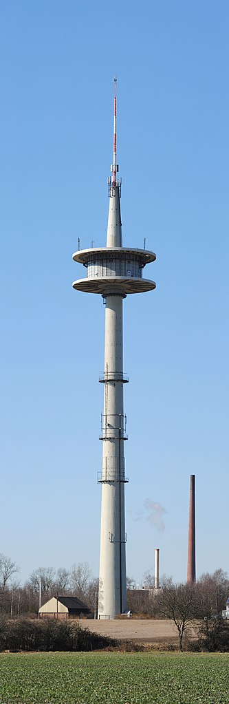
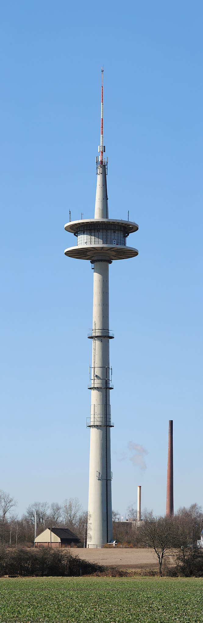
English: Panorama view from east on the telecommunication tower of Moers (Germany).
Français : Vue panoramique sur la tour de télecomunication de Moers, en Allemagne, vue depuis l'est.
This image was created with Hugin. This photograph was taken with a Nikon D3000 |
| Date | |
| Source | Own work |
| Author | kaʁstn Disk/Cat |
| Permission (Reusing this file) |
This file is licensed under the Creative Commons Attribution-Share Alike 3.0 Germany license.
 |
| Camera location | | View this and other nearby images on: OpenStreetMap |
|---|
| Object location | | View this and other nearby images on: OpenStreetMap |
|---|
| Camera Model | Nikon D3000 |
|---|---|
| Shutter speed | 1/320s |
| Aperture | F8.0 |
| Film speed (ISO) | 100 |
| Lens | AF-S DX Zoom-Nikkor 55-200mm f/4.-5.6G ED |
| Focal length | 165mm |

|
NOTE: This image is a panorama consisting of 7 frames that were merged or stitched in Hugin. As a result, this image necessarily underwent some form of digital manipulation. These manipulations may include blending, blurring, cloning, and colour and perspective adjustments. As a result of these adjustments, the image content may be slightly different from reality at the points where multiple images were combined. This manipulation is often required due to lens, perspective, and parallax distortions.
|
This image has been assessed using the Quality image guidelines and is considered a Quality image.
|

|
This image has been assessed under the valued image criteria and is considered the most valued image on Commons within the scope: Fernmeldeturm Moers (Moers Transmission Tower). You can see its nomination here. |
File history
Click on a date/time to view the file as it appeared at that time.
| Date/Time | Thumbnail | Dimensions | User | Comment | |
|---|---|---|---|---|---|
| current | 20:33, 11 March 2011 | 2,865 × 8,803 (11.74 MB) | Carschten (talk | contribs) | {{subst:User:Carschten/pic | Beschreibung = {{de|Panoramablick von Osten auf den Fernmeldeturm von Moers}} {{en|Panorama view from east on the telecommunication tower of {{W|Moers}} (Germany)}} | Datum |
You cannot overwrite this file.
File usage on Commons
The following 6 pages use this file:
- User talk:Carschten/Archive/Promotions
- Commons:Quality images/Subject/Places/Man made structures/Buildings, Exterior/Part 1
- Commons:Quality images candidates/Archives March 2011
- Commons:Valued image candidates/Moers 2011-03, Fernmeldeturm CN-1.jpg
- Commons:Valued images by topic/Places/Buildings/Skyscrapers and towers
- Commons talk:Quality images/Subject/Places/Man made structures
File usage on other wikis
The following other wikis use this file:
- Usage on de.wikipedia.org
- Usage on www.wikidata.org