File:NSB Di 4 Nattog Saltfjellet.jpg
Jump to navigation
Jump to search
Size of this preview: 800 × 494 pixels. Other resolutions: 320 × 198 pixels | 640 × 395 pixels | 1,024 × 632 pixels | 1,280 × 790 pixels | 2,560 × 1,580 pixels | 6,514 × 4,021 pixels.
Original file (6,514 × 4,021 pixels, file size: 6.01 MB, MIME type: image/jpeg)
Captions
Captions
Add a one-line explanation of what this file represents
Summary
[edit]
| Description |
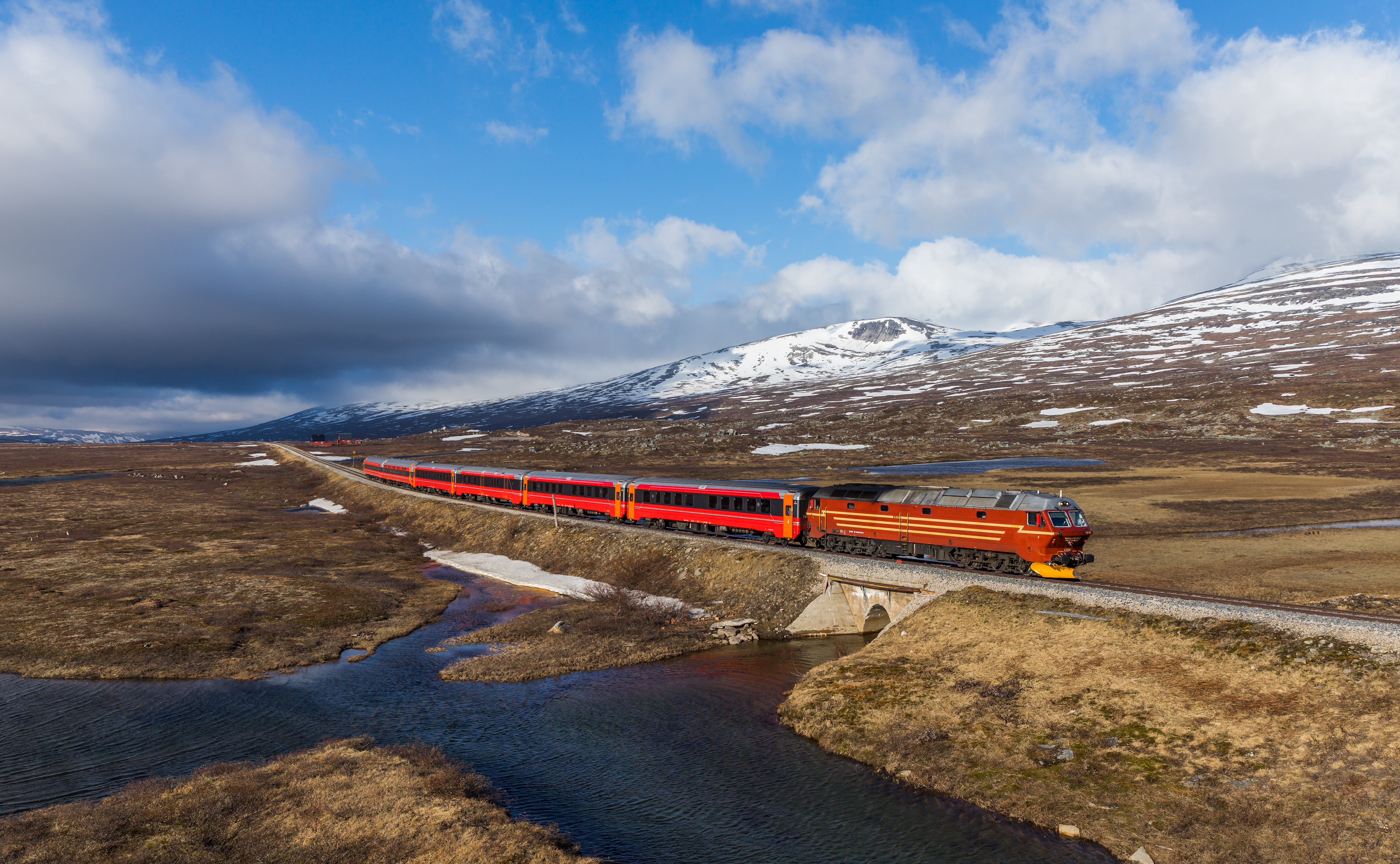
English: Norges Statsbaner's Di 4 654 hauls the daily night train from Trondheim to Bodø, Norway. The train has just reached the highest point of the Nordlandlandsbane on the Saltfjellet.
Deutsch: Di 4 654 der Norwegischen Staatsbahn zieht den täglichen Nachtzug Trondheim - Bodø, und hat soeben den höchsten Punkt der Nordlandsbahn auf dem Saltfjell erreicht. |
| Date | |
| Source | Own work, also available at https://bahnbilder.ch/picture/29362 |
| Author | Kabelleger / David Gubler |
| Camera location | | View this and other nearby images on: OpenStreetMap |
|---|
|
Licensing
[edit]
I, the copyright holder of this work, hereby publish it under the following license:
This file is licensed under the Creative Commons Attribution-Share Alike 4.0 International license.
- You are free:
- to share – to copy, distribute and transmit the work
- to remix – to adapt the work
- Under the following conditions:
- attribution – You must give appropriate credit, provide a link to the license, and indicate if changes were made. You may do so in any reasonable manner, but not in any way that suggests the licensor endorses you or your use.
- share alike – If you remix, transform, or build upon the material, you must distribute your contributions under the same or compatible license as the original.
File history
Click on a date/time to view the file as it appeared at that time.
| Date/Time | Thumbnail | Dimensions | User | Comment | |
|---|---|---|---|---|---|
| current | 21:30, 2 June 2018 | | 6,514 × 4,021 (6.01 MB) | Kabelleger (talk | contribs) | User created page with UploadWizard |
You cannot overwrite this file.
File usage on Commons
The following 14 pages use this file:
- User:Alex Noble/Favorites
- User:Eatcha/POTY-2018-Round-1-Results
- User:Kabelleger
- Commons:Featured picture candidates/File:NSB Di 4 Nattog Saltfjellet.jpg
- Commons:Featured picture candidates/Log/June 2018
- Commons:Featured pictures/Objects/Vehicles/Land vehicles
- Commons:Featured pictures/chronological/2018-A
- Commons:Picture of the Year/2018/Candidates
- Commons:Picture of the Year/2018/R1/Gallery/2018-A
- Commons:Picture of the Year/2018/R1/Gallery/ALL
- Commons:Picture of the Year/2018/R1/Gallery/M06
- Commons:Picture of the Year/2018/R1/Gallery/Vehicles and crafts
- Commons:Picture of the Year/2018/R1/v/NSB Di 4 Nattog Saltfjellet.jpg
- Commons:WikiProject Aviation/recent uploads/2018 June 2
File usage on other wikis
The following other wikis use this file:
- Usage on fr.wikipedia.org
- Usage on nl.wikipedia.org