File:Natural Regions of Chile.svg
Jump to navigation
Jump to search

Size of this PNG preview of this SVG file: 267 × 600 pixels. Other resolutions: 107 × 240 pixels | 213 × 480 pixels | 342 × 768 pixels | 455 × 1,024 pixels | 911 × 2,048 pixels | 1,183 × 2,658 pixels.
Original file (SVG file, nominally 1,183 × 2,658 pixels, file size: 1.16 MB)
Captions
Captions
Add a one-line explanation of what this file represents
Summary
[edit]
| Description |
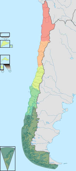
Español: Mapa de las regiones naturales de Chile. |
| Date | |
| Source |
This file was derived from: |
| Author |
|
| Other versions |
,_administrative_divisions_(CORFO_regions)_-_Nmbrs_-_colored_2018.svg) |
.svg)
Licensing
[edit]
This file is licensed under the Creative Commons Attribution-ShareAlike 3.0 Chile license.
- You are free:
- to share – to copy, distribute and transmit the work
- to remix – to adapt the work
- Under the following conditions:
- attribution – You must give appropriate credit, provide a link to the license, and indicate if changes were made. You may do so in any reasonable manner, but not in any way that suggests the licensor endorses you or your use.
- share alike – If you remix, transform, or build upon the material, you must distribute your contributions under the same or compatible license as the original.

File history
Click on a date/time to view the file as it appeared at that time.
| Date/Time | Thumbnail | Dimensions | User | Comment | |
|---|---|---|---|---|---|
| current | 22:37, 15 August 2023 | | 1,183 × 2,658 (1.16 MB) | Janitoalevic (talk | contribs) | Arreglo límite entre la zona centro y la zona sur. |
| 00:08, 11 September 2018 |  | 1,183 × 2,658 (1.15 MB) | Janitoalevic (talk | contribs) | Color correction | |
| 16:57, 22 February 2018 |  | 1,183 × 2,658 (1.15 MB) | Janitoalevic (talk | contribs) | Added islands and claims | |
| 20:48, 3 December 2017 |  | 1,183 × 2,658 (945 KB) | Janitoalevic (talk | contribs) | Fixed islands | |
| 20:38, 3 December 2017 |  | 1,183 × 2,658 (946 KB) | Janitoalevic (talk | contribs) | . | |
| 23:33, 20 August 2017 |  | 1,262 × 2,835 (939 KB) | Janitoalevic (talk | contribs) | Removed Ñuble Region (Will be fully implemtented in 2018) | |
| 02:38, 25 July 2017 |  | 1,262 × 2,835 (942 KB) | Janitoalevic (talk | contribs) | Added new region. | |
| 21:51, 7 June 2017 |  | 1,262 × 2,835 (967 KB) | Janitoalevic (talk | contribs) | . | |
| 21:14, 7 June 2017 |  | 1,262 × 2,835 (931 KB) | Janitoalevic (talk | contribs) | . | |
| 21:12, 7 June 2017 |  | 1,262 × 2,835 (931 KB) | Janitoalevic (talk | contribs) | Details. |
You cannot overwrite this file.
File usage on Commons
The following 6 pages use this file:
- User:Janitoalevic/Gallery/Maps
- Commons:Deletion requests/Archive/2018/09/01
- Commons:Deletion requests/File:NaturalregionsofChile.jpg
- File:Chile (+Antarctica & Islands), administrative divisions (CORFO regions) - Nmbrs - colored 2018.svg
- File:Mapa zonas naturales de Chile.png
- Category:Natural regions of Chile
File usage on other wikis
The following other wikis use this file:
- Usage on ar.wikipedia.org
- Usage on be.wikipedia.org
- Usage on br.wikipedia.org
- Usage on de.wikipedia.org
- Usage on en.wikipedia.org
- Usage on es.wikipedia.org
- Usage on eu.wikipedia.org
- Usage on fr.wikipedia.org
- Usage on lt.wikipedia.org
- Usage on mt.wikipedia.org
- Usage on nn.wikipedia.org
- Usage on no.wikipedia.org
- Usage on pt.wikipedia.org
- Usage on sl.wikipedia.org
- Usage on tr.wikipedia.org
- Usage on www.wikidata.org
- Usage on zh.wikipedia.org