File:North Rhine-Westphalia location map 02.svg
Jump to navigation
Jump to search

Size of this PNG preview of this SVG file: 527 × 524 pixels. Other resolutions: 241 × 240 pixels | 483 × 480 pixels | 772 × 768 pixels | 1,030 × 1,024 pixels | 2,060 × 2,048 pixels.
Original file (SVG file, nominally 527 × 524 pixels, file size: 1.83 MB)
Captions
Captions
Add a one-line explanation of what this file represents
Summary
[edit]| Description |
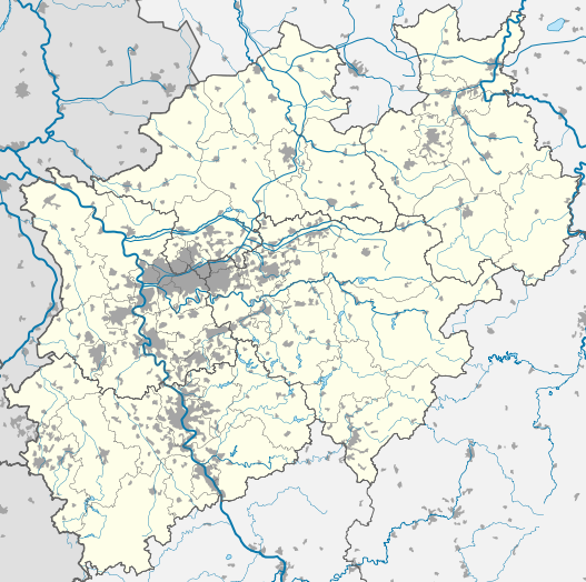
Deutsch: Positionskarte Nordrhein-Westfalen, Germany. Geographische Begrenzung der Karte:
English: Location map North Rhine-Westphalia, Germany. Geographic limits of the map:
Français : Carte du land Rhénanie-du-Nord-Westphalie (Allemagne) destinée à géolocalisation. Les limites géographiques sont:
|
|||||||||||||
| Date | ||||||||||||||
| Source |
Own work, based on (not all layers may be visible or included):
Only to compare some issues: | |||||||||||||
| SVG development | This W3C-invalid map was created with Adobe Illustrator. |
|||||||||||||
| Author |
TUBS |
|||||||||||||
| Other versions |
[]
|


Licensing
[edit]

|
Permission is granted to copy, distribute and/or modify this document under the terms of the GNU Free Documentation License, Version 1.2 or any later version published by the Free Software Foundation; with no Invariant Sections, no Front-Cover Texts, and no Back-Cover Texts. A copy of the license is included in the section entitled GNU Free Documentation License. |
This file is licensed under the Creative Commons Attribution 3.0 Unported, 2.5 Generic, 2.0 Generic and 1.0 Generic license.
Attribution: TUBS

- You are free:
- to share – to copy, distribute and transmit the work
- to remix – to adapt the work
- Under the following conditions:
- attribution – You must give appropriate credit, provide a link to the license, and indicate if changes were made. You may do so in any reasonable manner, but not in any way that suggests the licensor endorses you or your use.
This file is licensed under the Creative Commons Attribution-Share Alike 3.0 Unported, 2.5 Generic, 2.0 Generic and 1.0 Generic license.
Attribution: TUBS
- You are free:
- to share – to copy, distribute and transmit the work
- to remix – to adapt the work
- Under the following conditions:
- attribution – You must give appropriate credit, provide a link to the license, and indicate if changes were made. You may do so in any reasonable manner, but not in any way that suggests the licensor endorses you or your use.
- share alike – If you remix, transform, or build upon the material, you must distribute your contributions under the same or compatible license as the original.
| This file is made available under the Creative Commons CC0 1.0 Universal Public Domain Dedication. | |
| The person who associated a work with this deed has dedicated the work to the public domain by waiving all of their rights to the work worldwide under copyright law, including all related and neighboring rights, to the extent allowed by law. You can copy, modify, distribute and perform the work, even for commercial purposes, all without asking permission.
|
| I, the copyright holder of this work, release this work into the public domain. This applies worldwide. In some countries this may not be legally possible; if so: I grant anyone the right to use this work for any purpose, without any conditions, unless such conditions are required by law. |
| Copyleft: This work of art is free; you can redistribute it and/or modify it according to terms of the Free Art License. You will find a specimen of this license on the Copyleft Attitude site as well as on other sites. |

|
The copyright holder of this file, TUBS |
|
|
You may select the license of your choice.

|
I'd greatly appreciate, that you attribute this media file to Wikimedia Commons, if used outside Wikipedia or Commons. For use in publications such as books, newspapers, blogs, websites, please insert here the following line:
|
File history
Click on a date/time to view the file as it appeared at that time.
| Date/Time | Thumbnail | Dimensions | User | Comment | |
|---|---|---|---|---|---|
| current | 19:24, 16 December 2009 | | 527 × 524 (1.83 MB) | TUBS (talk | contribs) | korr crop area |
| 10:09, 16 December 2009 |  | 524 × 525 (18.51 MB) | TUBS (talk | contribs) | corr | |
| 12:09, 6 November 2009 |  | 657 × 656 (3.58 MB) | TUBS (talk | contribs) | korr | |
| 20:39, 31 October 2009 |  | 657 × 656 (904 KB) | TUBS (talk | contribs) | +channels | |
| 16:20, 31 October 2009 |  | 657 × 656 (886 KB) | TUBS (talk | contribs) | corrected location of some cities | |
| 13:38, 31 October 2009 |  | 657 × 656 (886 KB) | TUBS (talk | contribs) | removed bitmaps | |
| 13:33, 31 October 2009 |  | 657 × 656 (1.12 MB) | TUBS (talk | contribs) | new version | |
| 08:23, 4 November 2008 |  | 654 × 656 (491 KB) | TUBS (talk | contribs) | {{Information |Description= |Source= |Date= |Author= |Permission= |other_versions= }} | |
| 09:17, 8 October 2008 |  | 654 × 656 (486 KB) | TUBS (talk | contribs) | reduced border thickness | |
| 09:25, 30 September 2008 |  | 654 × 656 (486 KB) | TUBS (talk | contribs) | == Summary == {{Information |Description= {{de|Positionskarte Nordrhein-Westfalen, Germany. Geographische Begrenzung der Karte: * N: 52.532914° N * S: 50.336911° N * W: 5.866961° O * O: 9.462706° O}} {{en|Location map [[ |
You cannot overwrite this file.
File usage on Commons
The following 52 pages use this file:
- File:NRW2004 CDU.svg
- File:NRW2004 FDP.svg
- File:NRW2004 SPD.svg
- File:NRW cut 5.834–7.678°E, 50.453–52.515°N.png
- File:NRW cut 5.834–7.9546°E, 50.551–52.277°N2.png
- File:NRW election 2004 Gemeinden.svg
- File:NRW election 2004 Landrat.svg
- File:NRW election 2004 Oberbuergermeister.svg
- File:NRW relief cut 5.834–7.6046°E, 50.551–52.277°N.png
- File:NRW relief cut 5.834–8.718°E, 50.453–52.515°N.png
- File:Nordrhein-Westfalen, administrative divisions (districts only) - Nmbrs - colored (+population).svg
- File:Nordrhein-Westfalen, administrative divisions (districts only) - Nmbrs - monochrome (+population).svg
- File:Nordrhein-Westfalen, administrative divisions (districts only) - de - colored (+population).svg
- File:Nordrhein-Westfalen, administrative divisions (districts only) - de - monochrome (+population).svg
- File:Nordrhein-Westfalen, administrative divisions (districts only + government district sorted) - Nmbrs - colored (+population).svg
- File:Nordrhein-Westfalen, administrative divisions (districts only + government district sorted) - Nmbrs - monochrome (+population).svg
- File:Nordrhein-Westfalen, administrative divisions (districts only + government district sorted) - de - colored (+population).svg
- File:Nordrhein-Westfalen, administrative divisions (districts only + government district sorted) - de - monochrome (+population).svg
- File:Nordrhein-Westfalen, administrative divisions (government districts only) - Nmbrs - colored (+population).svg
- File:Nordrhein-Westfalen, administrative divisions (government districts only) - Nmbrs - monochrome (+population).svg
- File:Nordrhein-Westfalen, administrative divisions (government districts only) - de - colored (+population).svg
- File:Nordrhein-Westfalen, administrative divisions (government districts only) - de - monochrome (+population).svg
- File:Nordrhein-Westfalen, administrative divisions (government districts only+district borders) - Nmbrs - colored (less colors) (+population).svg
- File:Nordrhein-Westfalen, administrative divisions (government districts only+district borders) - Nmbrs - colored (more colors) (+population).svg
- File:Nordrhein-Westfalen, administrative divisions (government districts only+district borders) - Nmbrs - monochrome (+population).svg
- File:Nordrhein-Westfalen, administrative divisions (government districts only+district borders) - de - colored (less colors) (+population).svg
- File:Nordrhein-Westfalen, administrative divisions (government districts only+district borders) - de - colored (more colors) (+population).svg
- File:Nordrhein-Westfalen, administrative divisions (government districts only+district borders) - de - monochrome (+population).svg
- File:Nordrhein-Westfalen, administrative divisions - Nmbrs - colored (+population).svg
- File:Nordrhein-Westfalen, administrative divisions - Nmbrs - colored (less colors) (+population).svg
- File:Nordrhein-Westfalen, administrative divisions - Nmbrs - monochrome (+population).svg
- File:Nordrhein-Westfalen, administrative divisions - de - colored (+population).svg
- File:Nordrhein-Westfalen, administrative divisions - de - colored (+topo).svg
- File:Nordrhein-Westfalen, administrative divisions - de - colored (less colors) (+population).svg
- File:Nordrhein-Westfalen, administrative divisions - de - monochrome (+population).svg
- File:North-Rhine-Westphalia-topographic-map-04.jpg
- File:North Rhine-Westphalia FDP-Bezirksverbaende.svg
- File:North Rhine-Westphalia location map 01.svg
- File:North Rhine-Westphalia location map 02.svg
- File:North Rhine-Westphalia location map 03.svg
- File:North Rhine-Westphalia location map 04.svg
- File:North Rhine-Westphalia location map 05.svg
- File:North Rhine-Westphalia location map 06.svg
- File:North Rhine-Westphalia location map 07.svg
- File:North Rhine-Westphalia relief location map.jpg
- File:North Rhine-Westphalia topographic map 01.jpg
- File:North Rhine-Westphalia topographic map 01V.svg
- File:North Rhine-Westphalia topographic map 02.jpg
- File:North Rhine-Westphalia topographic map 02V.svg
- File:North Rhine-Westphalia topographic map 03.png
- File:North Rhine-Westphalia topographic map 04V.svg
- Template:Other versions/Location maps of North Rhine-Westphalia
_-_Nmbrs_-_colored_(%2Bpopulation).svg)
_-_Nmbrs_-_monochrome_(%2Bpopulation).svg)
_-_de_-_colored_(%2Bpopulation).svg)
_-_de_-_monochrome_(%2Bpopulation).svg)
_-_Nmbrs_-_colored_(%2Bpopulation).svg)
_-_Nmbrs_-_monochrome_(%2Bpopulation).svg)
_-_de_-_colored_(%2Bpopulation).svg)
_-_de_-_monochrome_(%2Bpopulation).svg)
_-_Nmbrs_-_colored_(%2Bpopulation).svg)
_-_Nmbrs_-_monochrome_(%2Bpopulation).svg)
_-_de_-_colored_(%2Bpopulation).svg)
_-_de_-_monochrome_(%2Bpopulation).svg)
_-_Nmbrs_-_colored_(less_colors)_(%2Bpopulation).svg)
_-_Nmbrs_-_colored_(more_colors)_(%2Bpopulation).svg)
_-_Nmbrs_-_monochrome_(%2Bpopulation).svg)
_-_de_-_colored_(less_colors)_(%2Bpopulation).svg)
_-_de_-_colored_(more_colors)_(%2Bpopulation).svg)
_-_de_-_monochrome_(%2Bpopulation).svg)
.svg)
_(%2Bpopulation).svg)
.svg)
.svg)
.svg)
_(%2Bpopulation).svg)
.svg)
File usage on other wikis
The following other wikis use this file:
- Usage on als.wikipedia.org
- Usage on az.wikipedia.org
- Usage on bs.wikipedia.org
- Usage on cv.wikipedia.org
- Usage on da.wikipedia.org
- Usage on de.wikipedia.org
- Usage on en.wikipedia.org
- Usage on frr.wikipedia.org
- Usage on fr.wikipedia.org
- Usage on ko.wikipedia.org
- Usage on nds-nl.wikipedia.org
- Usage on ru.wikipedia.org
- Usage on vi.wikipedia.org