File:Ordnance Survey Drawings - East Ilsley (OSD 158).jpg
Jump to navigation
Jump to search
Size of this preview: 474 × 599 pixels. Other resolutions: 190 × 240 pixels | 379 × 480 pixels | 607 × 768 pixels | 810 × 1,024 pixels | 1,619 × 2,048 pixels | 3,163 × 4,000 pixels.
Original file (3,163 × 4,000 pixels, file size: 5.81 MB, MIME type: image/jpeg)
Captions
Captions
Add a one-line explanation of what this file represents
| East Ilsley (OSD 158)
|
|||||
|---|---|---|---|---|---|
| Artist |
Stanley, William - Draughtsman |
.jpg) | |||
| Title |
Ordnance Survey Drawings: East Ilsley (OSD 158) |
||||
| Object type |
manuscript map |
||||
| Description |
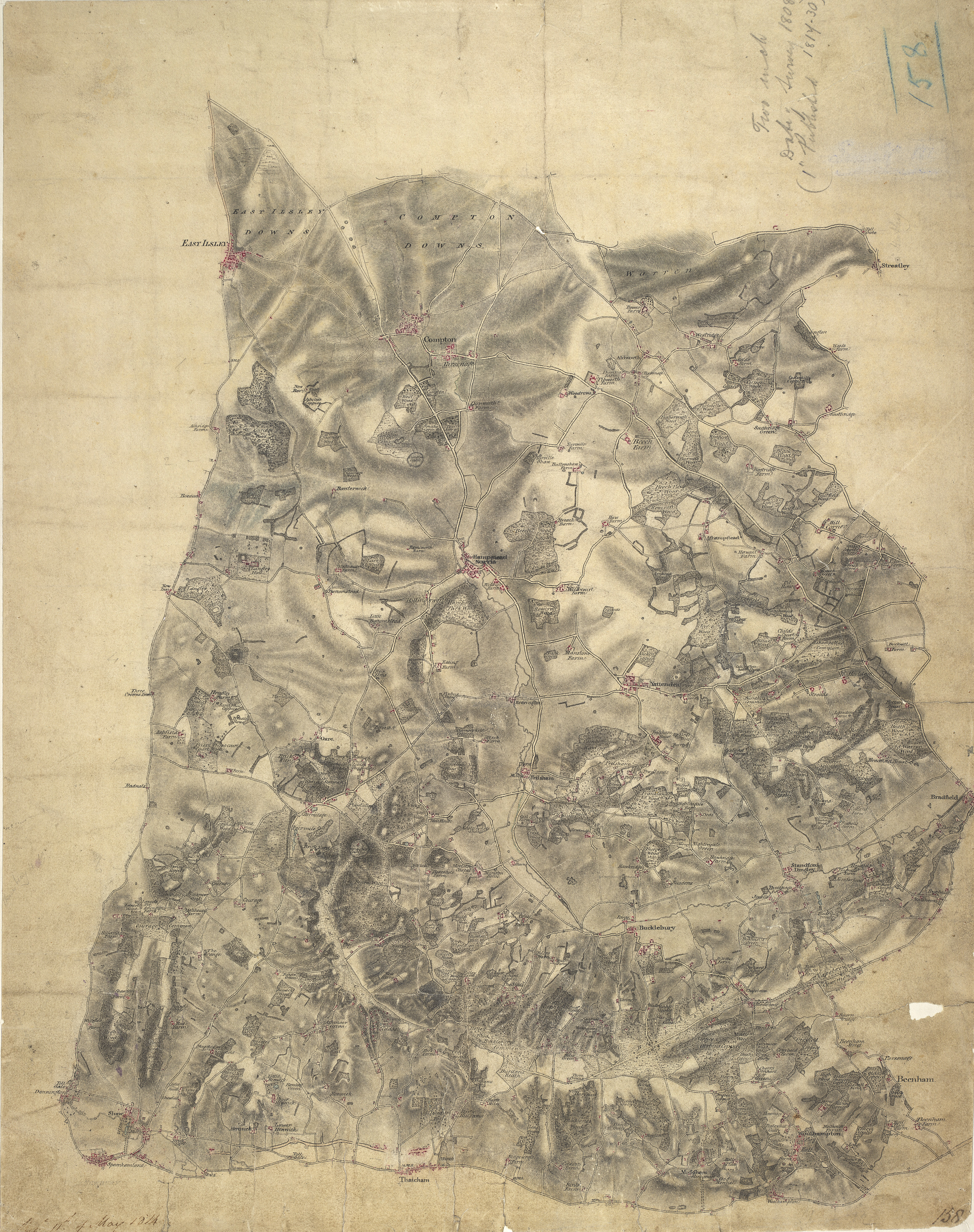
 Centre of map shown on a map of England
English: .A turnpike road, shown in faded yellow ochre, forms the southern boundary of this map of the Berkshire chalklands. It runs from Speenhamland, at the bottom left of the plan, to Woolhampton, at the right. The mileage appears alongside the route in black-ink figures, and toll gates are marked. Correspondence in the Ordnance Survey Letter Book records that William Stanley, military draughtsman and author of this drawing, spent more than a year from February 1821 revising the plan. Some of these corrections are apparent near Thatcham at the bottom centre of the map..
This image has been georeferenced.
|
||||
| Language |
English |
||||
| Date | 1808 | ||||
| Medium | Pen and ink on paper | ||||
| Collection | |||||
| Accession number |
Maps OSD 158 |
||||
| Credit line | British Library | ||||
| Notes |
Scale 2 inches : 1 mile (1:31680). Please note that the British Library provides these digital files "as-is"; materials will not be rephotographed under this programme. If resupply of files is required, the requestor will be required to purchase them at the standard rate. |
||||
| References |
http://www.bl.uk/onlinegallery/onlineex/ordsurvdraw/e/002osd000000002u00011100.html (English) |
||||
| Source/Photographer |
|
||||
| Permission (Reusing this file) |
|
||||


_(St_Edwards_Crown).svg)
.jpg¶ms=51.477248_N_-1.236599_E_)
.jpg¶ms=51.391311_N_-1.345999_E_)
.jpg¶ms=51.563186_N_-1.127199_E_)
.jpg¶ms=51.563186_N_-1.338986_E_)
.jpg¶ms=51.396369_N_-1.345999_E_)
.jpg¶ms=51.391311_N_-1.134212_E_)
.jpg¶ms=51.558127_N_-1.127199_E_)
File history
Click on a date/time to view the file as it appeared at that time.
| Date/Time | Thumbnail | Dimensions | User | Comment | |
|---|---|---|---|---|---|
| current | 08:09, 26 September 2013 | | 3,163 × 4,000 (5.81 MB) | LibraryBot (talk | contribs) | {{subst:User:Andrew Gray/OSD|ID= 002OSD000000002U00011100 |OSD_NUM= OSD 158 |MEDIUM= Pen and ink on paper |TITLE= East Ilsley |CREATOR= Stanley, William - Draughtsman |YEAR= 1808 |DESCRIPTION= .A turnpike road, shown in faded yellow ochre, forms the so... |
You cannot overwrite this file.
File usage on Commons
The following page uses this file:
File usage on other wikis
The following other wikis use this file:
- Usage on www.wikidata.org
.jpg&oldid=914306809)