File:Ordnance Survey Drawings - Froxfield (OSD 167).jpg
Jump to navigation
Jump to search
Size of this preview: 800 × 486 pixels. Other resolutions: 320 × 194 pixels | 640 × 389 pixels | 1,024 × 622 pixels | 1,280 × 777 pixels | 2,560 × 1,555 pixels | 4,000 × 2,429 pixels.
Original file (4,000 × 2,429 pixels, file size: 2.93 MB, MIME type: image/jpeg)
Captions
Captions
Add a one-line explanation of what this file represents
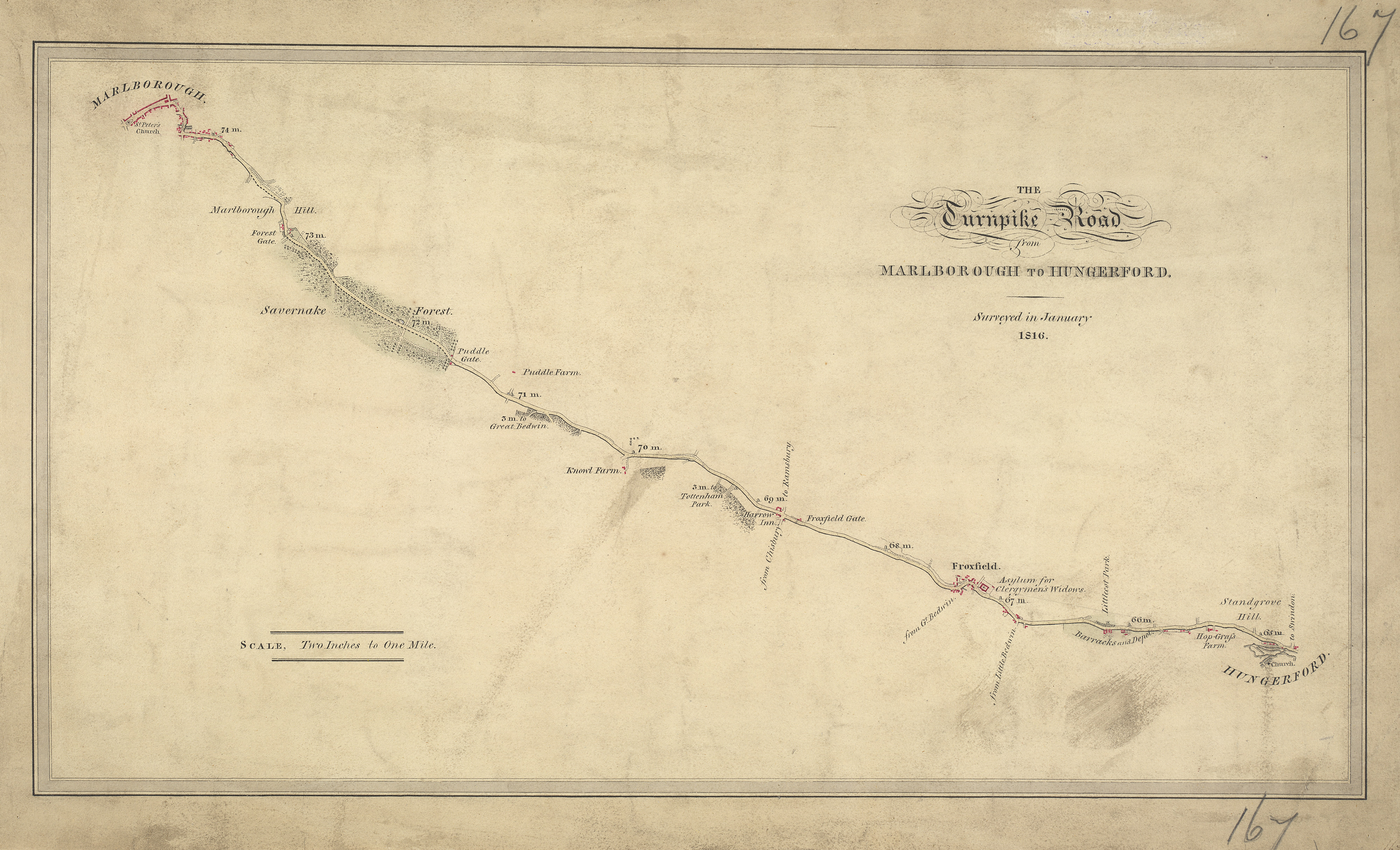
| The Turnpike Road From Marlborough To Hungerford (OSD 167)
|
|||||
|---|---|---|---|---|---|
| Artist |
Stanley, William - Draughtsman |
.jpg) | |||
| Title |
Ordnance Survey Drawings: Froxfield (OSD 167) |
||||
| Object type |
manuscript map |
||||
| Description |
 Centre of map shown on a map of England
English: .Records from the Ordnance Survey Letter Book suggest that Edmund Crocker surveyed the turnpike road from Hungerford to Marlborough and William Stanley, draughtsman, made the drawing. The road is coloured yellow ochre and one side is thickened to indicate its importance. Notes of mileage in ink figures appear alongside the road. The close attention given to communication routes highlights the military emphasis of these studies..
This image has been georeferenced.
|
||||
| Language |
English |
||||
| Date | 1816 | ||||
| Medium | Pen and ink on paper | ||||
| Collection | |||||
| Accession number |
Maps OSD 167 |
||||
| Credit line | British Library | ||||
| Notes |
Scale 2 inches : 1 mile (1:31680). Please note that the British Library provides these digital files "as-is"; materials will not be rephotographed under this programme. If resupply of files is required, the requestor will be required to purchase them at the standard rate. |
||||
| References |
http://www.bl.uk/onlinegallery/onlineex/ordsurvdraw/other/002osd000000002u00012200.html (English) |
||||
| Source/Photographer |
|
||||
| Permission (Reusing this file) |
|
||||


_(St_Edwards_Crown).svg)
.jpg¶ms=51.41597_N_-1.626995_E_)
.jpg¶ms=51.356728_N_-1.747145_E_)
.jpg¶ms=51.475212_N_-1.506845_E_)
.jpg¶ms=51.419361_N_-1.747145_E_)
.jpg¶ms=51.356728_N_-1.706579_E_)
.jpg¶ms=51.412579_N_-1.506845_E_)
.jpg¶ms=51.475212_N_-1.547411_E_)
File history
Click on a date/time to view the file as it appeared at that time.
| Date/Time | Thumbnail | Dimensions | User | Comment | |
|---|---|---|---|---|---|
| current | 08:21, 26 September 2013 | | 4,000 × 2,429 (2.93 MB) | LibraryBot (talk | contribs) | {{subst:User:Andrew Gray/OSD|ID= 002OSD000000002U00012200 |OSD_NUM= OSD 167 |MEDIUM= Pen and ink on paper |TITLE= Froxfield |CREATOR= Stanley, William - Draughtsman |YEAR= 1816 |DESCRIPTION= .Records from the Ordnance Survey Letter Book suggest that Ed... |
You cannot overwrite this file.
File usage on Commons
The following page uses this file:
File usage on other wikis
The following other wikis use this file:
- Usage on www.wikidata.org
.jpg&oldid=888959134)