File:Ordnance Survey Drawings - Woverhampton, Wolverhampton (OSD 212).jpg
Jump to navigation
Jump to search
Size of this preview: 463 × 599 pixels. Other resolutions: 185 × 240 pixels | 371 × 480 pixels | 594 × 768 pixels | 792 × 1,024 pixels | 1,584 × 2,048 pixels | 3,093 × 4,000 pixels.
Original file (3,093 × 4,000 pixels, file size: 5.44 MB, MIME type: image/jpeg)
Captions
Captions
Add a one-line explanation of what this file represents
| Wolverhampton 10 (OSD 212)
|
|||||
|---|---|---|---|---|---|
| Artist |
Dawson, Robert - Draughtsman |
.jpg) | |||
| Title |
Ordnance Survey Drawings: Woverhampton, Wolverhampton (OSD 212) |
||||
| Object type |
manuscript map |
||||
| Description |
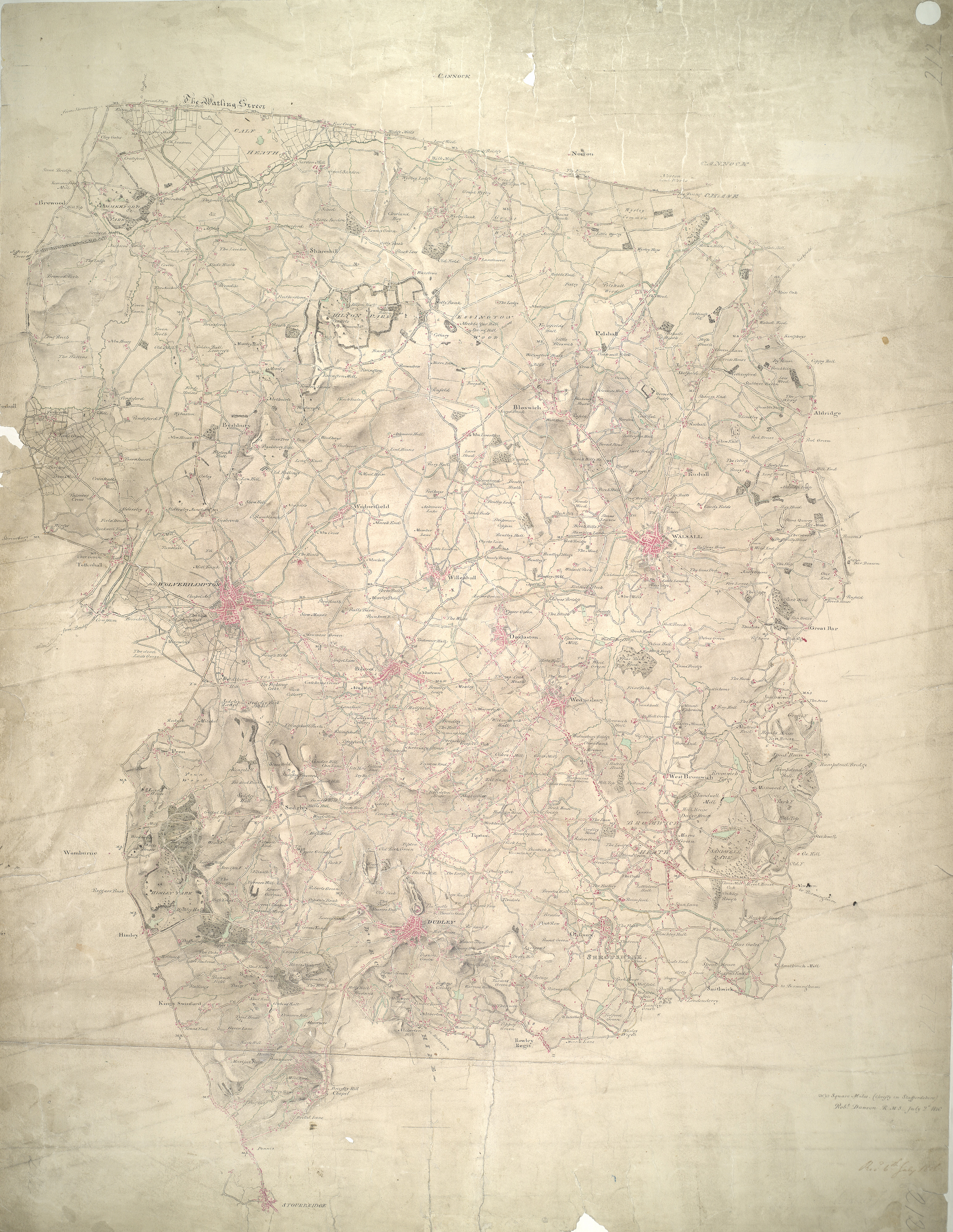
 Centre of map shown on a map of England
English: This plan covers part of the English Midland plateau. The Staffordshire and Worcestershire Canal is depicted down the left side. Opened for traffic in May 1772, the canal was built by engineer James Brindley as part of his 'Grand Cross', a far-sighted scheme to link the ports of Hull, Liverpool and Bristol by connecting the rivers Mersey, Trent and Severn. Work on a second waterway, the Birmingham Canal, started a year later to facilitate the transport of coal from the pits of the Black Country to Birmingham. The Industrial Revolution saw over 180 miles of canals and 216 locks built. Part of this network is visible on the plan highlighted in blue..
This image has been georeferenced.
|
||||
| Language |
English |
||||
| Date | 1816 | ||||
| Medium | Pen and ink on paper | ||||
| Dimensions | height: 390 mm (15.35 in); width: 310 mm (12.20 in) | ||||
| Collection | |||||
| Accession number |
Maps OSD 212 |
||||
| Credit line | British Library | ||||
| Notes |
Scale 2 inches : 1 mile (1:31680). Please note that the British Library provides these digital files "as-is"; materials will not be rephotographed under this programme. If resupply of files is required, the requestor will be required to purchase them at the standard rate. |
||||
| References |
http://www.bl.uk/onlinegallery/onlineex/ordsurvdraw/w/002osd000000010u00171000.html (English) |
||||
| Source/Photographer |
|
||||
| Permission (Reusing this file) |
|
||||


_(St_Edwards_Crown).svg)
.jpg¶ms=52.574038_N_-2.043376_E_)
.jpg¶ms=52.428513_N_-2.242374_E_)
.jpg¶ms=52.719562_N_-1.844378_E_)
.jpg¶ms=52.719562_N_-2.174523_E_)
.jpg¶ms=52.460701_N_-2.242374_E_)
.jpg¶ms=52.428513_N_-1.912229_E_)
.jpg¶ms=52.687374_N_-1.844378_E_)
File history
Click on a date/time to view the file as it appeared at that time.
| Date/Time | Thumbnail | Dimensions | User | Comment | |
|---|---|---|---|---|---|
| current | 09:33, 26 September 2013 | | 3,093 × 4,000 (5.44 MB) | LibraryBot (talk | contribs) | {{subst:User:Andrew Gray/OSD|ID= 002OSD000000010U00171000 |OSD_NUM= OSD 212 |MEDIUM= Pen and ink on paper |TITLE= Woverhampton, Wolverhampton |CREATOR= Dawson, Robert - Draughtsman |YEAR= 1816 |DESCRIPTION= This plan covers part of the English Midland ... |
You cannot overwrite this file.
File usage on Commons
The following page uses this file:
File usage on other wikis
The following other wikis use this file:
- Usage on www.wikidata.org
.jpg&oldid=906352221)