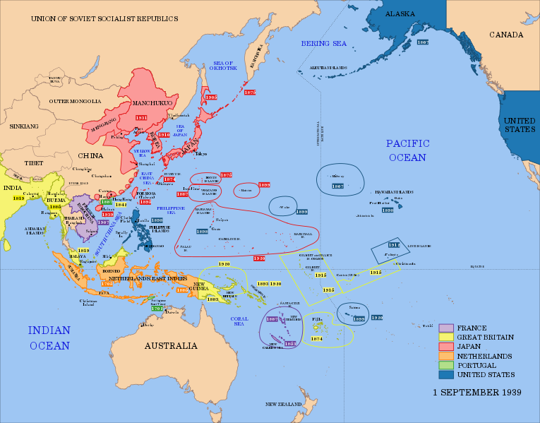
File:Pacific Area - Imperial Powers 1939 - Map.svg
Jump to navigation
Jump to search

Size of this PNG preview of this SVG file: 765 × 599 pixels. Other resolutions: 306 × 240 pixels | 613 × 480 pixels | 980 × 768 pixels | 1,280 × 1,003 pixels | 2,560 × 2,006 pixels | 1,039 × 814 pixels.
Original file (SVG file, nominally 1,039 × 814 pixels, file size: 4.44 MB)
Categories:
- Maps of the history of Oceania
- Maps showing the history of colonies
- Maps of World War II in the Pacific
- Maps of the Empire of Japan
- Maps of former colonies of the United Kingdom in Oceania
- Maps of former colonies of the United Kingdom in Asia
- Maps of former colonies of Portugal in Asia
- English-language SVG maps showing history


