File:Planning Regions of Connecticut.png
Jump to navigation
Jump to search
Size of this preview: 800 × 571 pixels. Other resolutions: 320 × 229 pixels | 640 × 457 pixels | 1,024 × 731 pixels | 1,280 × 914 pixels | 2,268 × 1,620 pixels.
Original file (2,268 × 1,620 pixels, file size: 551 KB, MIME type: image/png)
Captions
Captions
Add a one-line explanation of what this file represents
Summary
[edit]
| Description |
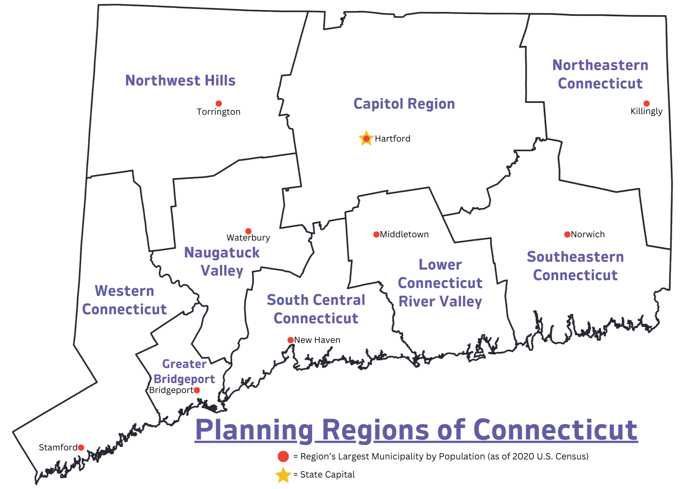
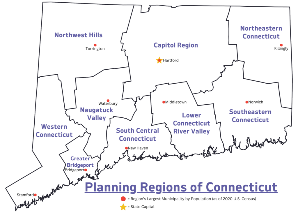
English: Map displays the official Planning Regions of Connecticut, and the largest municipality in each region by population (as of the 2020 United States Census) |
| Date | |
| Source | Own work |
| Author | AirportExpert |

|
This map image could be re-created using vector graphics as an SVG file. This has several advantages; see Commons:Media for cleanup for more information. If an SVG form of this image is available, please upload it and afterwards replace this template with
{{vector version available|new image name}}.
It is recommended to name the SVG file “Planning Regions of Connecticut.svg”—then the template Vector version available (or Vva) does not need the new image name parameter. |
Licensing
[edit]
I, the copyright holder of this work, hereby publish it under the following license:
| This file is made available under the Creative Commons CC0 1.0 Universal Public Domain Dedication. | |
| The person who associated a work with this deed has dedicated the work to the public domain by waiving all of their rights to the work worldwide under copyright law, including all related and neighboring rights, to the extent allowed by law. You can copy, modify, distribute and perform the work, even for commercial purposes, all without asking permission.
|
File history
Click on a date/time to view the file as it appeared at that time.
| Date/Time | Thumbnail | Dimensions | User | Comment | |
|---|---|---|---|---|---|
| current | 01:02, 29 December 2023 | | 2,268 × 1,620 (551 KB) | AirportExpert (talk | contribs) | Spelling correction |
| 00:45, 29 December 2023 |  | 2,268 × 1,620 (654 KB) | AirportExpert (talk | contribs) | Spelling correction | |
| 00:19, 29 December 2023 |  | 2,205 × 1,620 (580 KB) | AirportExpert (talk | contribs) | Uploaded own work with UploadWizard |
You cannot overwrite this file.
File usage on Commons
The following page uses this file:
File usage on other wikis
The following other wikis use this file:
- Usage on en.wikipedia.org
- Usage on www.wikidata.org