File:Polska hydrografia.png
Jump to navigation
Jump to search
Size of this preview: 650 × 599 pixels. Other resolutions: 260 × 240 pixels | 521 × 480 pixels | 833 × 768 pixels | 1,113 × 1,026 pixels.
Original file (1,113 × 1,026 pixels, file size: 534 KB, MIME type: image/png)
Captions
Captions
Add a one-line explanation of what this file represents
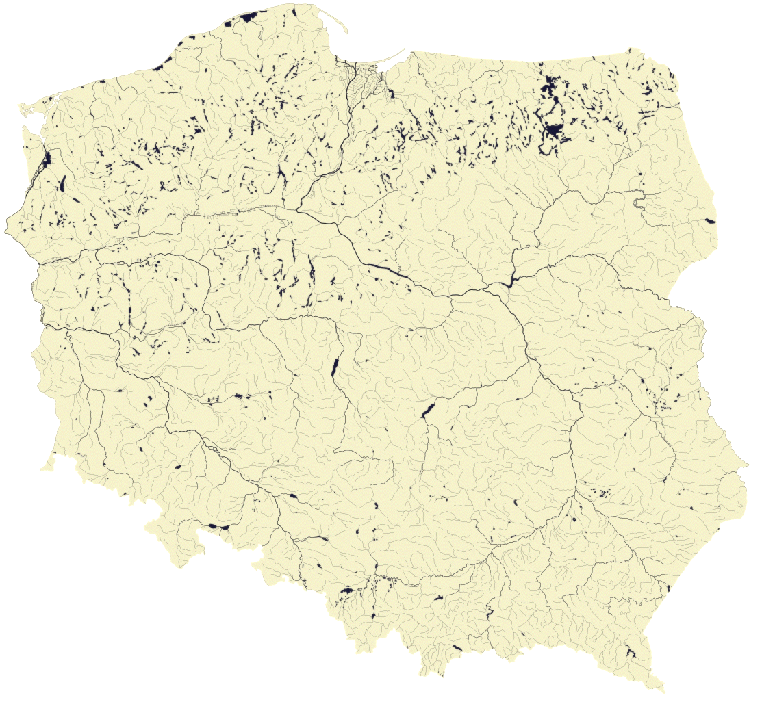
| Description | Hydrographic map of Poland. Author: Aotearoa, recolored in GraphicConverter by Mareklug. |
| Date | (UTC) |
| Source | |
| Author |
|
| Other versions |
Derivative works of this file: Bugonarew.jpg   |
| This is a retouched picture, which means that it has been digitally altered from its original version. Modifications: recolored for the colorblind, recompressed, saved as PNG. The original can be viewed here: Polska hydrografia2.jpg:
|

|
Permission is granted to copy, distribute and/or modify this document under the terms of the GNU Free Documentation License, Version 1.2 or any later version published by the Free Software Foundation; with no Invariant Sections, no Front-Cover Texts, and no Back-Cover Texts. A copy of the license is included in the section entitled GNU Free Documentation License. |
| This file is licensed under the Creative Commons Attribution-Share Alike 3.0 Unported license. | ||
| ||
| This licensing tag was added to this file as part of the GFDL licensing update. |
Original upload log
[edit]
This image is a derivative work of the following images:
- File:Polska_hydrografia2.jpg licensed with GFDL, GFDL/en
- 2006-04-09T11:11:08Z Krzysiu Jarzyna 1113x1026 (800444 Bytes) Mapa sieci hydrograficznej Polski Autor: [http://pl.wikipedia.org/wiki/Wikipedysta:Aotearoa Aotearoa] == Licencja == {{self|GFDL}}
Uploaded with derivativeFX
File history
Click on a date/time to view the file as it appeared at that time.
| Date/Time | Thumbnail | Dimensions | User | Comment | |
|---|---|---|---|---|---|
| current | 08:33, 24 January 2009 | | 1,113 × 1,026 (534 KB) | Mareklug (talk | contribs) | Reverted to version as of 23:52, 19 January 2009 -- nie sprawdzilo sie, brakuje granic Polski / did not work out in practice, the borders of Poland need to be showing after all |
| 08:21, 24 January 2009 |  | 1,113 × 1,026 (516 KB) | Mareklug (talk | contribs) | Reverted to version as of 08:19, 24 January 2009 - intended. for some reason upload uploade twice. putting the old version on top. this action corrects it. | |
| 08:19, 24 January 2009 |  | 1,113 × 1,026 (516 KB) | Mareklug (talk | contribs) | bardzo jasna wersja. moze tak? / very light version. maybe try this one? | |
| 08:19, 24 January 2009 |  | 1,113 × 1,026 (516 KB) | Mareklug (talk | contribs) | bardzo jasna wersja. moze tak? / very light version. maybe try this one? | |
| 23:52, 19 January 2009 |  | 1,113 × 1,026 (534 KB) | Mareklug (talk | contribs) | {{Information |Description=Hydrographic map of Poland Author: Aotearoa], recolored in GraphicConverter by [[user:Mareklug|Mareklug |Source=*File:Polska_hydrografia2.jpg |Date=2009-01-19 23:49 (UTC) |Author=*derivative work: ~~~ *[[ |
You cannot overwrite this file.
File usage on Commons
The following 2 pages use this file: