File:Qing Dynasty 1820.png
Jump to navigation
Jump to search

Size of this preview: 800 × 593 pixels. Other resolutions: 320 × 237 pixels | 640 × 475 pixels | 910 × 675 pixels.
Original file (910 × 675 pixels, file size: 398 KB, MIME type: image/png)
Captions
Captions
Add a one-line explanation of what this file represents

|
This historical map image could be re-created using vector graphics as an SVG file. This has several advantages; see Commons:Media for cleanup for more information. If an SVG form of this image is available, please upload it and afterwards replace this template with
{{vector version available|new image name}}.
It is recommended to name the SVG file “Qing Dynasty 1820.svg”—then the template Vector version available (or Vva) does not need the new image name parameter. |
Summary
[edit]| Description |
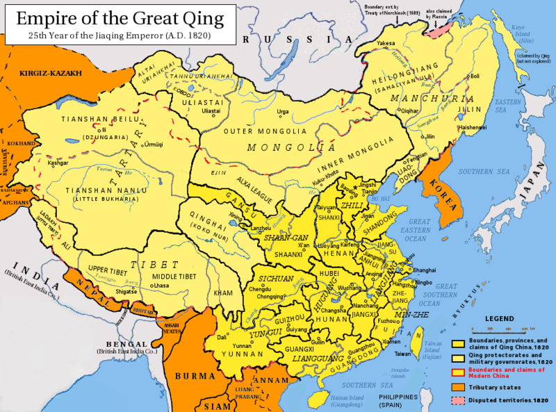
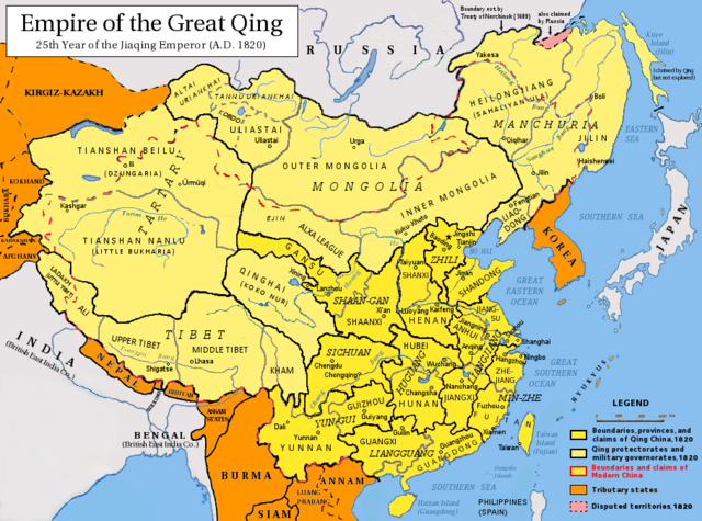
English: Map of the Qing Dynasty in 1820, representing its stablized territory from 1790-1839. (Includes provincial boundaries and the boundaries of modern China for reference.) Provinces in yellow, military governorates and protectorates in light yellow, tributary states in orange.
Adapted from File:ROC_PRC_comparison_eng.jpg and information complied from:
中文(简体):大清嘉庆二十五年疆域图。约合1790-1839稳定时期疆域。
中文(繁體):大清嘉慶廿五年疆域圖。約合1790-1839穩定時期疆域。
日本語: 大清の嘉慶25年の疆域の図。
Tiếng Việt: Đại Thanh bản đồ (1820).
Français : Carte du Grand Empire des Qing la 25e année Jiaqing du règne de l'empereur Qing Jiaqing (1820). Cette carte inclus les frontières provinciales et les frontières de la chine contemporaine pour référence. Les provinces sont en jaune, les gouvernorats et protectorats militaires en jaune claire, les états tributaires en orange. |
| Date | |
| Source | Own work |
| Author | Pryaltonian |
| Other versions | File:Qing_1820_CHGIS.png |
Licensing
[edit]I, the copyright holder of this work, hereby publish it under the following licenses:
This file is licensed under the Creative Commons Attribution-Share Alike 3.0 Unported license.
- You are free:
- to share – to copy, distribute and transmit the work
- to remix – to adapt the work
- Under the following conditions:
- attribution – You must give appropriate credit, provide a link to the license, and indicate if changes were made. You may do so in any reasonable manner, but not in any way that suggests the licensor endorses you or your use.
- share alike – If you remix, transform, or build upon the material, you must distribute your contributions under the same or compatible license as the original.

|
Permission is granted to copy, distribute and/or modify this document under the terms of the GNU Free Documentation License, Version 1.2 or any later version published by the Free Software Foundation; with no Invariant Sections, no Front-Cover Texts, and no Back-Cover Texts. A copy of the license is included in the section entitled GNU Free Documentation License. |
You may select the license of your choice.
See also
[edit]-
 1820 Map of Asia by Daniel Lizars
 -
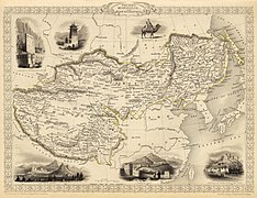 1851 map of Tibet, Mongolia and Manchuria by John Tallis
 -
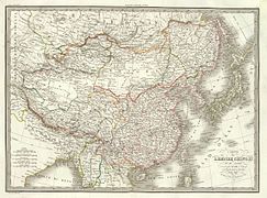
 1844 map of China and Japan by John Nicaragua Dower
 -
 1833 French map of China and Japan
 -
 1832 French map of China and Japan
 -
 1836 French map of China and Japan
_-_Geographicus_-_Asia-lizars-1820.jpg)

.jpg)
.jpg)
.jpg)
.jpg)
File history
Click on a date/time to view the file as it appeared at that time.
| Date/Time | Thumbnail | Dimensions | User | Comment | |
|---|---|---|---|---|---|
| current | 05:15, 17 May 2014 | | 910 × 675 (398 KB) | Tenohira (talk | contribs) | fix |
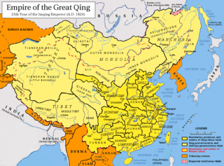
| 04:32, 17 May 2014 |  | 910 × 675 (401 KB) | Benlisquare (talk | contribs) | rev: per the guideline page at Commons:Overwriting existing files, you should be creating a fork file, not overwriting this existing one | |
| 00:48, 17 May 2014 |  | 910 × 675 (394 KB) | Tenohira (talk | contribs) | remove "nine-dotted line" https://en.wikipedia.org/wiki/File_talk:Qing_Dynasty_1820.png | |
| 23:59, 16 May 2014 |  | 910 × 675 (372 KB) | Tenohira (talk | contribs) | original | |
| 21:52, 19 December 2012 |  | 910 × 675 (401 KB) | Pryaltonian~commonswiki (talk | contribs) | Adjusted map to be more in line with contemporary-Qing maps, with references also from late-Qing and Republican China. | |
| 15:35, 22 September 2011 |  | 910 × 675 (380 KB) | Pryaltonian~commonswiki (talk | contribs) | Only southern Palawan was part of the Borneo and then Sulu sultanates, until Spanish annexation of Sulu in 1851. | |
| 15:10, 21 September 2011 |  | 910 × 675 (380 KB) | Pryaltonian~commonswiki (talk | contribs) | Modified to distinguish between provinces, military governorates, and protectorates. Tributary states also added. | |
| 03:48, 22 June 2010 |  | 910 × 675 (355 KB) | Benlisquare (talk | contribs) | Revert - redraw the map yourself. MS Paint overlaying of a corner is an eyesore. Illogical to have the title repeated twice. | |
| 21:46, 21 June 2010 |  | 910 × 675 (386 KB) | Hisacw (talk | contribs) | rv to NPOVify: the status on certain outlier islands (e.g. Sakhalin) is not explicitly defined, c.f. the map [http://go-passport.grolier.com/map?id=mh00032&pid=go] | |
| 05:59, 20 June 2010 |  | 910 × 675 (355 KB) | Benlisquare (talk | contribs) | Reverted to version as of 19:58, 27 September 2008 |
You cannot overwrite this file.
File usage on Commons
The following 5 pages use this file:
.png)
File usage on other wikis
The following other wikis use this file:
- Usage on als.wikipedia.org
- Usage on an.wikipedia.org
- Usage on ar.wikipedia.org
- Usage on azb.wikipedia.org
- Usage on az.wikipedia.org
- Usage on bat-smg.wikipedia.org
- Usage on ba.wikipedia.org
- Usage on be-tarask.wikipedia.org
- Usage on be.wikipedia.org
- Usage on bg.wikipedia.org
- Usage on cs.wikipedia.org
- Usage on da.wikipedia.org
- Usage on de.wikipedia.org
- Usage on en.wikipedia.org
- Qing dynasty
- History of Taiwan
- Inner Mongolia
- Administrative divisions of China
- Zhili
- Talk:History of the administrative divisions of China before 1912
- Tannu Uriankhai
- User:Pryaltonian
- Portal:Taiwan
- Taiwan under Qing rule
- User:Eumolpus214
- Talk:Qing dynasty/Archive 3
- History of Tuva
- Senkaku Islands dispute
- Tributary system of China
- Talk:Chinese civilization/Archive 26
- Talk:Qing dynasty/Archive 5
- Qing dynasty in Inner Asia
- Timeline of the Qing dynasty
- Timeline of Yunnan-Guizhou
- Talk:History of Xinjiang/Archive 1
- Administration of territory in dynastic China
- Government of the Qing dynasty
- User:SilverStar54/Administrative divisions of China
- Wikipedia:Reference desk/Archives/Humanities/2023 July 15
- User:Falcaorib/China
- Administrative divisions of the Qing dynasty
- Usage on es.wikipedia.org
View more global usage of this file.