File:Reliefkarte Estland.png
Jump to navigation
Jump to search
Size of this preview: 674 × 600 pixels. Other resolutions: 270 × 240 pixels | 539 × 480 pixels | 863 × 768 pixels | 1,150 × 1,024 pixels | 2,475 × 2,203 pixels.
Original file (2,475 × 2,203 pixels, file size: 5.84 MB, MIME type: image/png)
Captions
Captions
Add a one-line explanation of what this file represents
Summary
[edit]| Description |
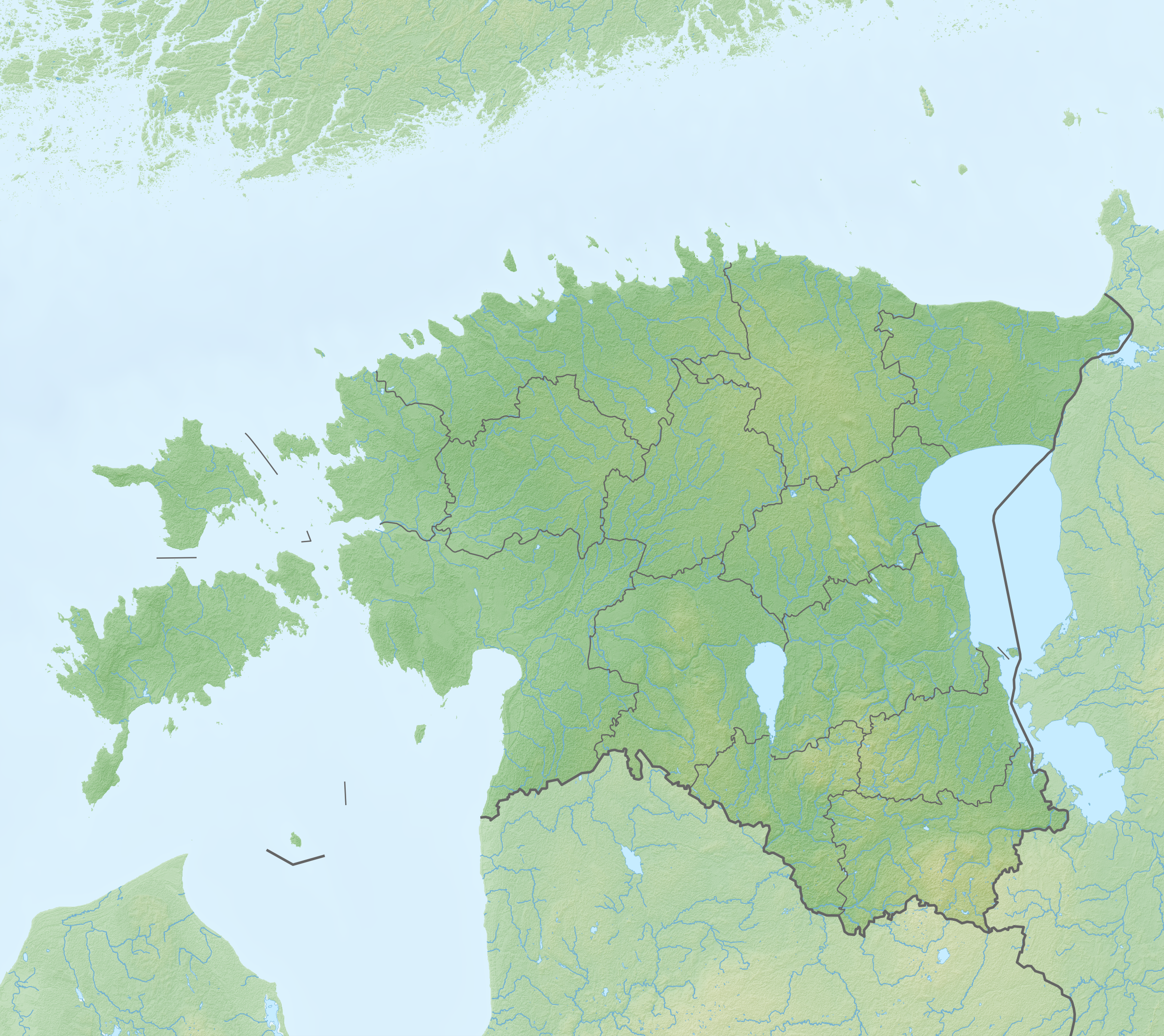
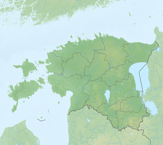
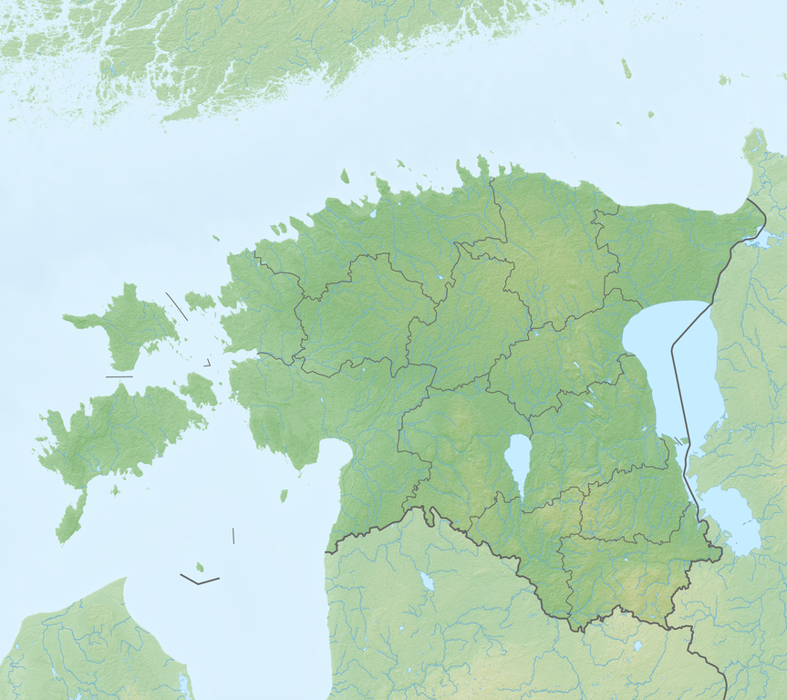
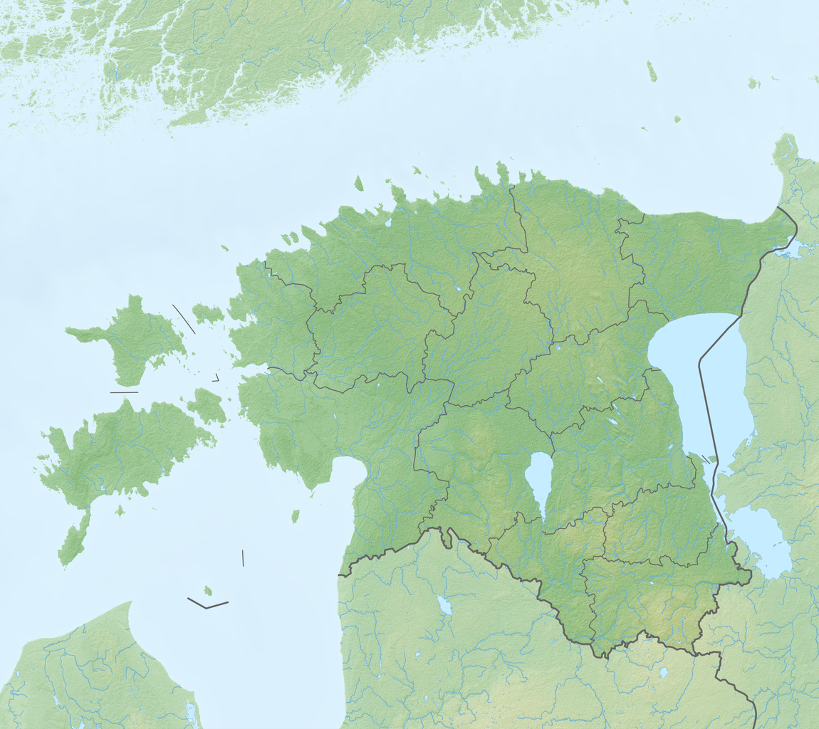
Deutsch: Reliefkarte Estland
|
||||||||||||
| Date | |||||||||||||
| Source | Own work | ||||||||||||
| Author | Tschubby | ||||||||||||
| Permission (Reusing this file) |
I, the copyright holder of this work, hereby publish it under the following licenses:
This file is licensed under the Creative Commons Attribution-Share Alike 2.5 Generic, 2.0 Generic and 1.0 Generic license.
You may select the license of your choice. |
||||||||||||
| Other versions |
|
||||||||||||


File history
Click on a date/time to view the file as it appeared at that time.
| Date/Time | Thumbnail | Dimensions | User | Comment | |
|---|---|---|---|---|---|
| current | 20:26, 12 April 2020 | | 2,475 × 2,203 (5.84 MB) | Tschubby (talk | contribs) | {{Information |description= |date= |source= |author= |permission= |other versions= }} |
| 07:55, 20 May 2018 |  | 2,588 × 2,303 (6.11 MB) | Tschubby (talk | contribs) | {{Information |description= |source= |date= |author= |permission= |other versions= }} | |
| 13:46, 15 May 2018 |  | 2,588 × 2,303 (5.97 MB) | Tschubby (talk | contribs) | {{Information |description= |source= |date= |author= |permission= |other versions= }} | |
| 11:30, 15 May 2018 |  | 2,588 × 2,303 (5.97 MB) | Tschubby (talk | contribs) | == {{int:filedesc}} == {{Information |Description= {{de| Reliefkarte Estland}} Topographischer Hintergrund: [http://www2.jpl.nasa.gov/srtm NASA Shuttle Radar Topography Mission] (public domain). SRTM3 v.2. |Source={{own}} |Date= 2018-05-15 |Author= Tschubby |Permission= {{self|GFDL|Cc-by-sa-3.0-migrated|Cc-by-sa-2.5,2.0,1.0}} |other_versions= }} Category:Location maps of Estonia |
You cannot overwrite this file.
File usage on Commons
There are no pages that use this file.
File usage on other wikis
The following other wikis use this file:
- Usage on arz.wikipedia.org
- Usage on az.wikipedia.org
- Şablon:Yer xəritəsi Estoniya
- Çud gölü
- Lahemaa Milli Parkı
- Voozi boğazı
- Vyaykevyayn boğazı
- Vyəynameri boğazı
- Suurvyəyn boğazı
- Soela boğazı
- İrbe boğazı
- Kassari adası
- Hiyumaa
- Kihnu adası
- Muhu
- Ruhnu adası
- Pakri adaları
- Yulemiste gölü
- Saaremaa
- Vormsi
- Abruka adası
- Naissaar
- Vaqula gölü
- Ermistu
- Kopli yarımadası
- Yuminda yarımadası
- Karuyarv gölü
- Aeqna adası
- Vesiloo adası
- Veysyarv gölü
- Mullutu-Suurlaht gölü
- Kuremaa gölü
- Estoniya adaları
- Paunkyula su anbarı
- Viimsi yarımadası
- Sırve burnu
- Tahkuna burnu
- Baltik stansiyası (Tallin)
- Tallin körfəzi
- Pranqli adası
- Piyrisar adası
View more global usage of this file.