File:Royal Farms stores footprint map.png
Jump to navigation
Jump to search
Size of this preview: 493 × 600 pixels. Other resolutions: 197 × 240 pixels | 532 × 647 pixels.
Original file (532 × 647 pixels, file size: 149 KB, MIME type: image/png)
Captions
Captions
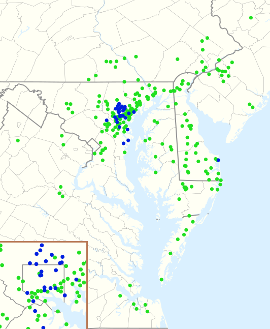
Royal Farms convenience stores' footprint map
Summary
[edit]| Description |
English: Geographic footprint of Royal Farms 241 locations, as of 30 January 2021. (211 locations with fuel, 30 without fuel.) (Baltimore Metro in inset.) |
| Date | |
| Source |
This file was derived from: |
| Author |
|


| Point Maps
══▻ FAQ ◅══ ══▻ Create your own ◅══ |
Licensing
[edit]
| This work is ineligible for copyright and therefore in the public domain because it consists entirely of information that is common property and contains no original authorship. |
File history
Click on a date/time to view the file as it appeared at that time.
| Date/Time | Thumbnail | Dimensions | User | Comment | |
|---|---|---|---|---|---|
| current | 19:38, 30 January 2021 | | 532 × 647 (149 KB) | BoringJim (talk | contribs) | Uploaded own work with UploadWizard |
You cannot overwrite this file.
File usage on Commons
There are no pages that use this file.
File usage on other wikis
The following other wikis use this file:
- Usage on en.wikipedia.org