File:SNCV electric network in the Borinage.png
Jump to navigation
Jump to search
Size of this preview: 800 × 588 pixels. Other resolutions: 320 × 235 pixels | 640 × 471 pixels | 1,024 × 753 pixels | 1,352 × 994 pixels.
Original file (1,352 × 994 pixels, file size: 161 KB, MIME type: image/png)
Captions
Captions
Add a one-line explanation of what this file represents
Summary
[edit]
| Description |
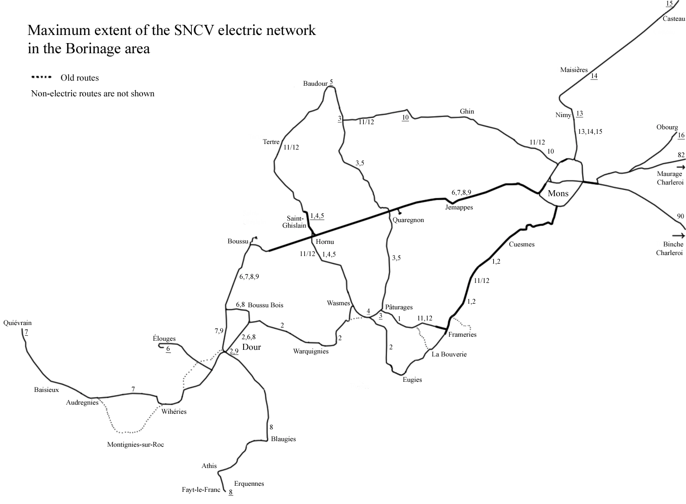
English: Map showing the electric tram routes in the Borinage area at the maximum extent. Not all lines where open at the same time and some routes were changed. The maximum extend was around 1954.
Nederlands: Kaart die de maximale uitbreiding van het elektrisch tramnet in de Borinage toont. Niet alle routes zijn gelijktijdig open en sommige routes zijn gewijzigd. |
| Date | |
| Source | Own work |
| Author | Smiley.toerist |
| Other versions | File:Borinage SNCV electric.png |
Licensing
[edit]
I, the copyright holder of this work, hereby publish it under the following licenses:

|
Permission is granted to copy, distribute and/or modify this document under the terms of the GNU Free Documentation License, Version 1.2 or any later version published by the Free Software Foundation; with no Invariant Sections, no Front-Cover Texts, and no Back-Cover Texts. A copy of the license is included in the section entitled GNU Free Documentation License. |
This file is licensed under the Creative Commons Attribution-Share Alike 3.0 Unported, 2.5 Generic, 2.0 Generic and 1.0 Generic license.
- You are free:
- to share – to copy, distribute and transmit the work
- to remix – to adapt the work
- Under the following conditions:
- attribution – You must give appropriate credit, provide a link to the license, and indicate if changes were made. You may do so in any reasonable manner, but not in any way that suggests the licensor endorses you or your use.
- share alike – If you remix, transform, or build upon the material, you must distribute your contributions under the same or compatible license as the original.
You may select the license of your choice.
File history
Click on a date/time to view the file as it appeared at that time.
| Date/Time | Thumbnail | Dimensions | User | Comment | |
|---|---|---|---|---|---|
| current | 09:38, 16 May 2011 | | 1,352 × 994 (161 KB) | Smiley.toerist (talk | contribs) | Lijnnummers toegevoegd en Frameries |
| 12:19, 12 May 2011 |  | 1,352 × 994 (159 KB) | Smiley.toerist (talk | contribs) | Links to Charleroi | |
| 21:44, 11 May 2011 |  | 1,352 × 994 (156 KB) | Smiley.toerist (talk | contribs) | Eugies correction | |
| 23:08, 10 May 2011 |  | 1,352 × 994 (155 KB) | Smiley.toerist (talk | contribs) | Aanpassing Casteau | |
| 22:46, 9 May 2011 |  | 1,352 × 994 (154 KB) | Smiley.toerist (talk | contribs) | {{Information |Description ={{en|1=Map showing the electric tram routes in the Borinage area at the maximum extent. Not all lines where open at the same time and some routes were changed. The maximum extend was around 1954.}} {{nl|1=Kaart die de maxim |
You cannot overwrite this file.
File usage on Commons
There are no pages that use this file.
File usage on other wikis
The following other wikis use this file:
- Usage on nl.wikipedia.org