File:Satellite image of Japan in April 2018.png
Jump to navigation
Jump to search
Size of this preview: 545 × 600 pixels. Other resolutions: 218 × 240 pixels | 436 × 480 pixels | 698 × 768 pixels | 931 × 1,024 pixels | 1,862 × 2,048 pixels | 6,000 × 6,600 pixels.
Original file (6,000 × 6,600 pixels, file size: 19.44 MB, MIME type: image/png)
Captions
Captions
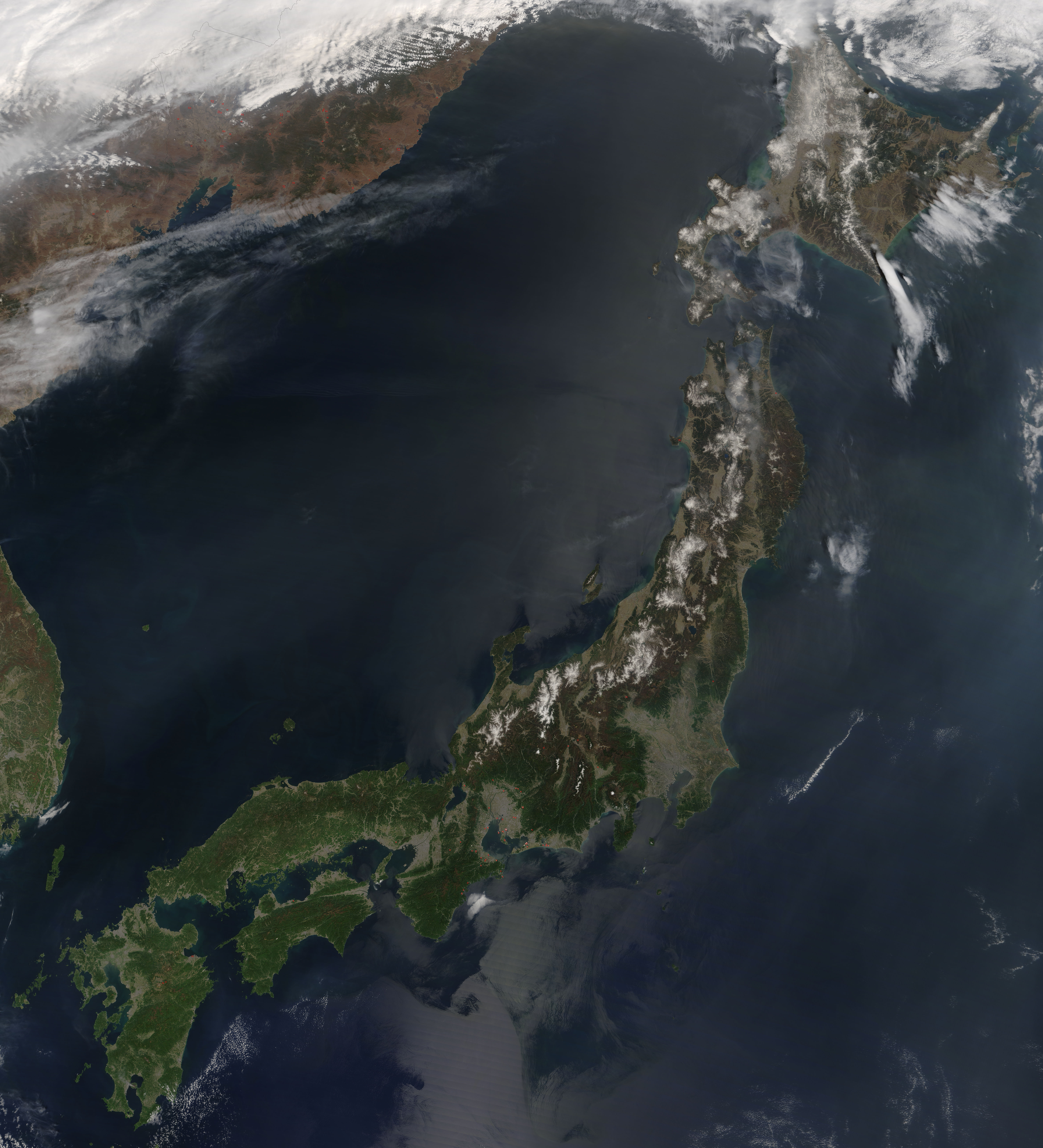
Satellite image of Japan in April 2018.
Summary
[edit]| Description |
English: Satellite image of Japan in April 2018. On April 21, 2018, the Moderate Resolution Imaging Spectroradiometer (MODIS) on board NASA’s Terra satellite acquired a true-color image of southern Japan. The four main islands seen in this image are, from north to south: Hokkaido, Honshu, Shikoku, and Kyushu. To the west, across the Sea of Japan, eastern South Korea can be seen while to the northwest parts of North Korea, China, and eastern Russia are visible.
Numerous red hot spots are scattered across the image, particularly near Ise Bay on Honshu and in eastern Russia. Each red hot spot is an area where the thermal bands on the MODIS instruments detected areas where the temperature is substantial higher than background. |
| Date | |
| Source | MODIS NASA - https://modis.gsfc.nasa.gov/gallery/individual.php?db_date=2018-04-27 |
| Author | Jeff Schmaltz, MODIS Land Rapid Response Team, NASA GSFC |
| Other versions |
|

Licensing
[edit]
| This file is in the public domain in the United States because it was solely created by NASA. NASA copyright policy states that "NASA material is not protected by copyright unless noted". (See Template:PD-USGov, NASA copyright policy page or JPL Image Use Policy.) | ||
 |
Warnings:
|
File history
Click on a date/time to view the file as it appeared at that time.
| Date/Time | Thumbnail | Dimensions | User | Comment | |
|---|---|---|---|---|---|
| current | 00:23, 13 April 2022 | | 6,000 × 6,600 (19.44 MB) | Artanisen (talk | contribs) | Uploaded a work by Jeff Schmaltz, MODIS Land Rapid Response Team, NASA GSFC from MODIS NASA - https://modis.gsfc.nasa.gov/gallery/individual.php?db_date=2018-04-27 with UploadWizard |
You cannot overwrite this file.
File usage on Commons
The following 3 pages use this file: