File:Schalzbachvorsäß Panorama 2.jpg
Jump to navigation
Jump to search
Size of this preview: 800 × 196 pixels. Other resolutions: 320 × 78 pixels | 640 × 157 pixels | 1,024 × 251 pixels | 1,280 × 313 pixels | 6,445 × 1,577 pixels.
Original file (6,445 × 1,577 pixels, file size: 5.58 MB, MIME type: image/jpeg)
Captions
Captions
Add a one-line explanation of what this file represents
| Description |
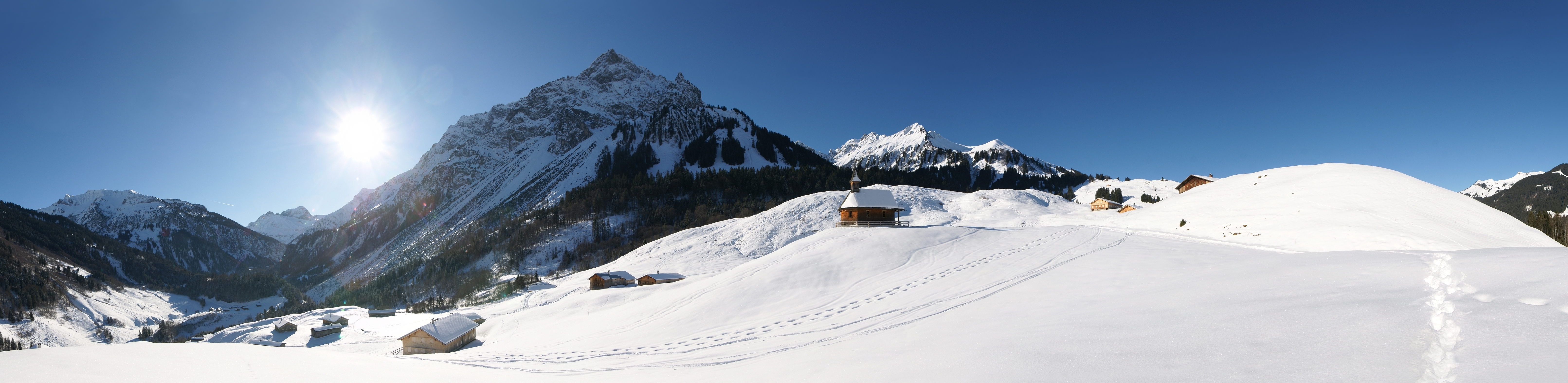
Deutsch: Winter Panorama auf dem 1.080m gelegenen Vorsäß “Schalzbach” mit Blick auf das tiefer gelegene Vorsäß „Vorderhopfreben“ in Schoppernau. Beide Siedlungen gehören zur Stufe zwei der Dreistufenwirtschaft. Die Berge von Links nach Rechts: der Heiterberg, die Juppenspitze, die Mohnenfluh, die Niedere Künzelspitze, der Toblermann, die Hochalpe und rechts aussen der Diedamskopf.
English: winter panorama on the "Schalzbach" Alps overlooking the deeper,"" Vorderhopfreben "in Schoppernau." Both settlements are the level two of the three levels of business. The mountains from left to right: The Toblermann, the High Alps, Diedamskopf, Heiter mountain and the low Künzelsau tip. |
| Date | |
| Source | Own work |
| Author | böhringer friedrich |
| Permission (Reusing this file) |
I, the copyright holder of this work, hereby publish it under the following license: This file is licensed under the Creative Commons Attribution-Share Alike 2.5 Generic license.
|
| Other versions |
|
This Photo was taken by Böhringer Friedrich.
|
Feel free to use my photos, but please mention me as the author and if you want send me a message. or ([email protected]) |
| Camera location | | View this and other nearby images on: OpenStreetMap |
|---|
| Annotations | This image is annotated: View the annotations at Commons |
File history
Click on a date/time to view the file as it appeared at that time.
| Date/Time | Thumbnail | Dimensions | User | Comment | |
|---|---|---|---|---|---|
| current | 20:57, 24 January 2010 | 6,445 × 1,577 (5.58 MB) | Böhringer (talk | contribs) | {{Information |Description= {{de|Winter Panorama auf dem 1.080m gelegenen Vorsäß “Schalzbach” mit Blick auf das tiefer gelegene Vorsäß „Vorderhopfreben“ in Schoppernau. Beide Siedlungen gehören zur Stuf |
You cannot overwrite this file.
File usage on Commons
There are no pages that use this file.