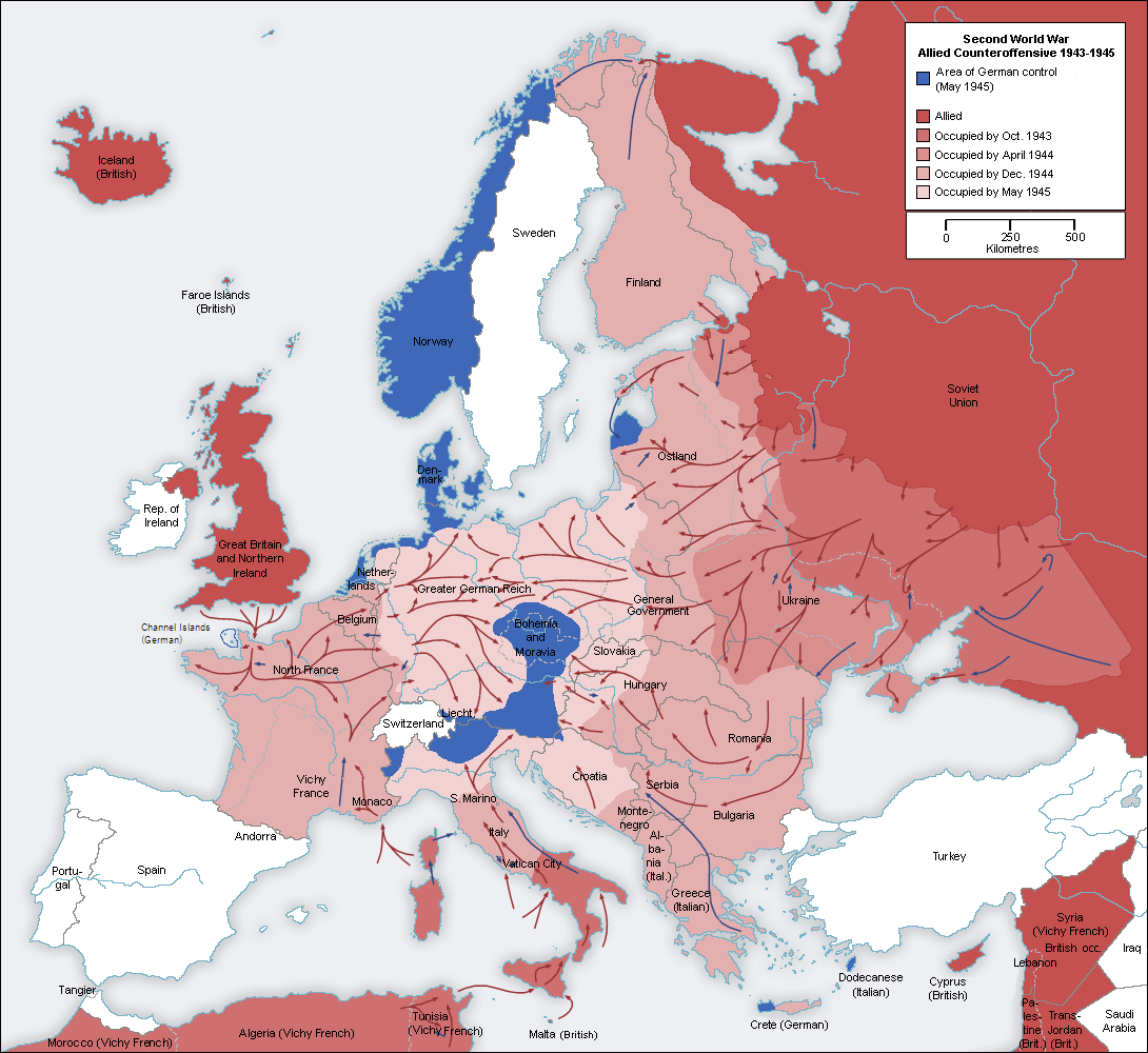
File:Second world war europe 1943-1945 map en.png
Jump to navigation
Jump to search
Size of this preview: 654 × 600 pixels. Other resolutions: 262 × 240 pixels | 523 × 480 pixels | 837 × 768 pixels | 1,090 × 1,000 pixels.
Original file (1,090 × 1,000 pixels, file size: 264 KB, MIME type: image/png)
Captions
Captions
Add a one-line explanation of what this file represents
I, the copyright holder of this work, hereby publish it under the following licenses:
| This file is licensed under the Creative Commons Attribution-Share Alike 3.0 Unported license. | ||
| ||
| This licensing tag was added to this file as part of the GFDL licensing update. |

|
Permission is granted to copy, distribute and/or modify this document under the terms of the GNU Free Documentation License, Version 1.2 or any later version published by the Free Software Foundation; with no Invariant Sections, no Front-Cover Texts, and no Back-Cover Texts. A copy of the license is included in the section entitled GNU Free Documentation License. |
You may select the license of your choice.
Original upload log
[edit]
This image is a derivative work of the following images:
- File:Second_world_war_europe_1943-1945_map_de.png licensed with Cc-by-sa-3.0-migrated, GFDL
- 2005-08-22T13:32:49Z Rony 1090x1000 (199724 Bytes)
Uploaded with derivativeFX
File history
Click on a date/time to view the file as it appeared at that time.
| Date/Time | Thumbnail | Dimensions | User | Comment | |
|---|---|---|---|---|---|
| current | 22:51, 24 October 2021 | | 1,090 × 1,000 (264 KB) | Rebelbear (talk | contribs) | Reverted to version as of 22:20, 24 October 2021 (UTC) |
| 22:43, 24 October 2021 |  | 1,090 × 1,000 (130 KB) | Rebelbear (talk | contribs) | Interestingly enough, the Channel Islands were still under German occupation at the end of the war (sorry, first upload did not work) | |
| 22:20, 24 October 2021 |  | 1,090 × 1,000 (264 KB) | Rebelbear (talk | contribs) | Interestingly enough, the Channel Islands were still under German occupation at the end of the war | |
| 17:24, 20 November 2019 |  | 1,090 × 1,000 (115 KB) | Claude Zygiel (talk | contribs) | Cosmetic (differenciate shorelines, borders, demarcation lines) | |
| 05:46, 2 December 2015 |  | 1,090 × 1,000 (108 KB) | Rhadamante (talk | contribs) | I don't know if there is a problem for color blinds with this version, but hte current one is totally unreadable | |
| 17:18, 22 May 2012 |  | 1,088 × 998 (286 KB) | DIREKTOR (talk | contribs) | Colours | |
| 10:46, 21 August 2010 |  | 1,090 × 1,000 (108 KB) | Jarry1250 (talk | contribs) | {{Information |Description=* Description: Second world war europe 1943-1945, map , relabelled into English * Original source: Own map, based on the maps of the [http://www.lib.utexas.edu/maps/ University of Texas Libraries] * Original author: [[User:San |
You cannot overwrite this file.
File usage on Commons
The following 5 pages use this file:
File usage on other wikis
The following other wikis use this file:
- Usage on ar.wikipedia.org
- Usage on be.wikipedia.org
- Usage on bg.wikipedia.org
- Usage on ca.wikipedia.org
- Usage on cs.wikipedia.org
- Usage on en.wikipedia.org
- Usage on es.wikipedia.org
- Usage on eu.wikipedia.org
- Usage on fa.wikipedia.org
- Usage on fi.wikipedia.org
- Usage on fr.wikipedia.org
- Usage on fy.wikipedia.org
- Usage on ja.wikipedia.org
- Usage on ko.wikipedia.org
- Usage on no.wikipedia.org
- Usage on pnb.wikipedia.org
- Usage on pt.wikipedia.org
- Usage on ru.wikipedia.org
- Usage on sv.wikipedia.org
- Usage on ta.wikipedia.org
- Usage on tr.wikipedia.org
- Usage on uk.wikipedia.org
- Usage on ur.wikipedia.org