File:Spain Canary Islands location map.svg
Jump to navigation
Jump to search

Size of this PNG preview of this SVG file: 800 × 355 pixels. Other resolutions: 320 × 142 pixels | 640 × 284 pixels | 1,024 × 455 pixels | 1,280 × 568 pixels | 2,560 × 1,137 pixels | 1,475 × 655 pixels.
Original file (SVG file, nominally 1,475 × 655 pixels, file size: 29 KB)
Captions
Captions
Add a one-line explanation of what this file represents
Summary
[edit]| Description |
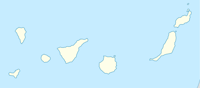
Quadratische Plattkarte, N-S-Streckung 110 %. Geographische Begrenzung der Karte:
Equirectangular projection, N/S stretching 110 %. Geographic limits of the map:
|
||
| Date | 10-08-2008 | ||
| Source | own work, using World Data Base II data | ||
| Author | NordNordWest | ||
| Other versions | Derivative works of this file: Spain Canary Islands location map with Spain.png | ||
| SVG development |
|

Licensing
[edit]
I, the copyright holder of this work, hereby publish it under the following licenses:

|
Permission is granted to copy, distribute and/or modify this document under the terms of the GNU Free Documentation License, Version 1.2 or any later version published by the Free Software Foundation; with no Invariant Sections, no Front-Cover Texts, and no Back-Cover Texts. A copy of the license is included in the section entitled GNU Free Documentation License. |
This file is licensed under the Creative Commons Attribution-Share Alike 3.0 Unported license.
- You are free:
- to share – to copy, distribute and transmit the work
- to remix – to adapt the work
- Under the following conditions:
- attribution – You must give appropriate credit, provide a link to the license, and indicate if changes were made. You may do so in any reasonable manner, but not in any way that suggests the licensor endorses you or your use.
- share alike – If you remix, transform, or build upon the material, you must distribute your contributions under the same or compatible license as the original.
You may select the license of your choice.
File history
Click on a date/time to view the file as it appeared at that time.
| Date/Time | Thumbnail | Dimensions | User | Comment | |
|---|---|---|---|---|---|
| current | 08:36, 29 August 2008 | | 1,475 × 655 (29 KB) | NordNordWest (talk | contribs) | |
| 18:55, 10 August 2008 |  | 492 × 218 (33 KB) | NordNordWest (talk | contribs) | {{Information |Description= {{de|Positionskarte der Kanarischen Inseln, Spanien}} Quadratische Plattkarte, N-S-Streckung 110 %. Geographische Begrenzung der Karte: * N: 29.5° N * S: 27.4° N * W: 18.4° W * O: 13.2° |
You cannot overwrite this file.
File usage on Commons
The following 67 pages use this file:
- User:NordNordWest/Gallery/Location maps
- File:Chaouia-Ouardigha in Morocco (Morocco controlled and claimed).svg
- File:Chaouia-Ouardigha in Morocco (Morocco view).svg
- File:Chaouia-Ouardigha in Morocco (de-facto).svg
- File:Doukkala-Abda in Morocco (Morocco controlled and claimed).svg
- File:Doukkala-Abda in Morocco (Morocco view).svg
- File:Doukkala-Abda in Morocco (de-facto).svg
- File:EU Member states and Candidate countries map.svg
- File:EU Member states and Candidate countries map 17 March 2015.svg
- File:European Union (+OMR), administrative divisions - Nmbrs (marker).svg
- File:European Union (+OMR), administrative divisions - Nmbrs (multizoom).svg
- File:European Union (+OMR), administrative divisions - Nmbrs - colored (marker).svg
- File:European Union (+OMR), administrative divisions - Nmbrs - colored (multizoom).svg
- File:European Union (+OMR), administrative divisions - de (marker).svg
- File:European Union (+OMR), administrative divisions - de (multizoom).svg
- File:European Union (+OMR), administrative divisions - de - colored (marker).svg
- File:European Union (+OMR), administrative divisions - de - colored (multizoom).svg
- File:Fes-Boulemane in Morocco (Morocco controlled and claimed).svg
- File:Fes-Boulemane in Morocco (Morocco view).svg
- File:Fes-Boulemane in Morocco (de-facto).svg
- File:Gharb-Chrarda-Beni Hssen in Morocco (Morocco controlled and claimed).svg
- File:Gharb-Chrarda-Beni Hssen in Morocco (Morocco view).svg
- File:Gharb-Chrarda-Beni Hssen in Morocco (de-facto).svg
- File:Grand Casablanca in Morocco (Morocco controlled and claimed).svg
- File:Grand Casablanca in Morocco (Morocco view).svg
- File:Grand Casablanca in Morocco (de-facto).svg
- File:Grand Casablanca in Morocco (special marker) (Morocco controlled and claimed).svg
- File:Grand Casablanca in Morocco (special marker) (Morocco view).svg
- File:Grand Casablanca in Morocco (special marker) (de-facto).svg
- File:Guelmim-Es Semara in Morocco (Morocco controlled and claimed).svg
- File:Guelmim-Es Semara in Morocco (Morocco view).svg
- File:Guelmim-Es Semara in Morocco (controlled) (de-facto).svg
- File:Guelmim-Es Semara in Morocco (de-facto).svg
- File:Guelmim-Es Semara in Morocco (undisputed) (de-facto).svg
- File:Laayoune-Boujdour-Sakia El Hamra in Morocco (Morocco controlled and claimed).svg
- File:Laayoune-Boujdour-Sakia El Hamra in Morocco (Morocco view).svg
- File:Laayoune-Boujdour-Sakia El Hamra in Morocco (controlled) (de-facto).svg
- File:Laayoune-Boujdour-Sakia El Hamra in Morocco (de-facto).svg
- File:Laayoune-Boujdour-Sakia El Hamra in Morocco (undisputed) (de-facto).svg
- File:Marrakech-Tensift-El Haouz in Morocco (Morocco controlled and claimed).svg
- File:Marrakech-Tensift-El Haouz in Morocco (Morocco view).svg
- File:Marrakech-Tensift-El Haouz in Morocco (de-facto).svg
- File:Meknes-Tafilalet in Morocco (Morocco controlled and claimed).svg
- File:Meknes-Tafilalet in Morocco (Morocco view).svg
- File:Meknes-Tafilalet in Morocco (de-facto).svg
- File:Oriental in Morocco (Morocco controlled and claimed).svg
- File:Oriental in Morocco (Morocco view).svg
- File:Oriental in Morocco (de-facto).svg
- File:Oued Ed-Dahab-Lagouira in Morocco (Morocco controlled and claimed).svg
- File:Oued Ed-Dahab-Lagouira in Morocco (Morocco view).svg
- File:Oued Ed-Dahab-Lagouira in Morocco (controlled) (de-facto).svg
- File:Oued Ed-Dahab-Lagouira in Morocco (de-facto).svg
- File:Rabat-Sale-Zemmour-Zaer in Morocco (Morocco controlled and claimed).svg
- File:Rabat-Sale-Zemmour-Zaer in Morocco (Morocco view).svg
- File:Rabat-Sale-Zemmour-Zaer in Morocco (de-facto).svg
- File:Souss-Massa-Draa in Morocco (Morocco controlled and claimed).svg
- File:Souss-Massa-Draa in Morocco (Morocco view).svg
- File:Souss-Massa-Draa in Morocco (de-facto).svg
- File:Tadla-Azilal in Morocco (Morocco controlled and claimed).svg
- File:Tadla-Azilal in Morocco (Morocco view).svg
- File:Tadla-Azilal in Morocco (de-facto).svg
- File:Tangier-Tetouan in Morocco (Morocco controlled and claimed).svg
- File:Tangier-Tetouan in Morocco (Morocco view).svg
- File:Tangier-Tetouan in Morocco (de-facto).svg
- File:Taza-Al Hoceima-Taounate in Morocco (Morocco controlled and claimed).svg
- File:Taza-Al Hoceima-Taounate in Morocco (Morocco view).svg
- File:Taza-Al Hoceima-Taounate in Morocco (de-facto).svg
.svg)
.svg)
.svg)
.svg)
.svg)
.svg)
,_administrative_divisions_-_Nmbrs_(marker).svg)
,_administrative_divisions_-_Nmbrs_(multizoom).svg)
,_administrative_divisions_-_Nmbrs_-_colored_(marker).svg)
,_administrative_divisions_-_Nmbrs_-_colored_(multizoom).svg)
,_administrative_divisions_-_de_(marker).svg)
,_administrative_divisions_-_de_(multizoom).svg)
,_administrative_divisions_-_de_-_colored_(marker).svg)
,_administrative_divisions_-_de_-_colored_(multizoom).svg)
.svg)
.svg)
.svg)
.svg)
.svg)
.svg)
.svg)
.svg)
.svg)
_(Morocco_controlled_and_claimed).svg)
_(Morocco_view).svg)
_(de-facto).svg)
.svg)
.svg)
_(de-facto).svg)
.svg)
_(de-facto).svg)
.svg)
.svg)
_(de-facto).svg)
.svg)
_(de-facto).svg)
.svg)
.svg)
.svg)
.svg)
.svg)
.svg)
.svg)
.svg)
.svg)
.svg)
.svg)
_(de-facto).svg)
.svg)
.svg)
.svg)
.svg)
.svg)
.svg)
.svg)
.svg)
.svg)
.svg)
.svg)
.svg)
.svg)
.svg)
.svg)
.svg)
File usage on other wikis
The following other wikis use this file:
- Usage on af.wikipedia.org
- Usage on az.wikipedia.org
- Usage on ba.wikipedia.org
- Usage on be-tarask.wikipedia.org
- Usage on be.wikipedia.org
- Usage on ce.wikipedia.org
- Usage on cs.wikipedia.org
- Las Palmas de Gran Canaria
- Pico del Teide
- Národní park Teide
- Santa Cruz de Tenerife
- Garajonay
- San Cristóbal de La Laguna
- Šablona:LocMap Kanárské ostrovy
- Mogán
- Šablona:LocMap vícenásobně
- Šablona:LocMap vícenásobně/doc
- Kostel Neposkvrněného početí Panny Marie (Santa Cruz de Tenerife)
- Kostel Neposkvrněného početí Panny Marie (San Cristóbal de La Laguna)
- Guayadeque
- Caldera de Taburiente
- Národní park Timanfaya
- Cumbre Vieja
- Fuerteventura (sopka)
- Lanzarote (sopka)
- Gran Canaria (sopka)
- Costa Calma
- Zednářský chrám v Santa Cruz de Tenerife
View more global usage of this file.