File:Stielers Handatlas 1891 68 Damagaram crop.jpg
Jump to navigation
Jump to search
Size of this preview: 800 × 591 pixels. Other resolutions: 320 × 236 pixels | 640 × 473 pixels | 811 × 599 pixels.
Original file (811 × 599 pixels, file size: 227 KB, MIME type: image/jpeg)
Captions
Captions
Add a one-line explanation of what this file represents
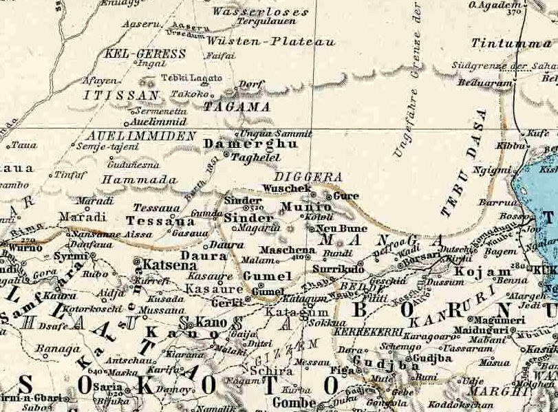
| Description | Crop of a German 1891 atlas, West Africa showing what is today south east Niger and north east Nigeria. Names are German spelling, often archaic. Map is centered on the Sultanate of Damagaram, a vasalate of the Bornu state. Yellow lines mark border between Bornu and the allied emirates of the Sokoto Caliipate. |
| Date | (UTC) |
| Source | |
| Author |
| This is a retouched picture, which means that it has been digitally altered from its original version. Modifications: crop. The original can be viewed here: Stielers Handatlas 1891 68.jpg:
|
|
The author died in Stielers Handatlas 1891, so this work is in the public domain in its country of origin and other countries and areas where the copyright term is the author's life plus 100 years or fewer. This work is in the public domain in the United States because it was published (or registered with the U.S. Copyright Office) before January 1, 1929. | |
| This file has been identified as being free of known restrictions under copyright law, including all related and neighboring rights. | |
Original upload log
[edit]
This image is a derivative work of the following images:
- Image:Stielers_Handatlas_1891_68.jpg licensed with PD-old, Stielers Handatlas 1891
- 2006-11-21T17:46:48Z Poccil 3788x3150 (1326869 Bytes) {{Stielers Handatlas 1891|67|69|Afrika in 6 Blättern, Blatt 3: Senegambien|Africa in 6 sheets, sheet 3: Senegambia}} [[Category:Old maps of Africa]]
Uploaded with derivativeFX
File history
Click on a date/time to view the file as it appeared at that time.
| Date/Time | Thumbnail | Dimensions | User | Comment | |
|---|---|---|---|---|---|
| current | 01:14, 30 August 2008 | | 811 × 599 (227 KB) | T L Miles (talk | contribs) | {{Information |Description= |Source=*Image:Stielers_Handatlas_1891_68.jpg |Date=2008-08-30 01:12 (UTC) |Author=*derivative work: ~~~ *Image:Stielers_Handatlas_1891_68.jpg: |Permission=see below |other_versions= }} {{RetouchedPicture|crop|edi |
You cannot overwrite this file.
File usage on Commons
The following page uses this file:
File usage on other wikis
The following other wikis use this file:
- Usage on ca.wikipedia.org
- Usage on de.wikipedia.org
- Usage on en.wikipedia.org
- Usage on fi.wikipedia.org
- Usage on fr.wikipedia.org
- Usage on ha.wikipedia.org
- Usage on it.wikipedia.org
- Usage on uk.wikipedia.org
- Usage on www.wikidata.org