File:Sudamérica-Blue.svg
Jump to navigation
Jump to search

Size of this PNG preview of this SVG file: 315 × 574 pixels. Other resolutions: 131 × 240 pixels | 263 × 480 pixels | 421 × 768 pixels | 562 × 1,024 pixels | 1,124 × 2,048 pixels.
Original file (SVG file, nominally 315 × 574 pixels, file size: 171 KB)
Captions
Captions
Add a one-line explanation of what this file represents
Summary
[edit]
| Description |
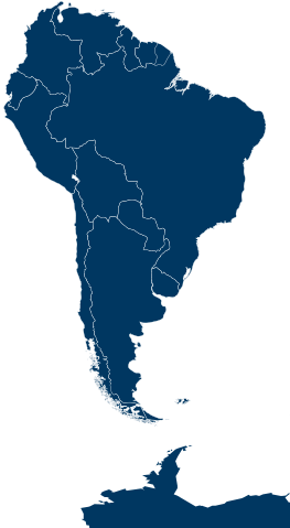
English: Blue South America + part of Antarctica simple map. |
| Date | |
| Source |
This file was derived from: South America on the globe (grey).svg |
| Author | Janitoalevic |
| SVG development |
.svg)
Licensing
[edit]
I, the copyright holder of this work, hereby publish it under the following license:
This file is licensed under the Creative Commons Attribution-Share Alike 4.0 International license.
- You are free:
- to share – to copy, distribute and transmit the work
- to remix – to adapt the work
- Under the following conditions:
- attribution – You must give appropriate credit, provide a link to the license, and indicate if changes were made. You may do so in any reasonable manner, but not in any way that suggests the licensor endorses you or your use.
- share alike – If you remix, transform, or build upon the material, you must distribute your contributions under the same or compatible license as the original.
File history
Click on a date/time to view the file as it appeared at that time.
| Date/Time | Thumbnail | Dimensions | User | Comment | |
|---|---|---|---|---|---|
| current | 20:53, 18 December 2017 | | 315 × 574 (171 KB) | Janitoalevic (talk | contribs) | New color |
| 17:06, 10 November 2017 |  | 315 × 574 (171 KB) | Janitoalevic (talk | contribs) | . | |
| 16:58, 10 November 2017 |  | 315 × 574 (170 KB) | Janitoalevic (talk | contribs) | . | |
| 16:21, 7 June 2017 |  | 315 × 574 (170 KB) | Janitoalevic (talk | contribs) | . | |
| 19:08, 26 July 2016 |  | 315 × 574 (18 KB) | Janitoalevic (talk | contribs) | User created page with UploadWizard |
You cannot overwrite this file.
File usage on Commons
The following 61 pages use this file:
- Sudamérica - América do Sul
- User:AbdealiJKTravis/logs/uncatimages/20160726
- User:Chumwa/OgreBot/Potential transport maps/2017 June 1-10
- User:Janitoalevic/Gallery/Pictures
- User talk:Al2fotos
- User talk:B1mbo
- User talk:Dentren
- User talk:Gabox0154
- User talk:Gusramirezb
- User talk:Janitoalevic
- User talk:Lin linao
- User talk:NoviSadGrad
- User talk:Slawojar
- User talk:Stasyan117
- User talk:Witli de Pencopolis
- Commons:Deletion requests/Archive/2017/11/10
- Commons:Deletion requests/Archive/2017/12/17
- Commons:Deletion requests/Archive/2018/01/03
- Commons:Deletion requests/Archive/2018/03/04
- Commons:Deletion requests/Archive/2018/04/20
- Commons:Deletion requests/Archive/2018/05/10
- Commons:Deletion requests/Archive/2018/05/14
- Commons:Deletion requests/Archive/2018/06/12
- Commons:Deletion requests/Archive/2018/06/18
- Commons:Deletion requests/Archive/2018/06/19
- Commons:Deletion requests/Archive/2018/08/17
- Commons:Deletion requests/Archive/2018/08/30
- Commons:Deletion requests/Archive/2018/09/01
- Commons:Deletion requests/File:03-inauguración-estación-glaciar-unión.jpg
- Commons:Deletion requests/File:Acción Republicana.svg
- Commons:Deletion requests/File:Acción Republicana (+texto).svg
- Commons:Deletion requests/File:Augusto Pinochet foto oficial coloreada.jpg
- Commons:Deletion requests/File:CChile.png
- Commons:Deletion requests/File:ChileRegions.png
- Commons:Deletion requests/File:Chile flg-map.png
- Commons:Deletion requests/File:Cuestión de Tacna y Arica.png
- Commons:Deletion requests/File:Departamento de Arica, Chile.png
- Commons:Deletion requests/File:Estación Polar Científica Conjunta Glaciar Unión 1.jpg
- Commons:Deletion requests/File:Flag map of Easter Island, Chile.png
- Commons:Deletion requests/File:Flag map of Easter Island.png
- Commons:Deletion requests/File:Kultrun.svg
- Commons:Deletion requests/File:Logo Gobierno de Chile 1990-1994.png
- Commons:Deletion requests/File:Logo Gobierno de Chile 1994-2000.png
- Commons:Deletion requests/File:Magallanes Comunas.png
- Commons:Deletion requests/File:Mapuche kultrun.png
- Commons:Deletion requests/File:NaturalregionsofChile.jpg
- Commons:Deletion requests/File:Outline Map of Crimea in Russia.png
- Commons:Deletion requests/File:Provincia de Tacna, Chile (1884-1929).png
- Commons:Deletion requests/File:Retrato Oficial de Augusto Pinochet.png
- Commons:Deletion requests/File:Retrato Oficial de Eduardo Frei Ruiz-Tagle.png
- Commons:Deletion requests/File:Retrato Oficial de Michelle Bachelet (Primer gobierno).png
- Commons:Deletion requests/File:Retrato Oficial de Ricardo Lagos.png
- Commons:Deletion requests/File:Retrato Oficial de Ricardo Lagos 2.png
- Commons:Deletion requests/File:Viaje al Glaciar Unión 2016.jpg
- Commons:Deletion requests/File:Viaje al Glaciar Unión INACH 2016 1.jpg
- Commons:Deletion requests/File:Viaje al Glaciar Unión INACH 2016 2.jpg
- Commons:Deletion requests/File:XII región y bandera Magallanica.png
- File talk:Acción Republicana.svg
- File talk:Augusto Pinochet foto oficial coloreada.jpg
- File talk:Natural Regions of Chile.svg
- File talk:Pueblos indigenas de Chile.svg - beta.png
.svg)
.png)
.png)
File usage on other wikis
The following other wikis use this file:
- Usage on azb.wikipedia.org
- Usage on de.wikipedia.org
- Usage on en.wikipedia.org
- Talk:Department of Tacna
- Talk:Arica y Parinacota Region
- Wikipedia:WikiProject Antarctica/Antarctic Chilean Territory work group
- Talk:Ñuble Province (1974–2018)
- User talk:Danrolo
- Talk:Del Desierto Lake
- Wikipedia:WikiProject Latin America/The 10,000 Challenge
- Talk:Chilean expansionism
- Wikipedia:Administrators' noticeboard/Archive291
- Talk:Ñuble Region
- Wikipedia:Help desk/Archives/2018 April 30
- Usage on es.wikipedia.org
- Usuario discusión:Warko
- Discusión:Ruta Nacional 40 (Argentina)
- Discusión:Cerro Torre
- Discusión:Provincia de Ñuble (1974-2018)
- Discusión:Región de La Araucanía
- Usuario discusión:Katholico
- Wikiproyecto Discusión:Chile
- Plantilla discusión:Iconos
- Discusión:Ministro de Estado de Chile
- Wikiproyecto Discusión:Ilustración/Taller de Heráldica y Vexilología/Solicitudes
- Discusión:Wallmapu
- Plantilla discusión:Ficha de entidad subnacional
- Discusión:Primer gobierno de Sebastián Piñera
- Discusión:LATAM Express
- Discusión:Litigio del campo de hielo patagónico sur
- Wikiproyecto Discusión:Patagonia
- Usuario discusión:B1mbo
- Discusión:LATAM
- Discusión:Distrito de La Yarada-Los Palos
- Usuario discusión:CesarGAC
- Usuario discusión:Janitoalevic/Archivo 2
- Discusión:Bandera de la región de Arica y Parinacota
- Wikiproyecto:Relaciones bilaterales/participantes
- Discusión:Elección presidencial de Chile de 2017
- Wikipedia:Tablón de anuncios de los bibliotecarios/Portal/Archivo/Miscelánea/2017/08
- Usuario discusión:Farisori/respaldo25
- Wikipedia:Mes de la Antártida/2018
- Wikipedia:Mes de la Antártida/2018/Participantes
- Wikipedia:Wikiproyectos/Solicitudes/Archivo/2018
- Wikipedia:Café/Archivo/2018/Enero
- Wikipedia:Café/Portal/Archivo/Miscelánea/2018/01
- Discusión:Casa Real Afroboliviana
- Wikipedia:Consultas de borrado/Juan Pablo Camacho
- Anexo Discusión:Gabinetes ministeriales del primer gobierno de Sebastián Piñera
View more global usage of this file.