File:Tabreux bridge GR 57.jpg
Original file (4,020 × 2,680 pixels, file size: 11.55 MB, MIME type: image/jpeg)
Captions
Summary
[edit]DescriptionTabreux bridge GR 57.jpg |
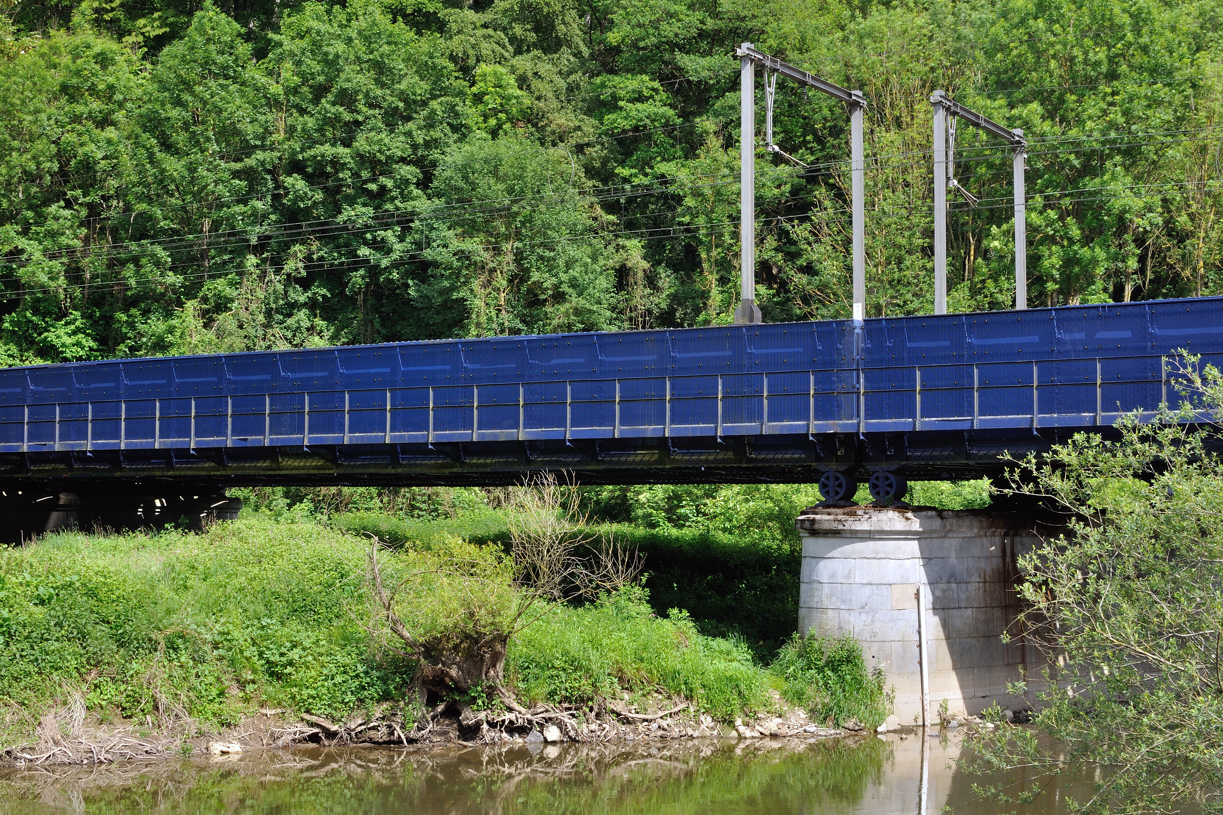
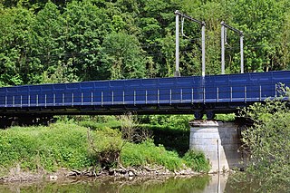
English: The Tabreux Railway bridge (with the footpath GR 57 along the railway bridge crossing the river Ourthe, Hamoir, Wallonia, Belgium
|
|||
Date | ||||
Source | Own work | |||
Author | Pierre-Jacques Despa |
Camera location | 50° 26′ 17.52″ N, 5° 32′ 05.64″ E | View this and other nearby images on: OpenStreetMap | 50.438199; 5.534899 |
---|
Object location | 50° 26′ 17.67″ N, 5° 32′ 07.42″ E | View this and other nearby images on: OpenStreetMap | 50.438241; 5.535395 |
---|
Licensing
[edit]- You are free:
- to share – to copy, distribute and transmit the work
- to remix – to adapt the work
- Under the following conditions:
- attribution – You must give appropriate credit, provide a link to the license, and indicate if changes were made. You may do so in any reasonable manner, but not in any way that suggests the licensor endorses you or your use.
This image was uploaded as part of the photo contest Wiki Loves Heritage in Belgium in 2018 in the European Year of Cultural Heritage.
Deutsch | English | français | Nederlands | +/− |
This image has been assessed using the Quality image guidelines and is considered a Quality image.
العربية ∙ جازايرية ∙ беларуская ∙ беларуская (тарашкевіца) ∙ български ∙ বাংলা ∙ català ∙ čeština ∙ Cymraeg ∙ Deutsch ∙ Schweizer Hochdeutsch ∙ Zazaki ∙ Ελληνικά ∙ English ∙ Esperanto ∙ español ∙ eesti ∙ euskara ∙ فارسی ∙ suomi ∙ français ∙ galego ∙ עברית ∙ हिन्दी ∙ hrvatski ∙ magyar ∙ հայերեն ∙ Bahasa Indonesia ∙ italiano ∙ 日本語 ∙ Jawa ∙ ქართული ∙ 한국어 ∙ kurdî ∙ Lëtzebuergesch ∙ lietuvių ∙ македонски ∙ മലയാളം ∙ मराठी ∙ Bahasa Melayu ∙ Nederlands ∙ Norfuk / Pitkern ∙ polski ∙ português ∙ português do Brasil ∙ rumantsch ∙ română ∙ русский ∙ sicilianu ∙ slovenčina ∙ slovenščina ∙ shqip ∙ српски / srpski ∙ svenska ∙ தமிழ் ∙ తెలుగు ∙ ไทย ∙ Tagalog ∙ toki pona ∙ Türkçe ∙ українська ∙ vèneto ∙ Tiếng Việt ∙ 中文 ∙ 中文(简体) ∙ 中文(繁體) ∙ +/− |
File history
Click on a date/time to view the file as it appeared at that time.
Date/Time | Thumbnail | Dimensions | User | Comment | |
---|---|---|---|---|---|
current | 19:34, 21 June 2018 | 4,020 × 2,680 (11.55 MB) | PJDespa (talk | contribs) | User created page with UploadWizard |
You cannot overwrite this file.
File usage on Commons
The following 5 pages use this file:
File usage on other wikis
The following other wikis use this file:
- Usage on da.wikipedia.org
- Usage on www.wikidata.org
Metadata
This file contains additional information such as Exif metadata which may have been added by the digital camera, scanner, or software program used to create or digitize it. If the file has been modified from its original state, some details such as the timestamp may not fully reflect those of the original file. The timestamp is only as accurate as the clock in the camera, and it may be completely wrong.
Camera manufacturer | NIKON CORPORATION |
---|---|
Camera model | NIKON D90 |
Copyright holder |
|
Exposure time | 1/100 sec (0.01) |
F-number | f/10 |
ISO speed rating | 200 |
Date and time of data generation | 16:14, 21 May 2018 |
Lens focal length | 35 mm |
Orientation | Normal |
Horizontal resolution | 670 dpi |
Vertical resolution | 670 dpi |
Software used | Adobe Photoshop Elements 8.0 Windows |
File change date and time | 19:49, 20 June 2018 |
Y and C positioning | Centered |
Pair of black and white reference values |
|
Exposure Program | Aperture priority |
Exif version | 2.3 |
Date and time of digitizing | 16:14, 21 May 2018 |
Meaning of each component |
|
APEX exposure bias | 0 |
Maximum land aperture | 1.6 APEX (f/1.74) |
Metering mode | Pattern |
Light source | Unknown |
Flash | Flash did not fire |
DateTime subseconds | 00 |
DateTimeOriginal subseconds | 00 |
DateTimeDigitized subseconds | 00 |
Supported Flashpix version | 1 |
Color space | sRGB |
Sensing method | One-chip color area sensor |
File source | Digital still camera |
Scene type | A directly photographed image |
Custom image processing | Normal process |
Exposure mode | Auto exposure |
White balance | Auto white balance |
Digital zoom ratio | 1 |
Focal length in 35 mm film | 52 mm |
Scene capture type | Standard |
Scene control | None |
Contrast | Normal |
Saturation | Normal |
Sharpness | Normal |
Subject distance range | Unknown |
GPS tag version | 0.0.2.2 |
Supported Flashpix version | 1 |
Image width | 4,020 px |
Image height | 2,680 px |
Date metadata was last modified | 21:49, 20 June 2018 |
Unique ID of original document | xmp.did:B7D971A5B174E8118889DEF378332767 |
Keywords |
|
IIM version | 22,200 |
Structured data
21 May 2018
50°26'17.51550"N, 5°32'5.63723"E
50°26'17.66926"N, 5°32'7.42358"E
0.01 second
10
35 millimetre
200
image/jpeg
- Images from Wiki Loves Heritage Belgium in 2018 - immovable heritage
- Images from Wiki Loves Heritage Belgium in 2018 - Wallonia
- Files with coordinates missing SDC location of creation (50° N, 5° E)
- CC-BY-4.0
- Self-published work
- Images from Wiki Loves Heritage Belgium in 2018
- Quality images
- Images from Wiki Loves Heritage Belgium in 2018 needing check
- Uploaded via Campaign:wlh-be
- Photographs taken on 2018-05-21
- Quality images of Hamoir
- Quality images by PJDespa
- Quality images of bridges in Belgium