File:Temperature variation in the Northern Channel Islands.jpg
Jump to navigation
Jump to search
Size of this preview: 800 × 580 pixels. Other resolutions: 320 × 232 pixels | 640 × 464 pixels | 1,024 × 742 pixels | 1,155 × 837 pixels.
Original file (1,155 × 837 pixels, file size: 183 KB, MIME type: image/jpeg)
Captions
Captions
Add a one-line explanation of what this file represents
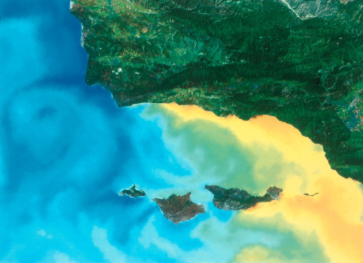
Temperature variation in the Northern Channel Islands
- Photo: Channel Islands NMS.
- Printing resolution: 300 DPI.
- Downloaded from http://www.sanctuaries.nos.noaa.gov/pgallery/pgchannel/habitats/habitats_1.html.
- Leyend: This satellite image illustrates the temperature variation in the Northern Channel Islands. Temperature ranges are represented as follows: blue = 44-52º F, green-yellow = 56-64º F, and orange-red = 65-72º F. The California current brings cold water down from the Gulf of Alaska, which influences the northwestern islands: San Miguel, Santa Rosa, and part of Santa Cruz. Warm currents affect Santa Barbara Island (not pictured), Anacapa and the eastern side of Santa Cruz.
This image is in the public domain because it contains materials that originally came from the U.S. National Oceanic and Atmospheric Administration, taken or made as part of an employee's official duties.
|

|
Attribution information, such as the author's name, e-mail, website, or signature, that was once visible in the image itself has been moved into the image metadata and/or image description page. This makes the image easier to reuse and more language-neutral, and makes the text easier to process and search for. Commons discourages placing visible author information in images.
|
File history
Click on a date/time to view the file as it appeared at that time.
| Date/Time | Thumbnail | Dimensions | User | Comment | |
|---|---|---|---|---|---|
| current | 23:54, 1 June 2007 | | 1,155 × 837 (183 KB) | Xhienne (talk | contribs) | removed watermark |
| 06:45, 23 December 2004 |  | 1,155 × 837 (190 KB) | Lucero del Alba~commonswiki (talk | contribs) | Temperature variation in the Northern Channel Islands |
You cannot overwrite this file.
File usage on Commons
The following 3 pages use this file:
File usage on other wikis
The following other wikis use this file:
- Usage on ca.wikipedia.org
- Usage on en.wikipedia.org
- Usage on fr.wikipedia.org