File:TiconderogaJeffreys1758.jpg
Jump to navigation
Jump to search
Size of this preview: 767 × 599 pixels. Other resolutions: 307 × 240 pixels | 614 × 480 pixels | 983 × 768 pixels | 1,280 × 1,000 pixels | 2,349 × 1,836 pixels.
Original file (2,349 × 1,836 pixels, file size: 984 KB, MIME type: image/jpeg)
Captions
Captions
Add a one-line explanation of what this file represents
| Description |
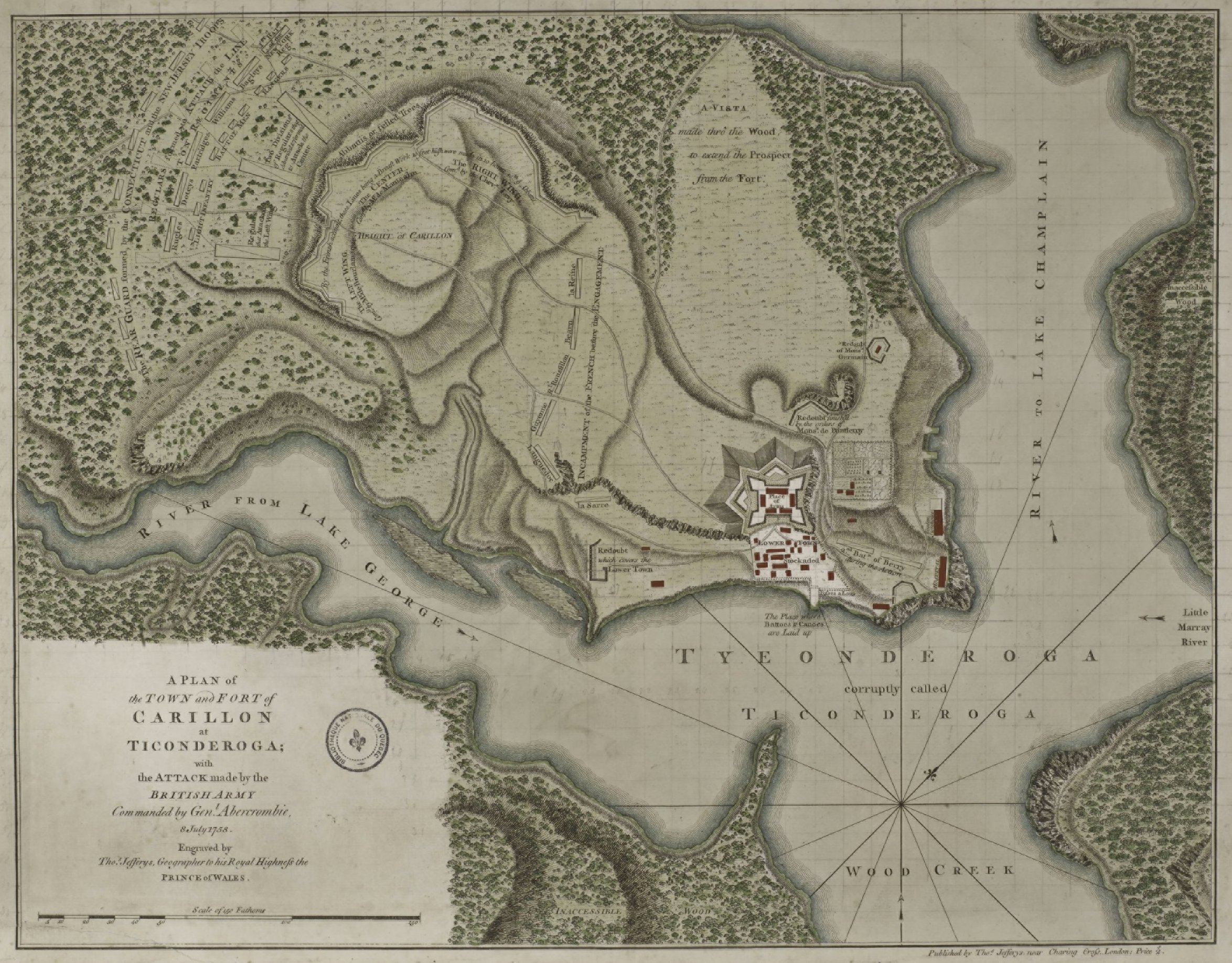
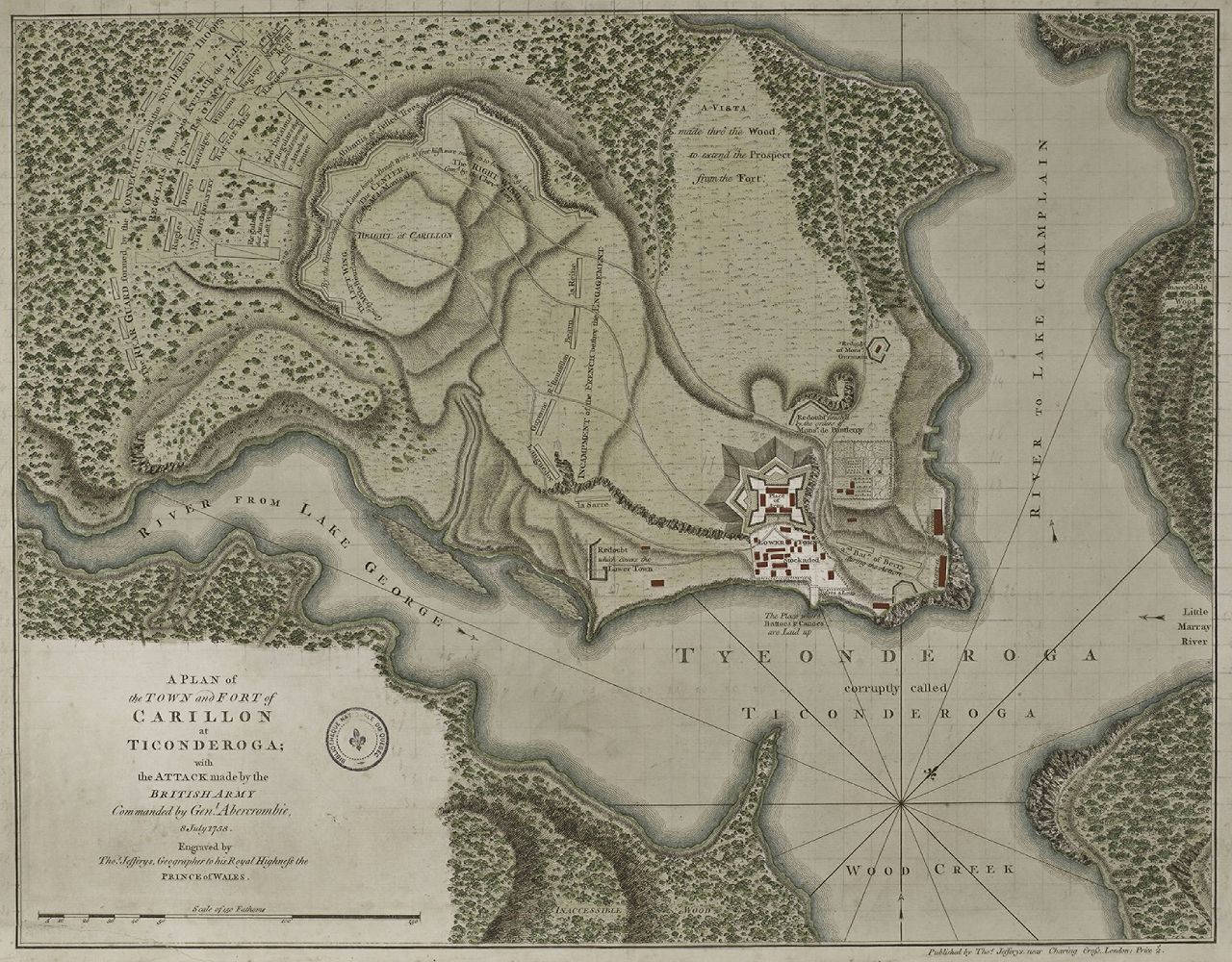
English: This is a period map showing the forces arrayed at the Battle of Carillon at Fort Ticonderoga (then known as Fort Carillon) in 1758. It is captioned A Plan of the Town and Fort of Carillon at Ticonderoga. |
||||||||||||||||||||||
| Date | |||||||||||||||||||||||
| Source |
The image is from the Library and Archive of Quebec. |
||||||||||||||||||||||
| Author |
|
||||||||||||||||||||||
| Permission (Reusing this file) |
|
||||||||||||||||||||||
| Other versions | Derivative works of this file: FortTiconderogaLayout1758.png | ||||||||||||||||||||||
File history
Click on a date/time to view the file as it appeared at that time.
| Date/Time | Thumbnail | Dimensions | User | Comment | |
|---|---|---|---|---|---|
| current | 16:58, 14 January 2009 | | 2,349 × 1,836 (984 KB) | Magicpiano (talk | contribs) | {{Information |Description={{en|1=This is a period map showing the forces arrayed at the en:Battle of Carillon at en:Fort Ticonderoga (then known as Fort Carillon) in 1758. It is captioned ''A Plan of the Town and Fort of Carillon at Ticonderog |
You cannot overwrite this file.
File usage on Commons
The following page uses this file:
File usage on other wikis
The following other wikis use this file:
- Usage on ca.wikipedia.org
- Usage on en.wikipedia.org
- Usage on fr.wikipedia.org
- Usage on it.wikipedia.org
- Usage on ja.wikipedia.org
- Usage on ko.wikipedia.org