File:USA-Canada-silhouette-transbg.png
From Wikimedia Commons, the free media repository
Jump to navigation
Jump to search
USA-Canada-silhouette-transbg.png (607 × 599 pixels, file size: 9 KB, MIME type: image/png)
File information
Structured data
Captions
Captions
Add a one-line explanation of what this file represents
Summary
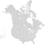
[edit]| DescriptionUSA-Canada-silhouette-transbg.png | Blank map of US states and Canadian provinces. (thin lines join areas of the same state/province for one-click coloring). Black-and-white version with transparent background; Hawaii shown to scale but moved closer. |
| Source | Own work, based on Image:BlankMap-USA-states-Canada-provinces.png |
| Author | User:SMcCandlish, based on original by User:Astrokey44 |
| Permission (Reusing this file) |
Originally posted as Image:BlankMap-USA-states-Canada-provinces.png, with licensing as given below |
| Other versions | Image:BlankMap-USA-states-Canada-provinces.png - original SVG, non-transparency, greyish version with more distance between Hawaii and the continent |
Licensing
[edit]I, the copyright holder of this work, hereby publish it under the following licenses:

|
Permission is granted to copy, distribute and/or modify this document under the terms of the GNU Free Documentation License, Version 1.2 or any later version published by the Free Software Foundation; with no Invariant Sections, no Front-Cover Texts, and no Back-Cover Texts. A copy of the license is included in the section entitled GNU Free Documentation License.http://www.gnu.org/copyleft/fdl.htmlGFDLGNU Free Documentation Licensetruetrue |
| This file is licensed under the Creative Commons Attribution-Share Alike 3.0 Unported license. | ||
| ||
| This licensing tag was added to this file as part of the GFDL licensing update.http://creativecommons.org/licenses/by-sa/3.0/CC BY-SA 3.0Creative Commons Attribution-Share Alike 3.0truetrue |
You may select the license of your choice.

|
File:BlankMap-USA-states-Canada-provinces, HI closer.svg is a vector version of this file. It should be used in place of this PNG file when not inferior.
File:USA-Canada-silhouette-transbg.png → File:BlankMap-USA-states-Canada-provinces, HI closer.svg
For more information, see Help:SVG.
|
File history
Click on a date/time to view the file as it appeared at that time.
| Date/Time | Thumbnail | Dimensions | User | Comment | |
|---|---|---|---|---|---|
| current | 23:33, 23 April 2007 |  | 607 × 599 (9 KB) | SMcCandlish (talk | contribs) | ==Summary== {{Information |Description=Blank map of US states and Canadian provinces. (thin lines join areas of the same state/province for one-click coloring). Black-and-white version with transparent background; Hawaii shown to scale but moved closer | |
You cannot overwrite this file.
File usage on Commons
There are no pages that use this file.
File usage on other wikis
The following other wikis use this file:
- Usage on bg.wikipedia.org
- Usage on en.wikipedia.org
- Usage on si.wikipedia.org

