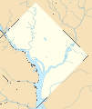
File:USA District of Columbia location map.svg

Original file (SVG file, nominally 800 × 949 pixels, file size: 278 KB)
Captions
Captions
Summary
[edit]| DescriptionUSA District of Columbia location map.svg |
Quadratische Plattkarte, N-S-Streckung 130.0 %. Geographische Begrenzung der Karte:
Equirectangular projection, N/S stretching 130.0 %. Geographic limits of the map:
|
| Date | |
| Source | Own work |
| Author | Alexrk2 |

|
This map has been made or improved in the German Kartenwerkstatt (Map Lab). You can propose maps to improve as well.
azərbaycanca ∙ čeština ∙ Deutsch ∙ Deutsch (Sie-Form) ∙ English ∙ español ∙ français ∙ italiano ∙ latviešu ∙ magyar ∙ Nederlands ∙ Plattdüütsch ∙ polski ∙ português ∙ română ∙ sicilianu ∙ slovenščina ∙ suomi ∙ македонски ∙ русский ∙ ქართული ∙ հայերեն ∙ বাংলা ∙ ไทย ∙ +/−
|
Licensing
[edit]
|
Permission is granted to copy, distribute and/or modify this document under the terms of the GNU Free Documentation License, Version 1.2 or any later version published by the Free Software Foundation; with no Invariant Sections, no Front-Cover Texts, and no Back-Cover Texts. A copy of the license is included in the section entitled GNU Free Documentation License.http://www.gnu.org/copyleft/fdl.htmlGFDLGNU Free Documentation Licensetruetrue |
- You are free:
- to share – to copy, distribute and transmit the work
- to remix – to adapt the work
- Under the following conditions:
- attribution – You must give appropriate credit, provide a link to the license, and indicate if changes were made. You may do so in any reasonable manner, but not in any way that suggests the licensor endorses you or your use.
File history
Click on a date/time to view the file as it appeared at that time.
| Date/Time | Thumbnail | Dimensions | User | Comment | |
|---|---|---|---|---|---|
| current | 18:58, 16 November 2012 |  | 800 × 949 (278 KB) | Alexrk2 (talk | contribs) | - |
| 18:56, 16 November 2012 |  | 800 × 949 (448 KB) | Alexrk2 (talk | contribs) | removed crisp-edges | |
| 22:37, 25 January 2010 |  | 800 × 949 (482 KB) | Alexrk2 (talk | contribs) | fixed line width; Kenilworth Park and Aquatic Gardens | |
| 22:23, 25 January 2010 |  | 800 × 949 (477 KB) | Alexrk2 (talk | contribs) | == Beschreibung == {{Information |Description= {{de|Positionskarte von District of Columbia, USA}} Quadratische Plattkarte, N-S-Streckung 130.0 %. Geographische Begrenzung der Karte: * N: 39.00° N * S: 38.79° N * |
You cannot overwrite this file.
File usage on Commons
The following 11 pages use this file:
- File:Checkers and Rally's footprint.png
- File:Costco footprint map USA 2021-01.png
- File:Dollar Tree footprint map 2020-12.png
- File:Family Dollar footprint map 2020-12.png
- File:M&T Bank footprint.png
- File:Royal Farms stores footprint map.png
- File:Save-A-Lot footprint map.png
- File:Target stores footprint 2020-12.png
- File:Valero brands branded gas stations 2020-12.png
- File:Walmart branded fuel stations map 2020-12.png
- File:Walmart locations with on-site fuel stations map 2020-20.png
File usage on other wikis
The following other wikis use this file:
- Usage on als.wikipedia.org
- Usage on ar.wikipedia.org
- Usage on az.wikipedia.org
- Usage on bn.wikipedia.org
- Usage on ceb.wikipedia.org
- Usage on ce.wikipedia.org
- Usage on de.wikipedia.org
- Washington Monument
- National Mall
- Vietnam Veterans Memorial
- Smithsonian National Zoological Park
- Washington National Cathedral
- Die Drei Soldaten
- Capital One Arena
- Robert F. Kennedy Memorial Stadium
- Georgetown (Washington, D.C.)
- Adams Memorial
- Watergate-Gebäudekomplex
- Wikipedia:Kartenwerkstatt/Positionskarten/Nordamerika
- Herbert C. Hoover Building
- Korean War Veterans Memorial
- District of Columbia War Memorial
- George Mason Memorial
- Theodore Roosevelt Island
- Nationals Park
- U.S. Department of Agriculture South Building
- U.S. Department of Agriculture Administration Building
- Vorlage:Positionskarte USA District of Columbia
- Kennedy-Warren Apartment Building
- Arlington Memorial Bridge
- Ulysses S. Grant Memorial
- Peace Monument
- Cutts-Madison House
- Old Post Office Pavilion
- Vorlage:Infobox NRHP
- Vorlage:Infobox NRHP/Doku
- Mount Pleasant (Washington, D.C.)
- Ford’s Theatre
- Cosmos Club
- Foggy Bottom
- Commercial National Bank (Washington, D.C.)
- Martin Luther King Jr. Memorial Library
- Dwight D. Eisenhower Memorial
- Folger Shakespeare Library
- Virginia Avenue Tunnel
- The Ellipse
- Audi Field
- St. Elizabeths East Entertainment and Sports Arena
View more global usage of this file.
Metadata
This file contains additional information such as Exif metadata which may have been added by the digital camera, scanner, or software program used to create or digitize it. If the file has been modified from its original state, some details such as the timestamp may not fully reflect those of the original file. The timestamp is only as accurate as the clock in the camera, and it may be completely wrong.
| Width | 800 |
|---|---|
| Height | 949 |