File:USA Mississippi location map.svg
Jump to navigation
Jump to search

Size of this PNG preview of this SVG file: 377 × 600 pixels. Other resolutions: 151 × 240 pixels | 301 × 480 pixels | 482 × 768 pixels | 643 × 1,024 pixels | 1,287 × 2,048 pixels | 754 × 1,200 pixels.
Original file (SVG file, nominally 754 × 1,200 pixels, file size: 619 KB)
Captions
Captions
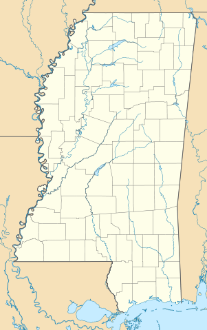
Location map of Mississippi, United States
Summary
[edit]
| Description |
Quadratische Plattkarte, N-S-Streckung 120.0 %. Geographische Begrenzung der Karte:
Equirectangular projection, N/S stretching 120.0 %. Geographic limits of the map:
|
| Date | |
| Source | Own work |
| Author | Alexrk2 |
| Other versions |
Derivative works of this file: Natchez Massacre location.png Derivative works of this file: |

|
This map has been made or improved in the German Kartenwerkstatt (Map Lab). You can propose maps to improve as well.
|
Licensing
[edit]
I, the copyright holder of this work, hereby publish it under the following licenses:

|
Permission is granted to copy, distribute and/or modify this document under the terms of the GNU Free Documentation License, Version 1.2 or any later version published by the Free Software Foundation; with no Invariant Sections, no Front-Cover Texts, and no Back-Cover Texts. A copy of the license is included in the section entitled GNU Free Documentation License. |
This file is licensed under the Creative Commons Attribution 3.0 Unported license.
- You are free:
- to share – to copy, distribute and transmit the work
- to remix – to adapt the work
- Under the following conditions:
- attribution – You must give appropriate credit, provide a link to the license, and indicate if changes were made. You may do so in any reasonable manner, but not in any way that suggests the licensor endorses you or your use.
You may select the license of your choice.
File history
Click on a date/time to view the file as it appeared at that time.
| Date/Time | Thumbnail | Dimensions | User | Comment | |
|---|---|---|---|---|---|
| current | 12:33, 20 June 2009 | | 754 × 1,200 (619 KB) | Alexrk2 (talk | contribs) | == Beschreibung == {{Information |Description= {{de|Positionskarte von Mississippi, USA}} Quadratische Plattkarte, N-S-Streckung 120.0 %. Geographische Begrenzung der Karte: * N: 35.2° N * S: 29.9° N * W: 91.9° W * O: 87 |
You cannot overwrite this file.
File usage on Commons
The following 21 pages use this file:
- File:Checkers and Rally's footprint.png
- File:Citgo locations 2020 September.png
- File:Costco footprint map USA 2021-01.png
- File:Dollar Tree footprint map 2020-12.png
- File:Family Dollar footprint map 2020-12.png
- File:Kum&GoFootprint July2020.png
- File:Natchez Massacre location.png
- File:QuikTrip Footprint 2020 October.png
- File:RaceTrac+RaceWay footprint 2020-01.png
- File:RaceTrac US footprint.png
- File:RaceWay US footprint.png
- File:Rooms To Go footprint map 2021-01.png
- File:Save-A-Lot footprint map.png
- File:Southeastern Grocers footprint 2020 December.png
- File:Speedway Footprint 2020 August.png
- File:Speedway Jun2018 to Aug2020 comparison.png
- File:Target stores footprint 2020-12.png
- File:USA Mississippi relief location map.svg
- File:Valero brands branded gas stations 2020-12.png
- File:Walmart branded fuel stations map 2020-12.png
- File:Walmart locations with on-site fuel stations map 2020-20.png
File usage on other wikis
The following other wikis use this file:
- Usage on af.wikipedia.org
- Usage on an.wikipedia.org
- Usage on ar.wikipedia.org
- Usage on azb.wikipedia.org
- جکسون، میسیسیپی
- یازو سیتی، میسیسیپی
- ویکسبرق، میسیسیپی
- اسالتیلو، میسیسیپی
- نچیز، میسیسیپی
- قالفپورت، میسیسیپی
- پانتوتوک، میسیسیپی
- ویکسبرق موحاصیرهسی
- پالدینق، میسیسیپی
- استار، میسیسیپی
- پرکینستن، میسیسیپی
- واینات، میسیسیپی
- اولان، میسیسیپی
- مانی، میسیسیپی
- آرکاباتلا، میسیسیپی
- بلدن، میسیسیپی
- داندی، میسیسیپی
- تیوک، میسیسیپی
- براونینق، میسیسیپی
- مینتر سیتی، میسیسیپی
- هاردی، میسیسیپی
- دنیس، میسیسیپی
- نسبیت، میسیسیپی
- لورمن، میسیسیپی
- فرویو، میسیسیپی
- کایل، میسیسیپی
- برکلیر، میسیسیپی
- بارتون، میسیسیپی
- پاریس، میسیسیپی
- ایقل بند، میسیسیپی
- بووینا، میسیسیپی
- ردوود، میسیسیپی
- فلاورز، میسیسیپی
- یودرا، میسیسیپی
- هالیوود، میسیسیپی
- نیکولسن، میسیسیپی
- دوایر، میسیسیپی
- هاسینتو، میسیسیپی
- ادینبورق، میسیسیپی
- بنتن، میسیسیپی
- هیلزبورو، میسیسیپی
- چرچ هیل، میسیسیپی
- آبویل، میسیسیپی
- آکونا، میسیسیپی
- موزکوو، میسیسیپی
- آقریکولا، میسیسیپی
View more global usage of this file.