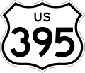
File:US 395 (1961 cutout).svg
From Wikimedia Commons, the free media repository
Jump to navigation
Jump to search

Size of this PNG preview of this SVG file: 449 × 385 pixels. Other resolutions: 280 × 240 pixels | 560 × 480 pixels | 896 × 768 pixels | 1,194 × 1,024 pixels | 2,389 × 2,048 pixels.
Original file (SVG file, nominally 449 × 385 pixels, file size: 8 KB)
File information
Structured data
Captions
Captions
US 395 shield
Summary
[edit]| DescriptionUS 395 (1961 cutout).svg |
English: 28 in by 24 in (711 mm by 610 mm) California-style U.S. Route shield, made to the specifications of the 2002 edition of Standard Highway Signs with 10 in (250 mm) numerals. Uses the Roadgeek fonts. (United States law does not permit the copyrighting of typeface designs, and the fonts are meant to be copies of a U.S. Government-produced work anyway.) |
||||
| Date | |||||
| Source | Own work | ||||
| Author | SPUI | ||||
| Permission (Reusing this file) |
|
||||
| Other versions |
This vector image includes elements that have been taken or adapted from this file: | ||||
| SVG development InfoField | This logo was created with Adobe Illustrator. |
File history
Click on a date/time to view the file as it appeared at that time.
| Date/Time | Thumbnail | Dimensions | User | Comment | |
|---|---|---|---|---|---|
| current | 23:50, 13 September 2022 |  | 449 × 385 (8 KB) | Fredddie (talk | contribs) | add stroke // Editing SVG source code using c:User:Rillke/SVGedit.js |
| 23:31, 11 September 2022 |  | 448 × 384 (8 KB) | Smasongarrison (talk | contribs) | slimmed down with svgomg // Editing SVG source code using c:User:Rillke/SVGedit.js | |
| 11:52, 28 January 2006 |  | 448 × 384 (10 KB) | SPUI~commonswiki (talk | contribs) | {{spuiother}} 28 in by 24 in (711 mm by 610 mm) California-style U.S. Route shield, made to the specifications of the [http://www.dot.ca.gov/hq/traffops/signtech/signdel/specs/G26-2.pdf 2002 edition of Standard Highway Signs] with 10 in (250 mm) numerals. |
You cannot overwrite this file.
File usage on Commons
The following 5 pages use this file:
File usage on other wikis
The following other wikis use this file:
- Usage on ar.wikipedia.org
- Usage on arz.wikipedia.org
- Usage on ca.wikipedia.org
- Usage on de.wikipedia.org
- Usage on en.wikipedia.org
- Southern California
- Inyo County, California
- Kern County, California
- Lassen County, California
- San Bernardino County, California
- Modoc County, California
- Mono County, California
- Sierra County, California
- Northern California
- Interstate 380 (California)
- U.S. Route 466
- California State Route 14
- California State Route 58
- California State Route 74
- U.S. Route 99
- California State Route 120
- California State Route 163
- Cajon Pass
- California State Route 299
- California State Route 18
- Eastern California
- California State Route 4
- Wikipedia:WikiProject U.S. Roads/Redirects/California
- California State Route 89
- U.S. Route 399
- California State Route 36
- California State Route 108
- California State Route 70
- California State Route 190
- California State Route 136
- California State Route 168
- California State Route 178
- California State Route 158
- California State Route 167
- Sierra Highway
- California State Route 182
- California State Route 203
- California State Route 270
- Sherwin Summit
- Interstate 15 in California
- Deadman Summit
- Devil's Gate Pass
View more global usage of this file.
Metadata
This file contains additional information such as Exif metadata which may have been added by the digital camera, scanner, or software program used to create or digitize it. If the file has been modified from its original state, some details such as the timestamp may not fully reflect those of the original file. The timestamp is only as accurate as the clock in the camera, and it may be completely wrong.
| Width | 449 |
|---|---|
| Height | 385 |
