File:US 80.svg
Jump to navigation
Jump to search

Size of this PNG preview of this SVG file: 600 × 600 pixels. Other resolutions: 240 × 240 pixels | 480 × 480 pixels | 768 × 768 pixels | 1,024 × 1,024 pixels | 2,048 × 2,048 pixels.
Original file (SVG file, nominally 600 × 600 pixels, file size: 7 KB)
Captions
Captions
Add a one-line explanation of what this file represents
Summary
[edit]
| Description |
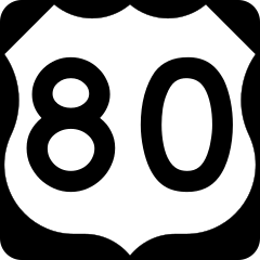
English: 600 mm × 600 mm (24 in × 24 in) U.S. Highway shield, made to the specifications of the 2004 edition of Standard Highway Signs. (Note that there is a missing "J" label on the left side of the diagram.) Uses the Roadgeek 2005 fonts. (United States law does not permit the copyrighting of typeface designs, and the fonts are meant to be copies of a U.S. Government-produced work anyway.) |
| Date | (UTC) |
| Source | 2004 MUTCD Standard Highway Signs |
| Author | Fredddie, originally SPUI |
Licensing
[edit]
This file is in the public domain because it comes from the Manual on Uniform Traffic Control Devices, sign number M1-4, which states specifically on page I-1 that:
|
.svg) |
File history
Click on a date/time to view the file as it appeared at that time.
| Date/Time | Thumbnail | Dimensions | User | Comment | |
|---|---|---|---|---|---|
| current | 00:56, 26 August 2017 | | 600 × 600 (7 KB) | Fredddie (talk | contribs) | |
| 01:51, 27 January 2006 |  | 600 × 600 (5 KB) | SPUI~commonswiki (talk | contribs) | {{spuiother}} 600 mm by 600 mm (24 in by 24 in) U.S. Route shield, made to the specifications of the [http://mutcd.fhwa.dot.gov/SHSm/Guide.pdf 2004 edition of Standard Highway Signs]. (Note that there is a missing "J" label on the left side of the diagram |
You cannot overwrite this file.
File usage on Commons
The following 11 pages use this file:
- Numbers
- U.S. Highway shields
- User:Fredddie/gallery/archive 15
- Commons:Files used on the AARoads Wiki/69
- Category:U.S. Route 80
- Category:U.S. Route 80 in Alabama
- Category:U.S. Route 80 in Louisiana
- Category:U.S. Route 80 in Mississippi
- Category:U.S. Route 80 in New Mexico
- Category:U.S. Route 80 in Texas
- Category:Views from U.S. Route 80
File usage on other wikis
The following other wikis use this file:
- Usage on ast.wikipedia.org
- Usage on bg.wikipedia.org
- Usage on bn.wikipedia.org
- Usage on de.wikipedia.org
- Benutzer:Stefan Tollkühn/Übersetzung/Interstate 65
- U.S. Highway 1
- Interstate 16
- Liste der United States Highways
- U.S. Highway 80
- U.S. Highway 280
- Benutzer:Gast32/Formvorlage USA
- Edmund Pettus Bridge
- U.S. Highway 441
- Liste der State-, U.S.- und Interstate-Highways in Louisiana
- Liste der Brücken über den Unterlauf des Mississippi
- U.S. Highway 27
- U.S. Highway 41
- U.S. Highway 301
- U.S. Highway 319
- U.S. Highway 331
- Regionalflughafen Montgomery
- Usage on en.wikipedia.org
- Jackson, Mississippi
- Louisiana
- Dallas
- Montgomery County, Alabama
- U.S. Route 1
- Interstate 95
- Dallas County, Alabama
- Hale County, Alabama
- Lee County, Alabama
- Lowndes County, Alabama
- Macon County, Alabama
- Marengo County, Alabama
- Perry County, Alabama
- Russell County, Alabama
- Sumter County, Alabama
- Savannah, Georgia
- Interstate 16
- Interstate 75
- Interstate 20
- Interstate 30
- Wood County, Texas
- Van Zandt County, Texas
- Upshur County, Texas
- Smith County, Texas
- Kaufman County, Texas
- Harrison County, Texas
- Gregg County, Texas
- Dallas County, Texas
- Interstate 59
View more global usage of this file.