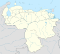
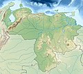
File:Venezuela relief location map (+claimed).jpg

Original file (1,861 × 1,494 pixels, file size: 538 KB, MIME type: image/jpeg)
Captions
Captions
Summary
[edit]| DescriptionVenezuela relief location map (+claimed).jpg |
Deutsch: Physische Positionskarte von Venezuela Quadratische Plattkarte. Geographische Begrenzung der Karte:
English: Physical Location map of Venezuela Equirectangular projection. Geographic limits of the map:
Français : Carte physique de Venezuela et des pays avoisinants. Projection équirectangulaire. Limites de la carte:
|
| Date | |
| Source |
This file was derived from: |
| Author |
|
| Other versions |
|
Licensing
[edit]
|
Permission is granted to copy, distribute and/or modify this document under the terms of the GNU Free Documentation License, Version 1.2 or any later version published by the Free Software Foundation; with no Invariant Sections, no Front-Cover Texts, and no Back-Cover Texts. A copy of the license is included in the section entitled GNU Free Documentation License.http://www.gnu.org/copyleft/fdl.htmlGFDLGNU Free Documentation Licensetruetrue |
- You are free:
- to share – to copy, distribute and transmit the work
- to remix – to adapt the work
- Under the following conditions:
- attribution – You must give appropriate credit, provide a link to the license, and indicate if changes were made. You may do so in any reasonable manner, but not in any way that suggests the licensor endorses you or your use.
- share alike – If you remix, transform, or build upon the material, you must distribute your contributions under the same or compatible license as the original.
Original upload log
[edit]This image is a derivative work of the following images:
- File:Guiana_shield_map-fr.svg licensed with Cc-by-sa-3.0,2.5,2.0,1.0, GFDL
- File:Venezuela_location_map.svg licensed with Cc-by-sa-3.0
Uploaded with derivativeFX
File history
Click on a date/time to view the file as it appeared at that time.
| Date/Time | Thumbnail | Dimensions | User | Comment | |
|---|---|---|---|---|---|
| current | 11:42, 27 July 2013 |  | 1,861 × 1,494 (538 KB) | Milenioscuro (talk | contribs) | User created page with UploadWizard |
You cannot overwrite this file.
File usage on Commons
The following 3 pages use this file:
File usage on other wikis
The following other wikis use this file:
- Usage on ar.wikipedia.org
- Usage on ast.wikipedia.org
- Usage on ban.wikipedia.org
- Usage on bg.wikipedia.org
- Ориноко
- Анхел
- Каракас
- Маракайбо (езеро)
- Маракайбо
- Маргарита (остров)
- Валенсия (Венецуела)
- Баркисимето
- Мерида (Венецуела)
- Маракай
- Сан Кристобал (Тачира)
- Баринас
- Барселона (Венецуела)
- Матурин
- Тепуи
- Шаблон:ПК Венецуела
- Сиудад Гуаяна
- Сиудад Боливар
- Сиера Пакарайма
- Иматака
- Канайма (парк)
- Турмеро
- Сера до Имери
- Лос Текес
- Кумана
- Пуерто Ла Крус
- Кабимас
- Гуатире
- Куа
- Гуаренас
- Сабанета
- Генерал Рафаел Урданета (мост)
- Чараяве
- Боливар (връх)
- Майкетия
- Кордилера де ла Коста (Венецуела)
- Гуайра
- Кордилера де Мерида
- Каура (река)
- Апуре (река)
- Араука (река)
- Касикияре
- Валенсия (езеро)
- Парагуана
- Пария (полуостров)
View more global usage of this file.
Metadata
This file contains additional information such as Exif metadata which may have been added by the digital camera, scanner, or software program used to create or digitize it. If the file has been modified from its original state, some details such as the timestamp may not fully reflect those of the original file. The timestamp is only as accurate as the clock in the camera, and it may be completely wrong.
| Software used | www.inkscape.org |
|---|


