File:Vermeja.jpg
Jump to navigation
Jump to search

Size of this preview: 800 × 528 pixels. Other resolutions: 320 × 211 pixels | 640 × 422 pixels | 1,024 × 676 pixels | 1,280 × 845 pixels | 3,000 × 1,980 pixels.
Original file (3,000 × 1,980 pixels, file size: 997 KB, MIME type: image/jpeg)
Captions
Captions
Add a one-line explanation of what this file represents
Summary
[edit]
| Description |
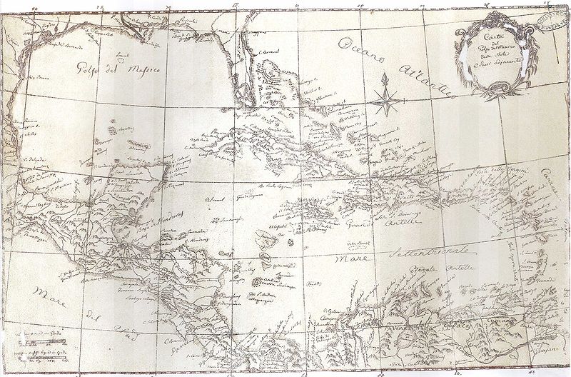
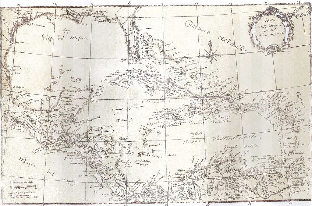
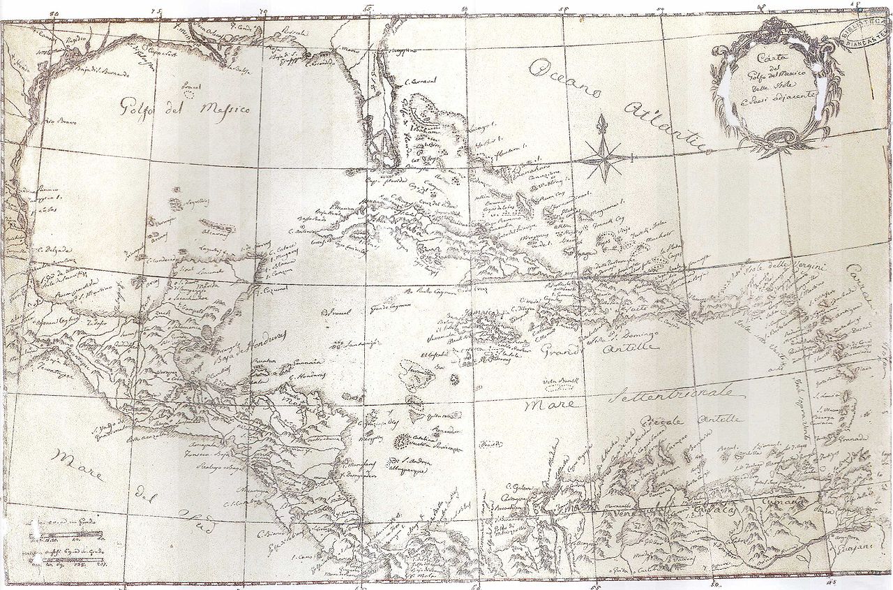
English: A. Codazi, Map of Antillas`s Sea and Mexican Gulf
Español: A. Codazzi, Mapa del Mar de las Antillas y el Golfo de México |
| Date | between 1818 and 1820 |
| Source | http://www.mitreum.net/codazzi/es/medida/cartografiajuvenil.php |
| Author | A. Codazzi |
Licensing
[edit]
This file may not have the correct information on its copyright status.
Notify the uploader with:
Items tagged with this template are sorted into Category:Items with disputed copyright information.
|

|
Permission is granted to copy, distribute and/or modify this document under the terms of the GNU Free Documentation License, Version 1.2 or any later version published by the Free Software Foundation; with no Invariant Sections, no Front-Cover Texts, and no Back-Cover Texts. A copy of the license is included in the section entitled GNU Free Documentation License. |
| This file is licensed under the Creative Commons Attribution-Share Alike 3.0 Unported license. | ||
| ||
| This licensing tag was added to this file as part of the GFDL licensing update. |
File history
Click on a date/time to view the file as it appeared at that time.
| Date/Time | Thumbnail | Dimensions | User | Comment | |
|---|---|---|---|---|---|
| current | 03:38, 16 February 2009 | | 3,000 × 1,980 (997 KB) | Pedro Francisco Celis (talk | contribs) | {{Information |Description={{en|1=A. Codazi, Map of Antillas`s Sea and Mexican Gulf}} {{es|1=A. Codazzi, Mapa del Mar de las Antillas y el Golfo de México}} |Source=http://www.mitreum.net/codazzi/es/medida/cartografiajuvenil.php |Author=1818 - 1820 |Date |
You cannot overwrite this file.
File usage on Commons
There are no pages that use this file.
File usage on other wikis
The following other wikis use this file:
- Usage on de.wikipedia.org
- Usage on eo.wikipedia.org
- Usage on es.wikipedia.org