File:Vojvodina, Serbia ESA375680.jpg
Original file (5,274 × 4,770 pixels, file size: 28.9 MB, MIME type: image/jpeg)
Captions
Captions
Summary
[edit]| Description |
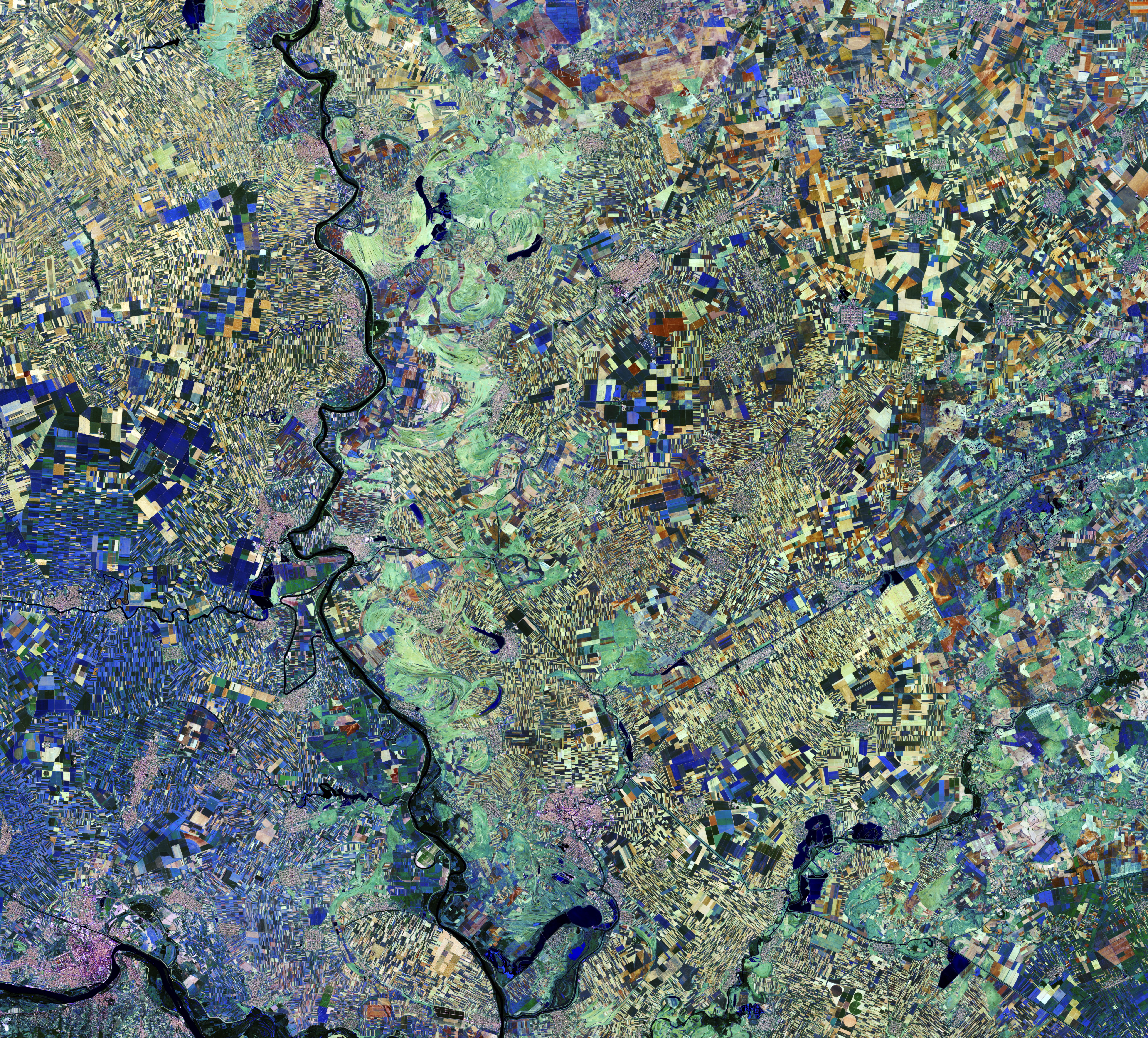
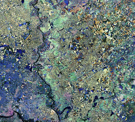
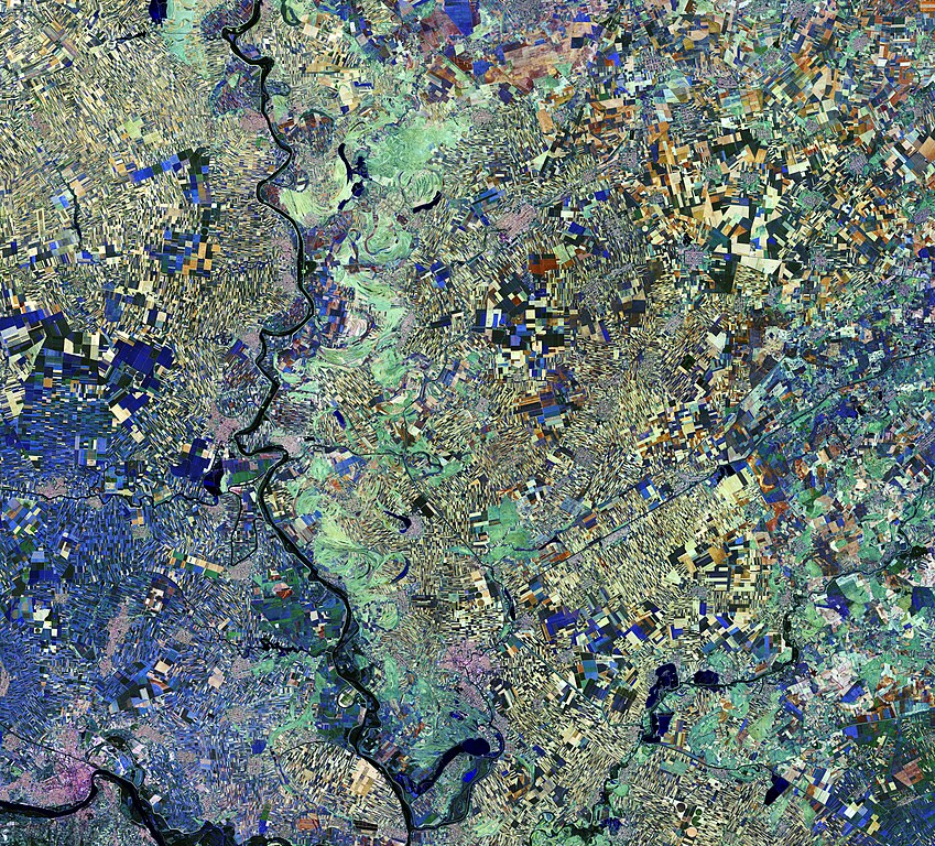
English: Vojvodina, Serbia, by Copernicus Sentinel-2A satellite.
The area pictured lies in the southern part of a region covered by the Pannonian Sea some 2–23 million years ago. Today, the land boasts a fertile soil – hence the plethora of agricultural fields visible as geometric shapes, reminiscent of cubist artwork. The Tisza river snakes down from the north. Curved, brushstroke-like light green areas primarily along the east side of the river reveal its former course. Some of these areas are now used for agriculture, while others may still be too wet. We can also see manmade waterways appearing as straight black lines – likely for draining the swamps, transportation and irrigation. Nestled among the fields, there are a number of small towns with grid layouts. This type of city planning was invented by ancient Greece’s Hippodamus – known as the ‘father of European urban planning’. The image captured on 28 August 2016 is clearly in false colour, and different colours indicate varying vegetative states. For example, yellowish patches indicate soil or freshly ploughed land, while shades of blue (primarily in the lower left) indicate either the same crop or different crops at a similar stage of growth. Sentinel-2’s main instrument has 13 spectral bands, and is designed to provide images that can be used to distinguish between different crop types as well as data on numerous plant features, such as active chlorophyll content and leaf water content, all of which are essential to accurately monitor plant growth. This kind of information helps informed decisions to be made, whether they are about deciding how much water or fertiliser is needed for a maximum harvest or for forming strategies to address climate change. While this has obvious economic benefits, this kind of information is also important for developing countries where food security is an issue. |
| Date | Taken on 28 August 2016 |
| Source | http://www.esa.int/spaceinimages/Images/2017/04/Vojvodina_Serbia |
| Author | ESA / Copernicus Sentinel-2A |
| Other versions |
|
| Title | Vojvodina, Serbia |
| Set | Earth observation image of the week |
| System | Copernicus |
| Mission | Sentinel-2 |
| Location | Serbia |
| Activity | Observing the Earth |
| Keywords | Agriculture; Urban areas; Satellite image |

Licensing
[edit]
This media was created by the European Space Agency (ESA).
Where expressly so stated, images or videos are covered by the Creative Commons Attribution-ShareAlike 3.0 IGO (CC BY-SA 3.0 IGO) licence, ESA being an Intergovernmental Organisation (IGO), as defined by the CC BY-SA 3.0 IGO licence. The user is allowed under the terms and conditions of the CC BY-SA 3.0 IGO license to Reproduce, Distribute and Publicly Perform the ESA images and videos released under CC BY-SA 3.0 IGO licence and the Adaptations thereof, without further explicit permission being necessary, for as long as the user complies with the conditions and restrictions set forth in the CC BY-SA 3.0 IGO licence, these including that:
See the ESA Creative Commons copyright notice for complete information, and this article for additional details.
|
 | |
This file is licensed under the Creative Commons Attribution-ShareAlike 3.0 IGO license. Attribution: ESA, CC BY-SA IGO 3.0
| ||
This file, which was originally posted to
http://www.esa.int/spaceinimages/Images/2017/04/Vojvodina_Serbia, was reviewed on 6 May 2017 by reviewer Daphne Lantier, who confirmed that it was available there under the stated license on that date.
|

|
This image contains data from a satellite in the Copernicus Programme, such as Sentinel-1, Sentinel-2 or Sentinel-3. Attribution is required when using this image.
Attribution: Contains modified Copernicus Sentinel data 2016
The use of Copernicus Sentinel Data is regulated under EU law (Commission Delegated Regulation (EU) No 1159/2013 and Regulation (EU) No 377/2014). Relevant excerpts:
Free access shall be given to GMES dedicated data [...] made available through GMES dissemination platforms [...].
Access to GMES dedicated data [...] shall be given for the purpose of the following use in so far as it is lawful:
GMES dedicated data [...] may be used worldwide without limitations in time.
GMES dedicated data and GMES service information are provided to users without any express or implied warranty, including as regards quality and suitability for any purpose. |
File history
Click on a date/time to view the file as it appeared at that time.
| Date/Time | Thumbnail | Dimensions | User | Comment | |
|---|---|---|---|---|---|
| current | 20:00, 5 May 2017 | | 5,274 × 4,770 (28.9 MB) | Yann (talk | contribs) | c:User:Rillke/bigChunkedUpload.js: HR from TIFF, 98% compressed |
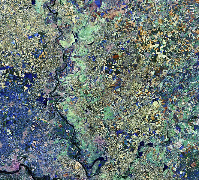
| 12:48, 6 May 2017 |  | 1,920 × 1,737 (6.06 MB) | Fæ (talk | contribs) | European Space Agency, Id 375680, http://www.esa.int/spaceinimages/Images/2017/04/Vojvodina_Serbia, User:Fæ/Project_list/ESA | |
| 17:28, 5 May 2017 |  | 1,920 × 1,737 (6.06 MB) | Yann (talk | contribs) | Transferred from http://www.esa.int/var/esa/storage/images/esa_multimedia/images/2017/04/vojvodina_serbia/16889065-1-eng-GB/Vojvodina_Serbia.jpg |
You cannot overwrite this file.
File usage on Commons
The following 4 pages use this file:
.jpg&redirect=no)
File usage on other wikis
The following other wikis use this file:
- Usage on en.wikipedia.org
- Usage on he.wikipedia.org
- Usage on ru.wikipedia.org
- Usage on uk.wikipedia.org