File:Waadhoeke locator map municipality NL.png
Jump to navigation
Jump to search
No higher resolution available.
Waadhoeke_locator_map_municipality_NL.png (760 × 598 pixels, file size: 98 KB, MIME type: image/png)
Captions
Captions
Add a one-line explanation of what this file represents
Summary
[edit]
| Description |
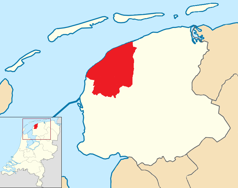
Nederlands: Waadhoeke, gemeente in Friesland, Nederland English: Waadhoeke, municipality in Friesland, Netherlands |
| Date | |
| Source |
Own work This image includes elements that have been taken or adapted from this file: |
| Author | Condor3d |
Licensing
[edit]
I, the copyright holder of this work, hereby publish it under the following license:
This file is licensed under the Creative Commons Attribution-Share Alike 4.0 International license.
- You are free:
- to share – to copy, distribute and transmit the work
- to remix – to adapt the work
- Under the following conditions:
- attribution – You must give appropriate credit, provide a link to the license, and indicate if changes were made. You may do so in any reasonable manner, but not in any way that suggests the licensor endorses you or your use.
- share alike – If you remix, transform, or build upon the material, you must distribute your contributions under the same or compatible license as the original.
File history
Click on a date/time to view the file as it appeared at that time.
| Date/Time | Thumbnail | Dimensions | User | Comment | |
|---|---|---|---|---|---|
| current | 12:31, 5 March 2018 | | 760 × 598 (98 KB) | Condor3d (talk | contribs) | color |
| 15:28, 20 February 2018 |  | 760 × 598 (81 KB) | Condor3d (talk | contribs) | border | |
| 11:50, 17 February 2018 |  | 760 × 598 (74 KB) | Condor3d (talk | contribs) | User created page with UploadWizard |
You cannot overwrite this file.
File usage on Commons
The following 14 pages use this file:
- File:Ameland locator map municipality NL 2018.png
- File:De Fryske Marren location map municipality NL 2018.png
- File:Harlingen location map municipality NL 2018.png
- File:Leeuwarden locator map municipality NL 2018.png
- File:Schiermonnikoog locator map municipality NL 2018.png
- File:Súdwest-Fryslân locator map municipality NL 2018.png
- File:Terschelling locator map municipality NL 2018.png
- File:Vlieland locator map municipality NL 2018.png
- Category:Births in Waadhoeke
- Category:Geography of Waadhoeke
- Category:Maps of Waadhoeke
- Category:People of Waadhoeke
- Category:Views of Waadhoeke
- Category:Waadhoeke
File usage on other wikis
The following other wikis use this file:
- Usage on af.wikipedia.org
- Usage on ca.wikipedia.org
- Usage on de.wikipedia.org
- Usage on en.wikipedia.org
- Usage on eo.wikipedia.org
- Usage on fa.wikipedia.org
- Usage on frr.wikipedia.org
- Usage on fr.wikipedia.org
- Usage on fy.wikipedia.org
- Usage on id.wikipedia.org
- Usage on incubator.wikimedia.org
- Usage on la.wikipedia.org
- Usage on li.wikipedia.org
- Usage on nds-nl.wikipedia.org
- Usage on nl.wikipedia.org
- Usage on ru.wikipedia.org
- Usage on stq.wikipedia.org
- Usage on uk.wikipedia.org
- Usage on vo.wikipedia.org
- Usage on www.wikidata.org
- Usage on zea.wikipedia.org