File:Warm Springs Reservoir Map.png
Jump to navigation
Jump to search

Size of this preview: 285 × 600 pixels. Other resolutions: 114 × 240 pixels | 228 × 480 pixels | 365 × 768 pixels | 1,075 × 2,262 pixels.
Original file (1,075 × 2,262 pixels, file size: 801 KB, MIME type: image/png)
Captions
Captions
Add a one-line explanation of what this file represents
Summary
[edit]
| Description |
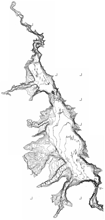
English: A topographic map of Warm Springs Reservoir. |
| Source | [1] |
| Author | United States Bureau of Reclamation |
Licensing
[edit]
| This article or image contains material based on a work of a Bureau of Reclamation employee, created as part of that person's official duties. As a work of the U.S. federal government, such work is in the public domain in the United States. |  |
File history
Click on a date/time to view the file as it appeared at that time.
| Date/Time | Thumbnail | Dimensions | User | Comment | |
|---|---|---|---|---|---|
| current | 17:25, 25 March 2011 | | 1,075 × 2,262 (801 KB) | Little Mountain 5 (talk | contribs) | {{Information |Description ={{en|1=A topographic map of Warm Springs Reservoir.}} |Source =[http://www.usbr.gov/pmts/sediment/projects/ReservoirSurveys/Reports/Warm%20Springs%20Reservoir%202000%20Reservoir%20Survey. |
You cannot overwrite this file.
File usage on Commons
There are no pages that use this file.