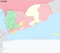
File:Yemen Warmap with Frontlines.png
From Wikimedia Commons, the free media repository
Jump to navigation
Jump to search

Size of this preview: 800 × 522 pixels. Other resolutions: 320 × 209 pixels | 640 × 418 pixels | 1,024 × 668 pixels | 1,280 × 835 pixels | 2,560 × 1,670 pixels | 3,199 × 2,087 pixels.
Original file (3,199 × 2,087 pixels, file size: 620 KB, MIME type: image/png)
File information
Structured data
Captions
Captions
Current military situation in Yemen
Situation miliaire actuelle au Yemen
الحالة العسكرية في اليمن
Summary
[edit]| DescriptionYemen Warmap with Frontlines.png |
Dansk: Borgerkrigen i Yemen, der started I 2015.
Deutsch: Detaillierte Karte des Bürgerkriegs im Jemen
English: Insurgency in Yemen detailed Map according to published reports. This map's information is sometimes based on w:Module:Yemeni Civil War detailed map. For sources, see that page's history and talk page. For a visual representation of the data, see that module's documentation page.
Español: Mapa detallado de la insurgencia en Yemen
Français : Conflit au Yémen, d'après une carte de Mark Monmonier
Italiano: Mappa dettagliata della situazione attuale in Yemen
Ελληνικά: Η κατάσταση στον Υεμενικό Εμφύλιο Πόλεμο, όπως έχει διαμορφωθεί σύμφωνα με δημοσιεύματα.
Русский: Подробная карта мятежа в Йемене
한국어: 예멘 반란 상세지도
اردو : یمنی خاناجنگی کی صورتحال
العربية : النزاع في اليمنː
فارسی : نقشهٔ جزئیات درگیریهای جنگ داخلی یمن
|
| Date | |
| Source | Own work |
| Author | TheMapLurker |
Licensing
[edit]I, the copyright holder of this work, hereby publish it under the following license:
This file is licensed under the Creative Commons Attribution-Share Alike 4.0 International license.
- You are free:
- to share – to copy, distribute and transmit the work
- to remix – to adapt the work
- Under the following conditions:
- attribution – You must give appropriate credit, provide a link to the license, and indicate if changes were made. You may do so in any reasonable manner, but not in any way that suggests the licensor endorses you or your use.
- share alike – If you remix, transform, or build upon the material, you must distribute your contributions under the same or compatible license as the original.
File history
Click on a date/time to view the file as it appeared at that time.
| Date/Time | Thumbnail | Dimensions | User | Comment | |
|---|---|---|---|---|---|
| current | 11:02, 1 June 2020 |  | 3,199 × 2,087 (620 KB) | Borysk5 (talk | contribs) | Removed AQAP-held area from Hadramaut district - as I explained in talk page of Module, government has since 2016 recaptured all territories there. |
| 06:23, 19 April 2020 |  | 2,771 × 1,805 (743 KB) | Mr. James Dimsey (talk | contribs) | New image. | |
| 02:34, 8 April 2020 |  | 3,210 × 2,803 (965 KB) | TheMapLurker (talk | contribs) | Uploaded own work with UploadWizard |
You cannot overwrite this file.
File usage on Commons
The following 2 pages use this file:
File usage on other wikis
The following other wikis use this file:
- Usage on ar.wikipedia.org
- Usage on en.wikipedia.org
- Usage on pnb.wikipedia.org
- Usage on ru.wikipedia.org
- Usage on ur.wikipedia.org
Metadata
This file contains additional information such as Exif metadata which may have been added by the digital camera, scanner, or software program used to create or digitize it. If the file has been modified from its original state, some details such as the timestamp may not fully reflect those of the original file. The timestamp is only as accurate as the clock in the camera, and it may be completely wrong.
| PNG file comment |
|
|---|---|
| Horizontal resolution | 28.35 dpc |
| Vertical resolution | 28.35 dpc |
| File change date and time | 08:28, 1 June 2020 |
Hidden categories: