File:ZatokaPuckaXVIIwiek-Kazimierzowo.jpg
Jump to navigation
Jump to search
Size of this preview: 457 × 599 pixels. Other resolutions: 183 × 240 pixels | 366 × 480 pixels | 1,018 × 1,335 pixels.
Original file (1,018 × 1,335 pixels, file size: 502 KB, MIME type: image/jpeg)
Captions
Captions
Add a one-line explanation of what this file represents
| Description |
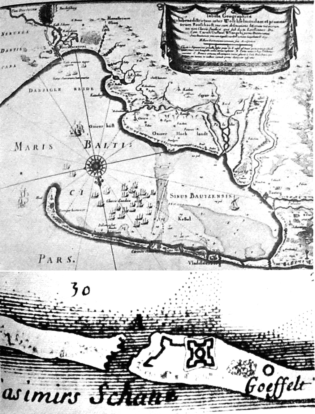
Polski:
|
||||
| Date | |||||
| Source |
|
||||
| Author |
drawn by: F. Getkant, E. Dahlberg scan: Julo |
||||
| Permission (Reusing this file) |
|
||||
| Other versions |
 |
||||
File history
Click on a date/time to view the file as it appeared at that time.
| Date/Time | Thumbnail | Dimensions | User | Comment | |
|---|---|---|---|---|---|
| current | 18:23, 30 September 2009 | | 1,018 × 1,335 (502 KB) | Julo (talk | contribs) | b/w balance corrected |
You cannot overwrite this file.
File usage on Commons
The following page uses this file:
File usage on other wikis
The following other wikis use this file:
- Usage on pl.wikipedia.org