File:Antarctica 1912.tif
Jump to navigation
Jump to search

Size of this JPG preview of this TIF file: 715 × 600 pixels. Other resolutions: 286 × 240 pixels | 572 × 480 pixels | 915 × 768 pixels | 1,220 × 1,024 pixels | 2,441 × 2,048 pixels | 5,676 × 4,763 pixels.
Original file (5,676 × 4,763 pixels, file size: 77.38 MB, MIME type: image/tiff)
Captions
Captions
Add a one-line explanation of what this file represents
| Description |
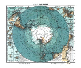
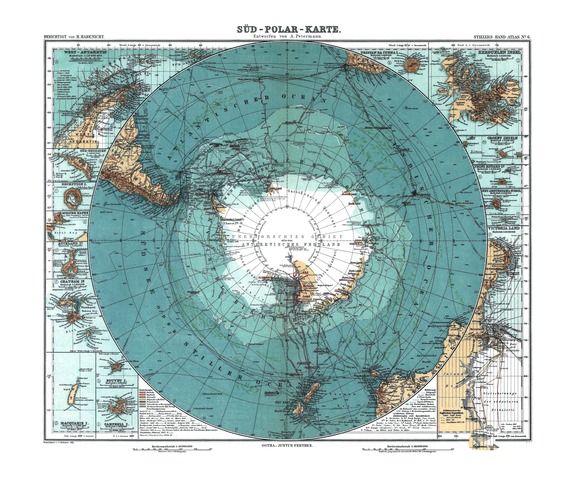
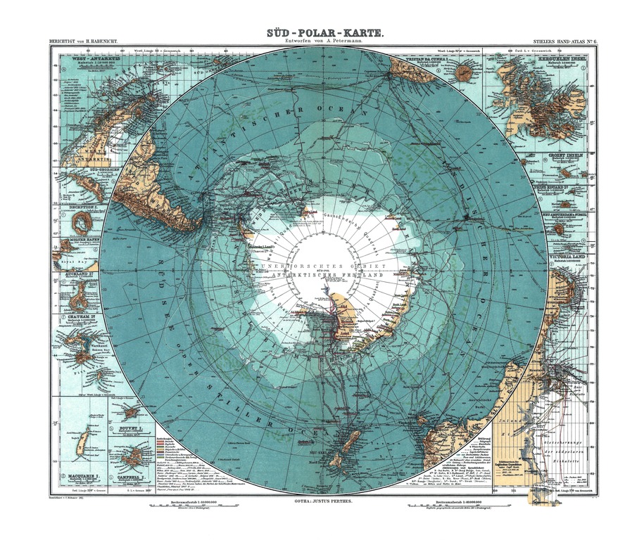
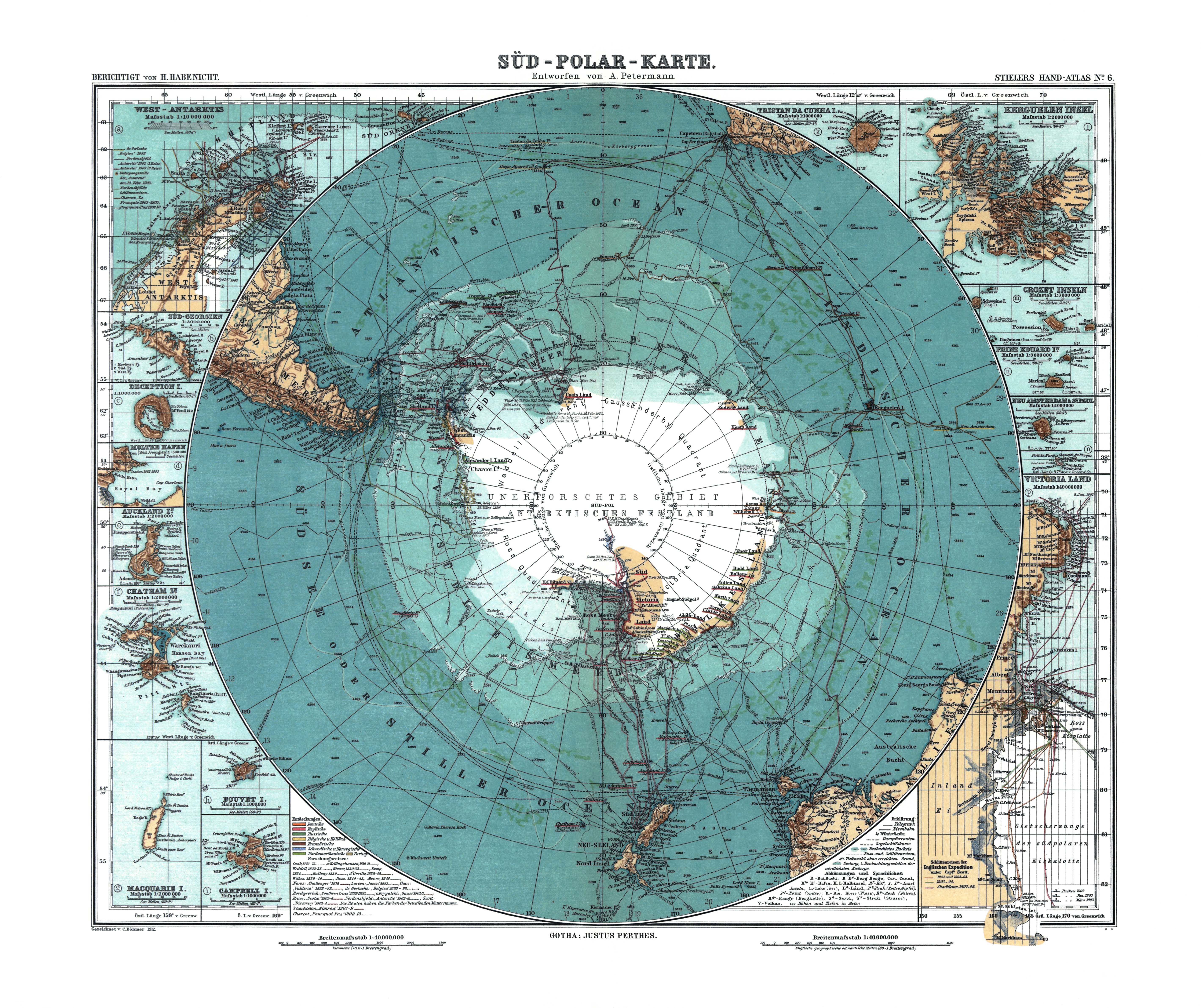
English: Map of Antarctica. Scale [ca. 1:40,000,000]. Col., 34 x 41 cm.
Deutsch: Karte der Antarktis. Maßstab [ca. 1:40,000,000]. farbig, 34 x 41 cm. |
||
| Date | |||
| Source |
Stieler Handatlas, 9. von Grund aus neubearb. und neugestochene Aufl. 8. berichtigter Abdruck. Verlag J. Perthes, Gotha, 1912.
|
||
| Author |
Petermann, A.; Habenicht, H.; Böhmer, C. |
||
| Other versions |
|

Licensing
[edit]|
This work is in the public domain in its country of origin and other countries and areas where the copyright term is the author's life plus 70 years or fewer. | |
| This file has been identified as being free of known restrictions under copyright law, including all related and neighboring rights. | |
File history
Click on a date/time to view the file as it appeared at that time.
| Date/Time | Thumbnail | Dimensions | User | Comment | |
|---|---|---|---|---|---|
| current | 16:56, 14 March 2010 |  | 5,676 × 4,763 (77.38 MB) | Christoph Braun (talk | contribs) | (blemishes removed, photofilter applied, levels adjusted, curves adjusted, removed CA, whitened border, adjusted temperature) |
| 16:04, 14 March 2010 | 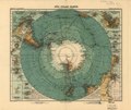 | 5,676 × 4,763 (77.38 MB) | Christoph Braun (talk | contribs) | {{Information |Description={{en|1=Map of Antarctica. Scale [ca. 1:40,000,000]. Col., 34 x 41 cm.}} {{de|1=Karte der Antarktis. Maßstab [ca. 1:40,000,000]. farbig, 34 x 41 cm.}} |Source={{LOC-map|id=g9800.ct000774}} |Author=Petermann, A.; Habenicht, H.; B |
You cannot overwrite this file.
File usage on Commons
There are no pages that use this file.